
-
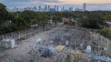 'Is it really necessary to generate another image?': UN scientist explains how everyday people can limit AI's environmental impact12 Comments
 -
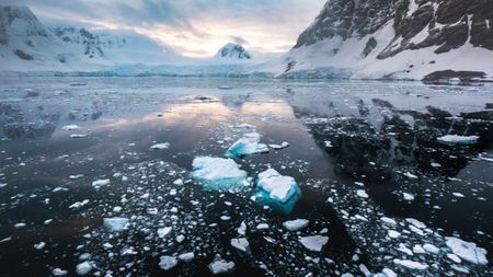
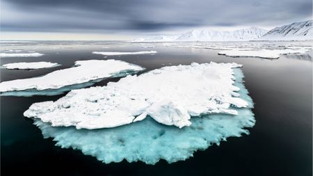
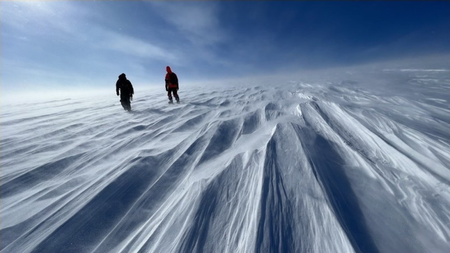
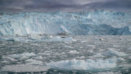
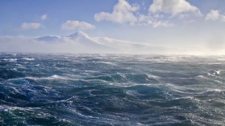
 The 'Doomsday Glacier' is poised to lose its ice shelf this year. An Antarctic researcher explains what that means for global sea levels5 Comments
 -
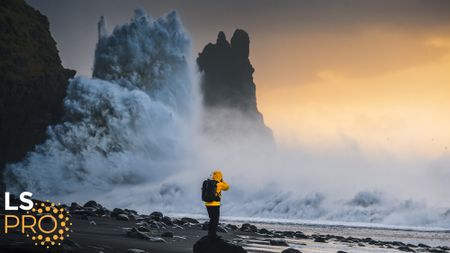
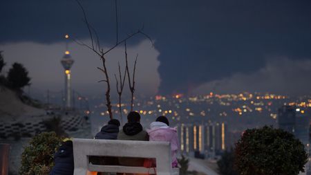
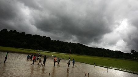
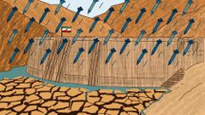 War has brought Iran's water crisis to a breaking point: 'Things will collapse unless there is meaningful structural change'5 Comments


-
-
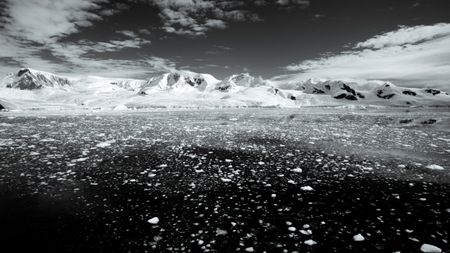
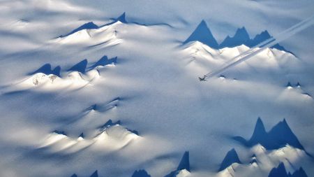
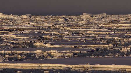
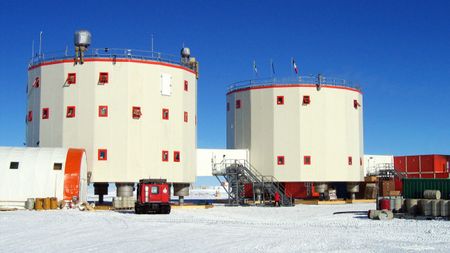 AntarcticaAntarctica just experienced minus 119 F, Earth's coldest temperature since 2012 — here's why
 -
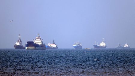 Planet EarthBiological 'superspreader' event could be imminent as more than 1,000 ships idle in the Strait of Hormuz, scientists warn
 -
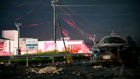 EarthquakesMagnitude 6.8 earthquake traps shoppers as mall collapses in Japan — here's why the seismic event was unusual
 -
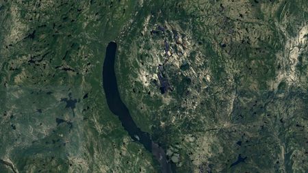
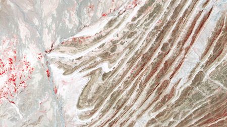 Earth from spaceColossal scars of 60 million-year-long continental collision streak across warped mountains in Pakistan
 -
 Science word of the dayWhat does 'seamount' mean?
 -
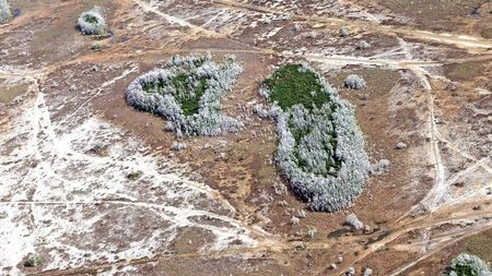
 Science word of the dayWhat does 'pando' mean?
-


-
-
AntarcticaAntarctica just experienced minus 119 F, Earth's coldest temperature since 2012 — here's why
-
 AntarcticaA Texas-size chunk of winter sea ice is missing from Antarctica — and it's probably not coming back
 -
 AntarcticaHundreds of hidden earthquakes discovered beneath Antarctica — and they're happening in a very odd location
 -
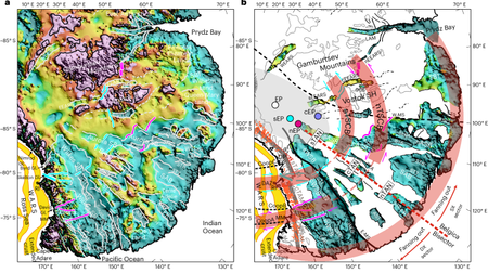 AntarcticaScientists discover giant, fan-shaped structure deep beneath the East Antarctic Ice Sheet
 -
 InterviewThe 'Doomsday Glacier' is poised to lose its ice shelf this year. An Antarctic researcher explains what that means for global sea levels5 Comments
 -
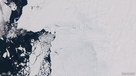
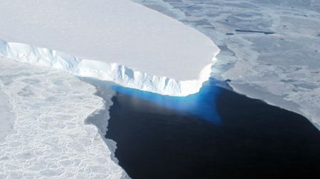 Antarctica'Poised to disintegrate': Antarctica's 'Doomsday Glacier' is set to lose its ice shelf this year14 Comments
 -
 AntarcticaAntarctica’s sudden sea ice loss is one of the most extreme and confusing events in the modern climate record. Scientists now know why it's happening.2 Comments
 -
 AntarcticaDon Juan Pond: Antarctica's salty, syrupy lake that never freezes, even when it's minus 58 F
 -
 AntarcticaAntarctica could warm 1.4 times faster than the rest of the Southern Hemisphere in the coming decades, study finds
-


-
-
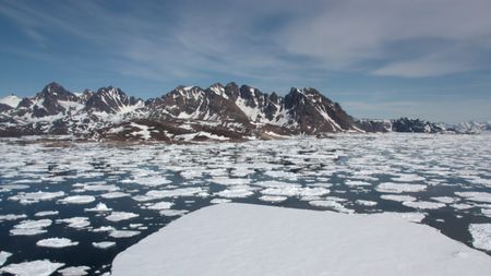
 ArcticFirst experiment to thicken Arctic ice with seawater shows promise — but there's a big catch7 Comments
 -
 ArcticSea ice loss in the Arctic has triggered a critical tipping point that's destroying the food chain5 Comments
 -
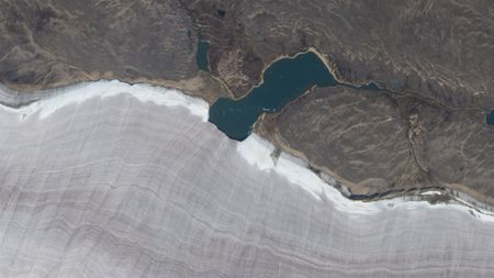 Earth from spaceMini lake meets snowy rim of Canada's oldest ice mass
 -
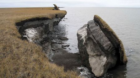
 ArcticPermafrost thaw and 'shrubification' have tipped Alaska's North Slope into a wildfire regime not seen for 3,000 years
 -
 ArcticCritical moment when El Niño started to erode Russia's Arctic sea ice discovered
 -
 ArcticHuge ice dome in Greenland vanished 7,000 years ago — melting at temperatures we're racing toward today6 Comments
 -
 ArcticArctic 'methane bomb' may not explode as permafrost thaws, new study suggests
 -
 ArcticScientists 'reawaken' ancient microbes from permafrost — and discover they start churning out CO2 soon after27 Comments
 -
 Arctic'It was so unexpected': 90 billion liters of meltwater punched its way through Greenland ice sheet in never-before-seen melting event2 Comments
-


-
-
 Interview'It affects your daily life suddenly': Sea level researcher explains why once-in-a-century floods could become the new normal
 -
 Climate changeTropical forests stop absorbing carbon dioxide during El Niño events. This year could be the worst.
 -
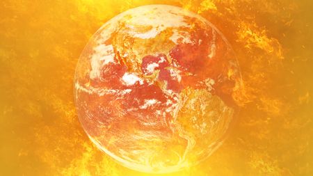
 Climate change'Uncharted territory': Record-high ocean temperatures confirmed for June as El Niño strengthens its grip3 Comments
 -
 Climate changeWater shortages could prevent the US from mining more lithium, deepening reliance on foreign imports4 Comments
 -
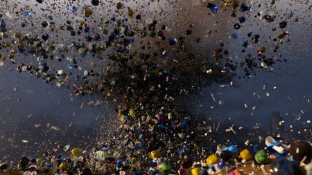
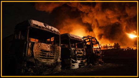
 Climate changeA single day of attacks on Iranian oil refineries released as much sulfur dioxide as a volcanic eruption
 -
 Climate change'The biggest El Niño event since the 1870s': 'Super' El Niño is now the most likely scenario by the end of this year — and the humanitarian cost could be huge10 Comments
 -
 Special reportPollution may fuel depression, anxiety and other mental health problems, emerging research suggests
 -
 Climate changeOnce-in-a-century 'super' El Niño in the cards as ocean temperatures reach near record highs in April
 -
 Climate changeMicroplastics absorb heat in the atmosphere and contribute to global warming — as if they weren't bad enough
-


-
-
EarthquakesMagnitude 6.8 earthquake traps shoppers as mall collapses in Japan — here's why the seismic event was unusual
-
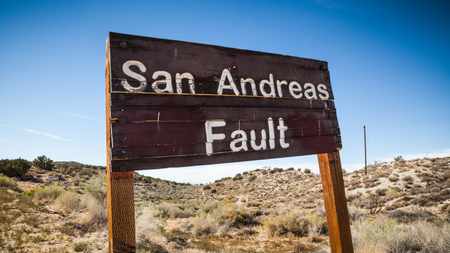
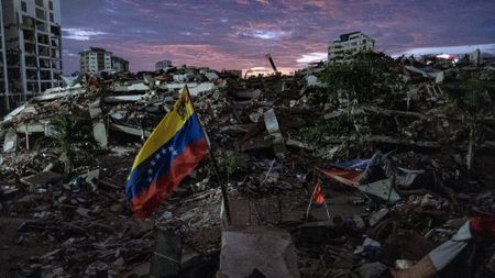 AnalysisVenezuela's devastating 'earthquake doublet' holds a warning for California's San Andreas Fault
 -
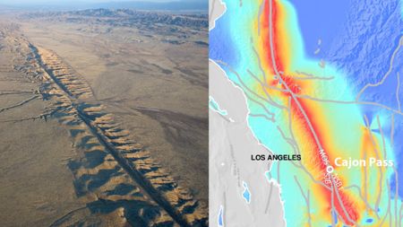 Earthquakes'The system is critically stressed': San Andreas and San Jacinto faults scarily close to major earthquake, study finds13 Comments
 -
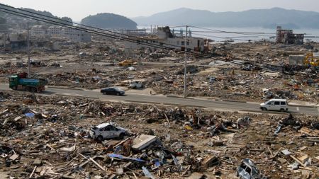 EarthquakesHidden slippery clay on seafloor may have worsened devastating 2011 tsunami in Japan
 -
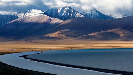 EarthquakesVanishing lakes in Tibet may have triggered earthquakes by awakening faults in Earth's crust
 -
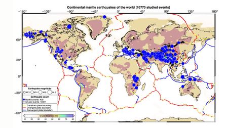 Earthquakes'Impossible' mantle earthquakes actually occur all over the world, study finds
 -
 EarthquakesScars from ancient 'megaquakes' at Cascadia subduction zone discovered in deep-sea landslides
 -
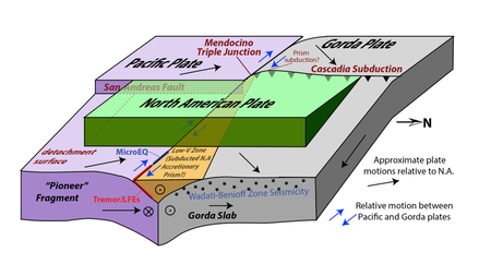 EarthquakesFragment of lost tectonic plate discovered where San Andreas and Cascadia faults meet10 Comments
 -
 EarthquakesParkfield, San Andreas, and the quest for a 'crystal ball' for predicting earthquakes before they happen
-


-
-
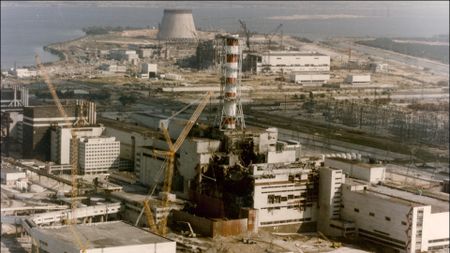 Nuclear EnergyScience history: Chernobyl nuclear power plant melts down, bringing the world to the brink of disaster — April 26, 1986
 -
 OpinionOur fossil fuel economy is a house of cards and Trump's war in Iran is about to topple it. The need for a clean energy transition has never been clearer.
 -
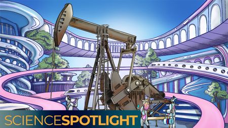 Fossil FuelsThe world is being held hostage by its reliance on oil. How can we break free from the fossil fuel?4 Comments
 -
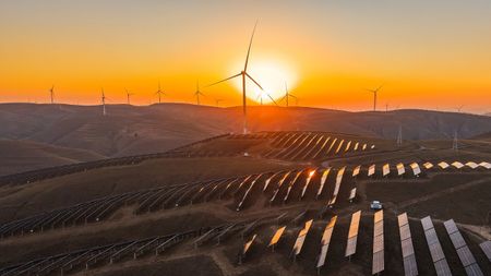 Renewable EnergyClean energy is surging — with or without Trump
 -
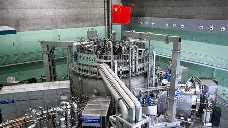 Nuclear EnergyChina's 'artificial sun' reactor shatters major fusion limit — a step closer to near-limitless clean energy15 Comments
 -
 Nuclear Energy'This technology is possible today': Nuclear waste could be future power source and increase access to a rare fuel3 Comments
 -
 Nuclear EnergyNuclear fusion record smashed as German scientists take 'a significant step forward' to near-limitless clean energy31 Comments
 -
 Nuclear EnergyThere's 90,000 tons of nuclear waste in the US. How and where is it stored?5 Comments
 -
 EnergyWhat is 'induced atmospheric vibration' and did it really cause power outages across Spain and Portugal?
-


-
-
 Science word of the dayWhat does 'Cenozoic' mean?
 -
 Science word of the dayWhat does 'abiotic' mean?
 -
 Science word of the dayWhat does 'abiogenesis' mean?
 -
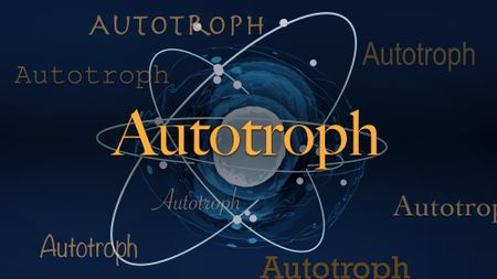 Science word of the dayWhat does 'autotroph' mean?
 -
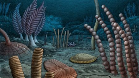 EvolutionComplex animals evolved up to 10 million years earlier than previously thought, fossil discovery shows
 -
 Evolution'Maybe they're waiting for something that only happens thousands of years later': The hidden life 'sleeping' deep beneath Earth for millions of years5 Comments
 -
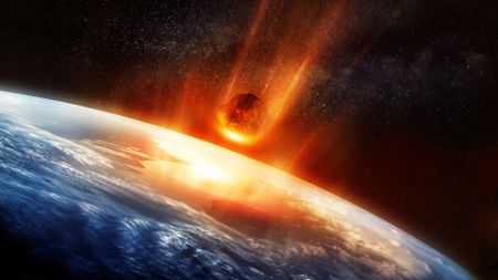
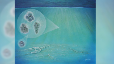 EvolutionLife may have rebounded 'ridiculously fast' after the dinosaur-killing asteroid impact10 Comments
 -
 EvolutionScience history: Experiment shows mutations arise spontaneously, supporting pillar of Darwinian evolution — Nov. 20, 1943
 -
 EvolutionTomatoes randomly mated with another plant 9 million years ago. The result? Potatoes.9 Comments
-


-
-
Earth from spaceColossal scars of 60 million-year-long continental collision streak across warped mountains in Pakistan
-
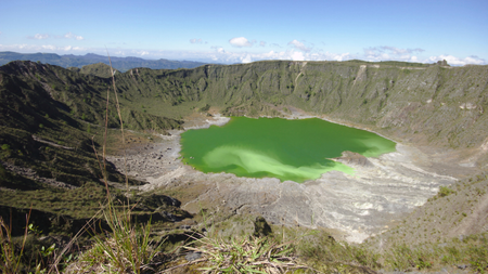
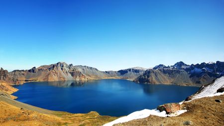 Incredible PlacesHeaven Lake: China's deepest lake sits atop a colossal volcano and belongs mostly to North Korea
 -
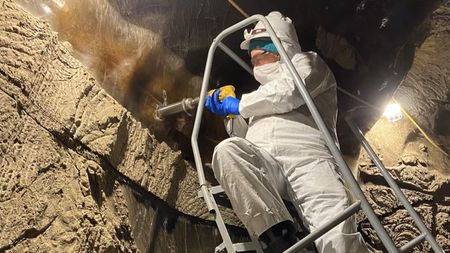
 Geology'This was one of the most arduous expeditions I've ever done': Scientists confirm that 15-mile-wide pit found on Google Maps is ancient meteor crater
 -
 Geology'Unequivocal evidence' of Earth's oldest impact crater turns out to be off by half a billion years7 Comments
 -
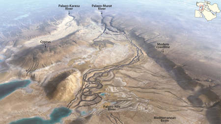 GeologyScientists reveal the origin of the Euphrates — a river that fed the 'cradle of civilization'4 Comments
 -
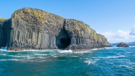 GeologyFingal's Cave: Scotland's 'cave of melody' where eerie echoes bounce off pillars of solidified lava3 Comments
 -
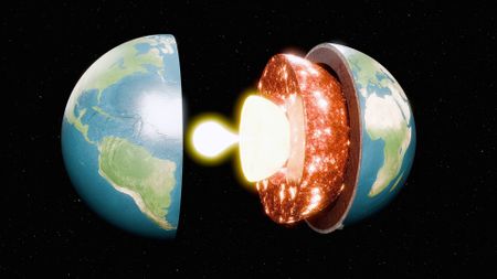 Life's Little MysteriesHow hot is Earth's core?
 -
 GeologyThe Appalachian Mountains hold enough lithium to make 500 billion cellphones, researchers discover13 Comments
 -
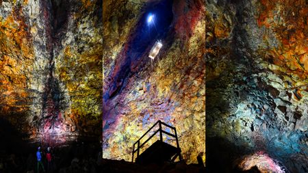 GeologyThríhnúkagígur: The only volcano on Earth where you can descend into a magma chamber4 Comments
-


-
-
Science word of the dayWhat does 'pando' mean?
-
 OpinionExtreme heat waves are making our cities buckle. Investing in urban nature is no longer optional.5 Comments
 -
 Plants66 billion trees have been planted in China's Great Green Wall — and they appear to be growing faster than natural forests40 Comments
 -
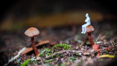 INTERVIEW'It sounds so impossible': Student studying fungus that makes users hallucinate tiny people may be on the verge of a scientific breakthrough22 Comments
 -
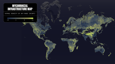 PlantsEarth's underground fungal network is so massive, it would span 10% of the Milky Way, map reveals7 Comments
 -
 PlantsFlowering plants transformed into 'hopeful monsters' in 9 dire bursts across evolutionary time, study finds2 Comments
 -
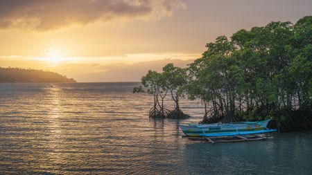 PlantsMangroves clean up $8.7 billion of nitrogen pollution every year, study finds
 -
 PlantsSome fungi can influence the weather — and now we know how they do it5 Comments
 -
 PlantsScientists are racing to save Australia's 'zombie tree' from a fast-spreading fungal disease
-


-
-
Science word of the dayWhat does 'seamount' mean?
-
 Rivers & OceansGreenland meltwater will drive a 'strong weakening, but not a shutdown' of key Atlantic currents, study finds
 -
 Earth from spaceColorful 'painting-like' ripples cover an ancient seafloor structure the Bahamas
 -
 Rivers & OceansAtlantic 'cold blob' is responsible for shifts in the Indian summer monsoon that threaten over 1 billion people
 -
 Rivers & OceansMysterious 'cold blob' in the Atlantic is a sign of the Gulf Stream weakening — and that's bad news for the US East Coast9 Comments
 -
 Rivers & OceansTrump administration to remove 900 deep sea monitoring instruments that would have studied the collapsing Atlantic current
 -
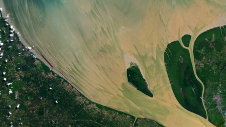 Earth from spaceFull moon helps paint vibrant, muddy 'brushstrokes' in Indonesian river
 -
 Rivers & OceansBuilding a massive dam between Alaska and Russia could prevent AMOC collapse, scientists say9 Comments
 -
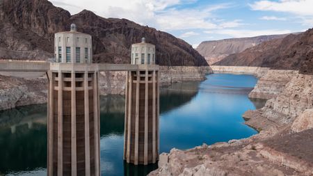 Rivers & Oceans'A completely new reality': Bolder measures are needed to prevent extreme water shortages in cities like Phoenix and Las Vegas that depend on the Colorado River10 Comments
-


-
-
 Earth from spaceShadowy tendrils of ancient lava have scarred a dark volcano next to a 'skull' in the Sahara
 -
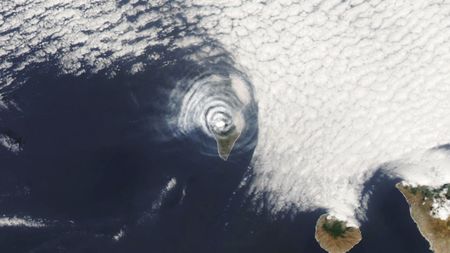 Earth from spaceBizarre 'bull's-eye' cloud rings appear above erupting volcano on Atlantic island
 -
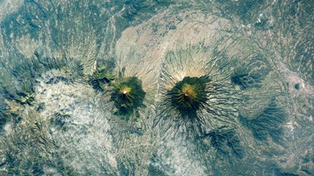 Earth from spaceIndonesia's near-identical, 'Twin Peaks' volcanoes form striking mirror image2 Comments
 -
 AnalysisSome 'extinct' volcanoes may just be going through a growth spurt, before they 'wake up in this catastrophic stage,' emerging research suggests4 Comments
 -
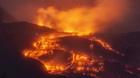
 VolcanoesA transition may be coming for a massive Italian volcano5 Comments
 -
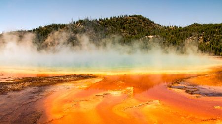 VolcanoesYellowstone's volcano may be fueled in a very different way than we thought
 -
 VolcanoesMount Etna is like no other volcano on Earth, representing 'a new type of volcanism,' new research reveals3 Comments
 -
 VolcanoesVanuatu's 'barefoot volcanologist' stands at ash- and sulfur-spewing Mount Yasur in award-winning photograph6 Comments
 -
 VolcanoesThe world's 'hidden' volcanoes pose the greatest risk for global crisis
-


-
-
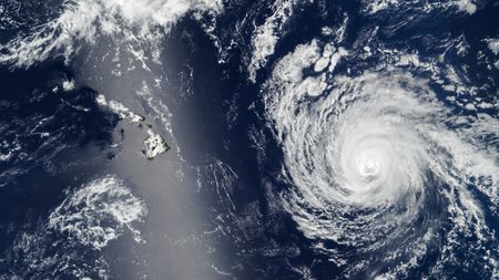
 Weather'These are striking forecasts': Super El Niño keeps getting even more likely, and it could bring a humanitarian crisis
 -
 WeatherEl Niño is officially here, and will be among the strongest ever recorded, NOAA announces
 -
 WeatherComing El Niño will be the strongest ever recorded, new forecast predicts10 Comments
 -
 Earth from spaceShimmering silver 'sunglint' obscures Hawaii as hurricane approaches
 -
 INTERVIEW'One of the most rapid transitions that I've seen': NOAA forecaster on how this year's El Niño could shatter records5 Comments
 -
 WeatherEl Niño could be here by May, new forecast reveals — here's what it means for summer weather18 Comments
 -
 WeatherFlorida is facing its most intense drought in 15 years. Here's how it got so bad and how long it will last.5 Comments
 -
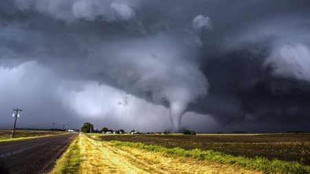 Interview'I've seen the movies. What a horrible way to die': What it's like to be sucked into a tornado and survive2 Comments
 -
 Weather'Super El Niño' could push global temperatures to unprecedented highs, forecasters say5 Comments
-


-
-
AntarcticaAntarctica just experienced minus 119 F, Earth's coldest temperature since 2012 — here's why
-
Planet EarthBiological 'superspreader' event could be imminent as more than 1,000 ships idle in the Strait of Hormuz, scientists warn
-
EarthquakesMagnitude 6.8 earthquake traps shoppers as mall collapses in Japan — here's why the seismic event was unusual
-
Earth from spaceColossal scars of 60 million-year-long continental collision streak across warped mountains in Pakistan
-
Science word of the dayWhat does 'seamount' mean?
-
Science word of the dayWhat does 'pando' mean?
-
Science word of the dayWhat does 'Cenozoic' mean?
-
Science word of the dayWhat does 'abiotic' mean?
-
Science word of the dayWhat does 'abiogenesis' mean?
-
Rivers & OceansGreenland meltwater will drive a 'strong weakening, but not a shutdown' of key Atlantic currents, study finds
-