


-
 James Webb telescope reveals largest-ever map of the universe's megastructures4 Comments
 -
 'Fireball' meteorite that smashed into New Jersey home contains ingredients of life from ancient proto-planet
 -
 'It's more than a hope, it's a guarantee': The Vera C. Rubin Observatory's 10-year movie of the universe is about to 'blow our minds,' chief scientist says


-
-
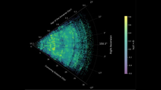
 Mysterious 'little red dots' at the beginning time may finally have an explanation
 -
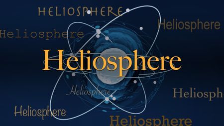 Science word of the dayWhat does 'heliosphere' mean?
 -
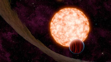
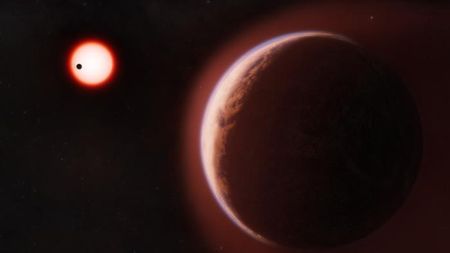 'It's absolutely exciting!': Astronomers discover atmosphere around an Earth-like planet in the habitable zone for first time3 Comments
 -
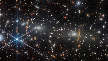 Space photo of the weekJames Webb telescope uses trippy Einstein prediction to probe the farthest reaches of the universe
 -
 'Fireball' meteorite that smashed into New Jersey home contains ingredients of life from ancient proto-planet
 -
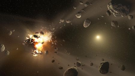
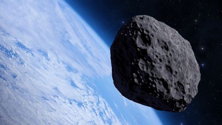 'Shared cosmic experience': 90% of the world's population may see 'once-in-a-millennium' asteroid fly by Earth in 2029
-


-
-
'It's absolutely exciting!': Astronomers discover atmosphere around an Earth-like planet in the habitable zone for first time3 Comments
-
Space photo of the weekJames Webb telescope uses trippy Einstein prediction to probe the farthest reaches of the universe
-
'Fireball' meteorite that smashed into New Jersey home contains ingredients of life from ancient proto-planet
-
'Shared cosmic experience': 90% of the world's population may see 'once-in-a-millennium' asteroid fly by Earth in 2029
-
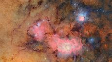
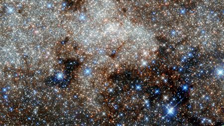 Sugar found in raspberries discovered near the center of the Milky Way
 -
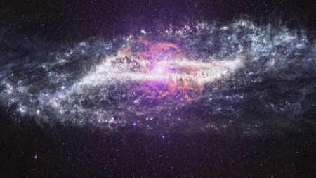 Space Photo of the WeekJames Webb telescope captures never-before-seen glimpse of 'Centaur' galaxy's battle wounds — Space photo of the week
 -
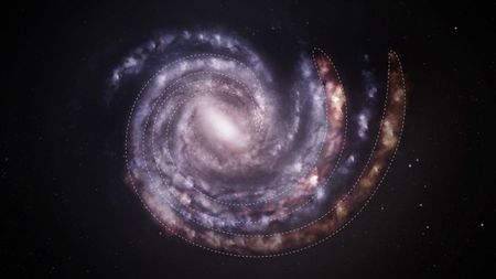 The Milky Way may be wider, heavier, and more lopsided than we realized2 Comments
 -
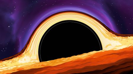 'What we found was striking': Scientists detect new kind of signal from a black hole's 'point of no return'
 -
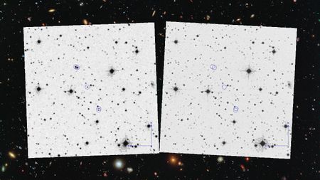
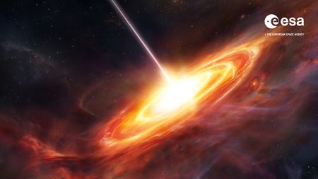 Euclid telescope discovers the 2 most ancient monster black holes in the universe — each brighter than a trillion suns
-


-
-
 We've spent decades looking for the wrong type of alien radio signals, new paper claims6 Comments
 -
 US government declassifies dozens of additional UFO files, including strange military videos9 Comments
 -
 Book excerpt'I have no doubt that life is out there': Why radio astronomers are convinced alien contact is only a matter of time14 Comments
 -
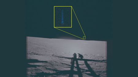 Declassified Apollo 12 images show UFOs on the moon — Space photo of the week26 Comments
 -
 The government is very serious about UFOs. So why are researchers being stymied?
 -
 Scientists squished microbes into a steel 'sandwich' — and made a profound discovery about life in space
 -
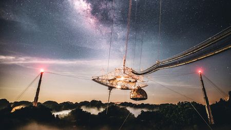
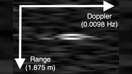
SETI scientists reveal 100 'signals of interest' from collapsed Arecibo Observatory10 Comments
-
 Advanced alien civilizations could be communicating 'like fireflies' in plain sight, researchers suggest8 Comments
 -
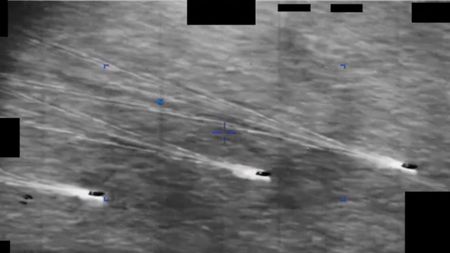
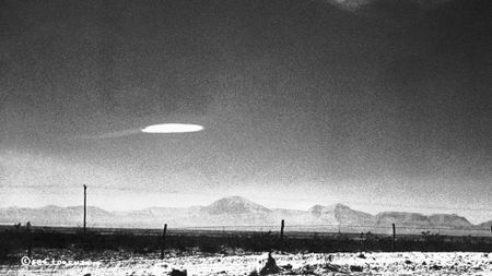
 Scientists are debating a 70-year-old UFO mystery as new images come to light19 Comments
-


-
-
 Interview'The moon looked wrong': Artemis II mission controller Chris White tells the story behind NASA's historic photos
 -
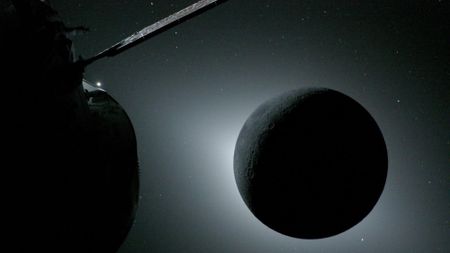
 Secretive Chinese probe snaps first photo of Earth's mysterious 'quasi-moon' — and it may pose a big problem3 Comments
 -
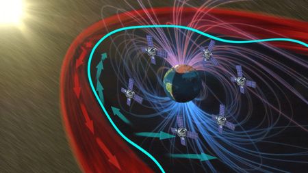 Scientists propose launching a giant 'airbag' into space to protect us from solar superstorms — and experts say it's 'quite feasible'2 Comments
 -
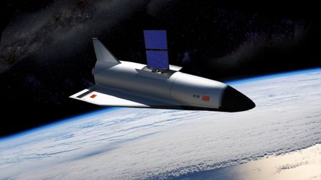 China's top-secret 'dragon' space plane just released another unidentified object over Earth
 -
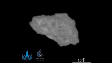
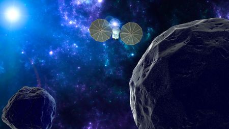 AnalysisChina's secretive Tianwen-2 mission arrives at Earth's 'quasi-moon' ahead of historic landing
 -
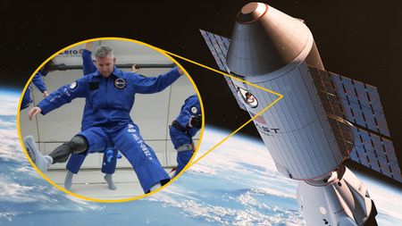 Interview'Is having two legs useful' in space?: Astronaut John McFall explains what life in orbit might be like for the first physically disabled person in space
 -
 Earth-based telescope shares image of Artemis II capsule near the moon — one of the farthest photos of humans ever taken
 -
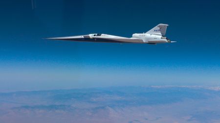 NASA's experimental X-59 jet breaks the sound barrier twice, reaching Mach 1.423 Comments
 -
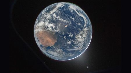 Space photo of the weekArtemis II crew's iconic view of Earth shows simultaneous auroras over both poles
-


-
-
Mysterious 'little red dots' at the beginning time may finally have an explanation
-
Science word of the dayWhat does 'heliosphere' mean?
-
'It's absolutely exciting!': Astronomers discover atmosphere around an Earth-like planet in the habitable zone for first time3 Comments
-
Space photo of the weekJames Webb telescope uses trippy Einstein prediction to probe the farthest reaches of the universe
-
'Fireball' meteorite that smashed into New Jersey home contains ingredients of life from ancient proto-planet
-
'Shared cosmic experience': 90% of the world's population may see 'once-in-a-millennium' asteroid fly by Earth in 2029
-
Sugar found in raspberries discovered near the center of the Milky Way
-
Interview'The moon looked wrong': Artemis II mission controller Chris White tells the story behind NASA's historic photos
-
Space Photo of the WeekJames Webb telescope captures never-before-seen glimpse of 'Centaur' galaxy's battle wounds — Space photo of the week
-
The Milky Way may be wider, heavier, and more lopsided than we realized2 Comments
-