
Images: Southwestern Wildfires Seen from Space

Colorado wildfires as seen from space

Smoke and heat from western wildfires on June 19, 2012

NASA's Aqua satellite captured smoke and heat from several large fires burning in the western U.S. on June 19, 2012.
High Park Fire, Day 1

NASA's Aqua satellite captured this picture of smoke from Colorado's High Park fire on June 9, 2012. Red outlines approximate the boundaries of the actively burning fire.
Article continues belowHigh Park Fire, Day 2
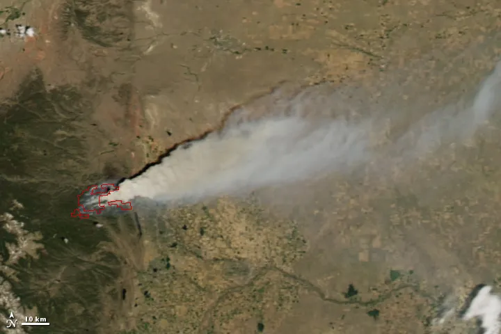
NASA's Aqua satellite captured this picture of smoke from Colorado's High Park fire on June 10, 2012. Notice how actively burning fire, shown by the red lines, has grown from the day prior.
A Fire in the Forest

The Suomi NPP satellite took this picture on June 10th, showing the High Park Fire. Vegetated areas are colored in shades of green: forests are dark green, grasslands bright green. Snow-covered mountains are blue peaks. Areas without vegetation (like cities) appear purple.
Little Bear Wildfire

The Moderate Resolution Imaging Spectroradiometer (MODIS) on NASA
Smoke Over Texas

A wider view of New Mexico's Little Bear wildfire, showing smoke blowing over north Texas.
Whitewater-Baldy, Biggest in New Mexico History
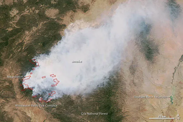
An image of the Whitewater-Baldy wildfire taken on May 30. Burning through the Gila National Forest in southwestern New Mexico, it has charred more of the landscape than any other fire in the state's history.
