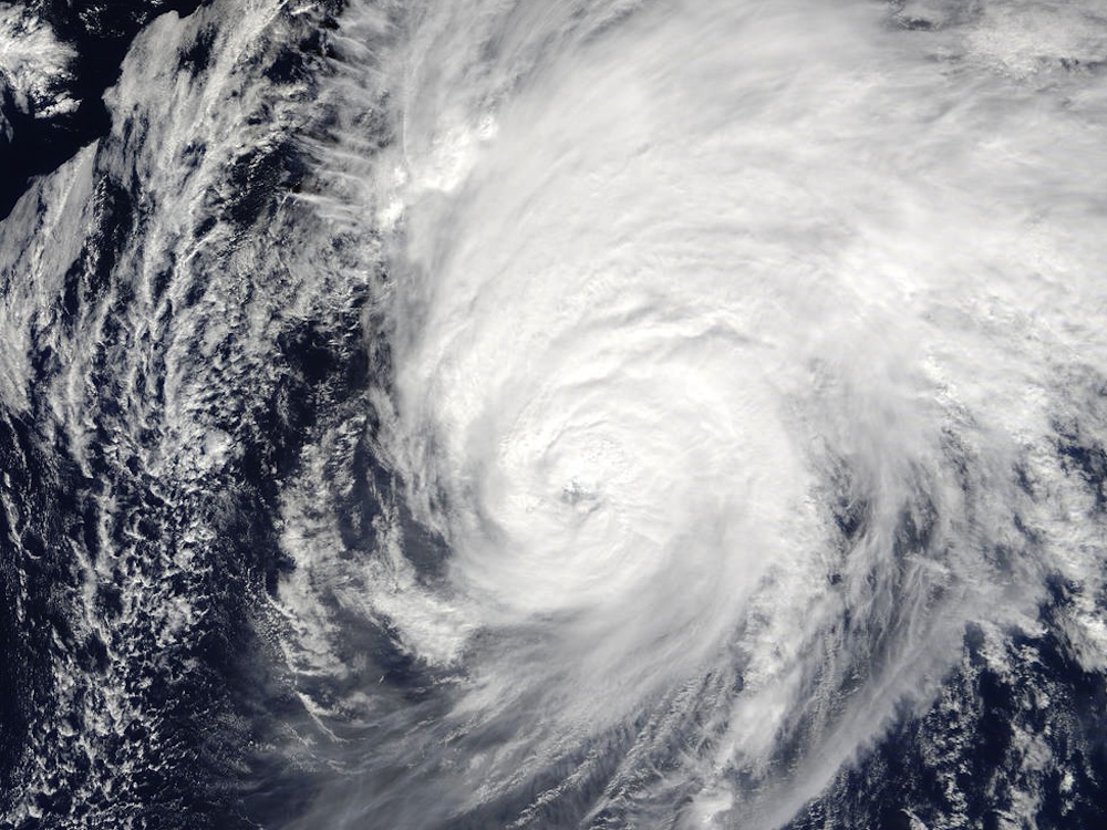
Twin Hurricanes Matthew and Nicole Could Herald More Storms to Come

When Hurricane Nicole formed in the Atlantic Ocean right on the heels of Hurricane Matthew, which tore across Haiti and the Bahamas last week before lashing the southeastern United States, it was the first time on record that two major Atlantic hurricanes have occurred in the month of October. But these rare, back-to-back hurricanes may be an early sign of worse weather to come if La Niña climate conditions take hold across the globe, according to weather scientists.
Hurricane Nicole battered Bermuda yesterday afternoon (Oct. 13) with torrential rain and winds of up to 130 miles per hour (209 km/h), causing widespread property damage and leaving thousands of homes without power. The storm is now moving northeast across the Atlantic, away from Bermuda, and is expected to become a post-tropical cyclone tomorrow (Oct. 15), according to an advisory posted today (Oct. 14) at 11 a.m. ET (1500 GMT) by the National Hurricane Center (NHC).
It was the second major hurricane to make landfall in the western Atlantic within five days, and the first time that two major hurricanes of Category 4 or Category 5 have formed in the Atlantic in October since record keeping began in 1851. [See Photos of the Tropical Storms and Hurricanes of 2016]
On Oct. 4, as Nicole strengthened over the ocean and Matthew made landfall in Haiti, the storms were the first large hurricanes — above Category 2 — to occur at the same time in the western Atlantic since 1964, according to the NHC.
The twin hurricanes may herald a much stormier time in the Atlantic, after a few years of relatively low hurricane activity, said Kevin Walsh, a professor of tropical meteorology at Australia’s University of Melbourne, who has watched the development of Matthew and Nicole over recent weeks.
"We know during El Niño years in the Atlantic you get usually suppressed numbers of tropical cyclones — and of course El Niño is all over now, and we may or may not be moving into a mild La Niña," Walsh told Live Science. "But, if a big La Niña does actually set in, then it's quite possible that we could have increased hurricane numbers in the Atlantic."
The return of La Niña
El Niño and La Niña are the opposite phases of the El Niño Southern Oscillation (ENSO) cycle, caused by fluctuations in temperature between the ocean and the atmosphere in the tropical zones of the central and eastern Pacific Ocean, according to the National Oceanic and Atmospheric Administration (NOAA).
Get the world’s most fascinating discoveries delivered straight to your inbox.
Each phase of the ENSO cycle can have different effects on the climate in different parts of the world. They usually last from nine months to a year, but some persist for several years, like the latest El Niño phase from 2011 to 2015, NOAA said.
If the oceans and atmosphere over the Pacific Ocean are now entering a prolonged La Niña phase, then hurricanes in the Atlantic Ocean are likely to become more common the longer it lasts, Walsh said.
"The only thing that it really depends on is how long the La Niña hangs around — and we don't know that at present, so it's a bit soon to be trying to predict for the Atlantic next year," he added. [A History of Destruction: 8 Great Hurricanes]
Tropical Storm Matthew first formed in a relatively normal way off the African coast in late September. The storm gained strength as it tracked across the Atlantic toward the Caribbean, where it rapidly intensified into a Category 5 hurricane on Sept. 30.
But Tropical Storm Nicole took a strange route across the Atlantic Ocean after it formed in early October, and meteorologists predicted more than once that the storm could disappear entirely.
"It is a bit unusual, partly because it's done a sort of funny loop-de-loop in the middle of nowhere, and then become quite strong after that," Walsh said.
Growing a hurricane
The way Hurricane Nicole lingered over the Atlantic likely increased its chances of becoming a stronger hurricane, Walsh said.
For example, the storm may have intensified after running into an area of very warm sea temperatures, or when atmospheric conditions turned more favorable for hurricane formation, he added.
Walsh also noted that an uncommon number of major hurricanes have hit Bermuda in recent years, although the region often endures several tropical storms each year.
"It's pretty rare for a hurricane to strike Bermuda directly, but that's happened a lot in the last few years," he said.
Only seven major hurricanes have passed within 40 nautical miles (74 km) of Bermuda since record- keeping began in 1851, but in 2014, the islands were hit by two hurricanes only six days apart: Hurricane Fay on Oct. 12, and Hurricane Gonzalo on Oct. 18.
Hurricane Fay was a Category 1 storm when it made landfall, and Gonzalo had weakened from a Category 4 storm to a Category 2 before it struck the island, but the combined effect of the two hurricanes just days apart resulted in heavy damage and disruption.
For now, the National Hurricane Center reports no "imminent tropical threats" in the Atlantic basin: no tropical storms or depressions that show the potential to develop into a hurricane.
But more than a month remains before the official end of this year's Atlantic hurricane season, on Nov. 30 — and until then, scientists and storm watchers will be keeping a keen eye on the tropics.
Original article on Live Science.
Tom Metcalfe is a freelance journalist and regular Live Science contributor who is based in London in the United Kingdom. Tom writes mainly about science, space, archaeology, the Earth and the oceans. He has also written for the BBC, NBC News, National Geographic, Scientific American, Air & Space, and many others.

 Live Science Plus


