What is El Niño?
El Niño is a climate cycle in the Pacific Ocean that impacts weather patterns around the world.
The cycle begins when warm water in the western tropical Pacific Ocean shifts eastward along the equator toward the coast of South America. Normally, this warm water pools near Indonesia and the Philippines, but during El Niño, the Pacific's warmest surface waters sit offshore of northwestern South America.
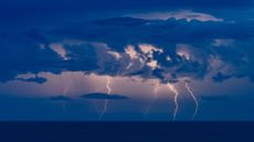
Tropical storms also occur in more eastward locations during El Niño because atmospheric moisture is fuel for thunderstorms, and the greatest amount of evaporation takes place above the ocean's warmest water.
The opposite of El Niño is La Niña, which is when the waters of the tropical eastern Pacific are colder than normal and trade winds blow more strongly than usual.
Collectively, El Niño and La Niña are parts of an oscillation in the ocean-atmosphere system called the El Niño-Southern Oscillation, or ENSO cycle, which also has a neutral phase.
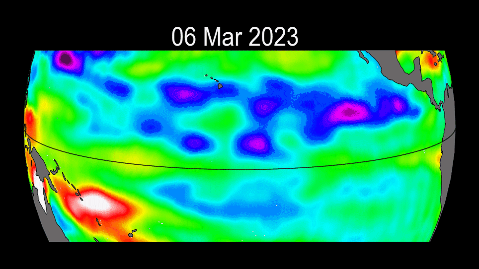
The ongoing progress of the 2023 El Niño event.


-
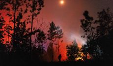
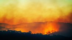
 Tropical forests stop absorbing carbon dioxide during El Niño events. This year could be the worst.
El Niño transforms tropical forests from carbon sinks to sources. 2026 could be the worst year yet.
climate-change -
 'Uncharted territory': Record-high ocean temperatures confirmed for June as El Niño strengthens its grip
Global sea surface temperatures reached record highs for June as a newly declared El Niño hit the Pacific Ocean, prompting concerns over extreme weather, flooding, sea level rise and stress to global ocean ecosystems.
3 Commentsclimate-change -
 Satellites reveal Earth has a surprising symmetry in the way it reflects light — and it might be tied to the El Niño cycle
Even though the Eastern and Western halves of Earth are fairly different, they reflect the same amount of sunlight, a new study finds.
planet-earth -
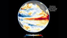 NASA satellite captures wave of warm water hundreds of miles long that signals a devastatingly strong El Niño
This year's El Niño is on track to be among the strongest ever recorded.
28 Commentsplanet-earth -
 El Niño is officially here, and will be among the strongest ever recorded, NOAA announces
The National Oceanic and Atmospheric Administration gives the climate event a 63% chance to "rank among the largest El Niño events in the historical record going back to 1950."
weather -
 Coming El Niño will be the strongest ever recorded, new forecast predicts
A June update by the European Centre for Medium-Range Weather Forecasts suggests that the coming weather event will be the strongest ever measured.
10 Commentsweather -
 'The biggest El Niño event since the 1870s': 'Super' El Niño is now the most likely scenario by the end of this year — and the humanitarian cost could be huge
A "very strong" El Niño is now the most probable scenario for the October-to-February period.
10 Commentsclimate-change -
 Once-in-a-century 'super' El Niño in the cards as ocean temperatures reach near record highs in April
Climate scientists have revealed that last month's sea surface temperatures were the second-warmest for any April on record, reflecting the emergence of El Niño.
climate-change -
 'One of the most rapid transitions that I've seen': NOAA forecaster on how this year's El Niño could shatter records
INTERVIEW Nathaniel Johnson, a member of NOAA's El Niño forecasting team, says that this year's transition to El Niño could be the fastest on record.
5 CommentsINTERVIEW


