














Iran's Massive Earthquake Explained

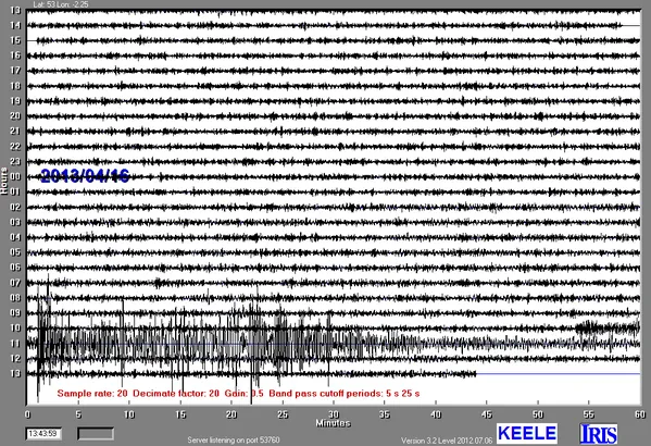
The strongest earthquake to hit Iran in more than 50 years was a subduction-zone quake — the same tectonic setting underlying deadly temblors in Japan, Chile and Indonesia.
The magnitude-7.8 Khash earthquake struck 51 miles (82 kilometers) beneath the Earth's surface, where the Arabian Plate dives under the massive Eurasian Plate, the U.S. Geological Survey (USGS) reported. The quake hit today (April 16) at 3:14 p.m. local time (6:44 a.m. EDT). Shaking was felt from New Delhi to Dubai, and dozens of people have been reported killed by collapsed structures, according to news reports. The USGS said that there will be more than a 47 percent chance of more than 1,000 fatalities.
Known as the Makran subduction zone, the plate boundary has produced some of the Middle East's biggest and deadliest earthquakes. For example, in November 1945, a magnitude-8.0 earthquake in Pakistan triggered a tsunami within the Gulf of Oman and the Arabian Sea, killing more than 4,000 people.
Considering subduction-zone earthquakes can strike nearly 435 miles (700 km) deep in the Earth, today's quake was likely within the Arabian Plate itself, not along the zone where the two massive slabs meet, said Bill Barnhart, a research geophysicist with the USGS in Denver.
"We don't fully know yet, but instead of being slip along the slab, it was probably an earthquake within the slab," Barnhart told OurAmazingPlanet. "This is related to the subducting slab flexing as it goes down deeper into the Earth."
Off the coast of Pakistan, at the mouth of the Persian Gulf, the Arabian Plate is sliding northward at about 1.5 inches (37 millimeters) per year. The motion pushes oceanic crust beneath the Eurasian Plate, which covers most of Europe and Asia, according to the USGS.
To the west, in Iran and Iraq, are the Zagros Mountains, a smaller version of the Himalayas, where continental crust carried on the Arabian Plate collides with the Eurasian Plate's continental crust. To the east, in Pakistan and India, is another plate boundary, where the Indian and Eurasian plates meet.
Get the world’s most fascinating discoveries delivered straight to your inbox.
A smaller earthquake hit Iran on April 9. The magnitude-6.3 Bushehr earthquake, which hit in the southern Zagros Mountains, was unrelated to today's temblor, the USGS said. That quake was a thrust-fault earthquake, meaning the ground on one side of the fault moved vertically up and over the other side, shortening the distance between the two sides. The epicenter was 55 miles (89 km) southeast of Bushehr, the city where Iran's only nuclear power station is located.
In 2003, some 26,000 people in Iran were killed by a 6.6-magnitude quake that flattened the historic city of Bam, located about 400 miles (650 km) east of Bushehr on the other side of the Zagros Mountains. The Bam earthquake was a strike-slip, meaning the ground on either side of the faults moved mostly horizontally, as the San Andreas Fault does.
Email Becky Oskin or follow her @beckyoskin. Follow us @OAPlanet, Facebook & Google+. Original article on LiveScience's OurAmazingPlanet.
