Our amazing planet.

Wintery Weather Aims for Washington State

western washington satellite image
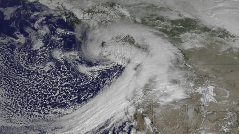
(Image credit: NOAA)

While the rest of the country is enjoying unseasonably warm weather, the Pacific Northwest is hunkering down for a wintery blast.

A front is moving into western Washington state today bringing strong and potentially damaging winds to the coast and north interior, as seen in the image above, taken by the GOES West satellite on March 12. Very high surf of 25 to 30 feet (7.6 to 9 meters) will affect the coast. Windy conditions are expected across all of western Washington. Heavy snows are expected in the mountains with up to one and a half feet possible by the end of the day.

Snow is in the forecast for Seattle, according to the National Weather Service. Across the lowlands, snow will fall in spots, with accumulation at less than an inch. The instability in the atmosphere could also bring thunderstorms and hail across the region.

Earlier this year, a perfect recipe for snow hit the Pacific Northwest, bringing nearly a winter's worth of snow to Seattle in a matter of hours. The metro region got slammed with 4 to 8 inches (10 to 20 centimeters) on Jan. 18, forcing schools to close and grounding flights throughout the region as Seattle battled whiteout conditions

Live Science Staff
For the science geek in everyone, Live Science offers a fascinating window into the natural and technological world, delivering comprehensive and compelling news and analysis on everything from dinosaur discoveries, archaeological finds and amazing animals to health, innovation and wearable technology. We aim to empower and inspire our readers with the tools needed to understand the world and appreciate its everyday awe.