It's quick and easy to access Live Science Plus, simply enter your email below. We'll send you a confirmation and sign you up for our daily newsletter, keeping you up to date with the latest science news.
The High Park wildfire continues to burn just west of Fort Collins, Colo. The burned area, shown in dark red in the June 18, 2012 image, shows the nearly 60,000 acres that have burned so far. The fire, which started on June 9 by a lightning strike, destroyed 189 homes as of June 19. Evacuation orders remain in place in many areas. In the June 18 image, clouds hover just north of the burned area, with smoke from the fire visible as blue.
Before the Fire
(Image credit: USGS | NASA)
A satellite image taken June 8, 2011, of the same area of Colorado before the wildfires.
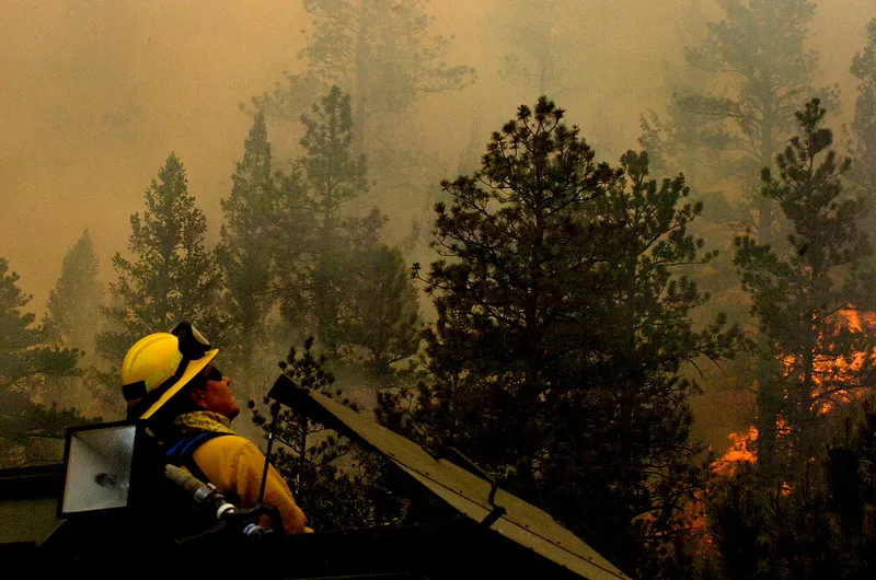
High Park Fire
(Image credit: Official Army National Guard photo by Sgt. Jess Geffre/RELEASED)
As wildfires continue to burn in Colorado and neighboring states, maps using the latest Web-scraping technology help residents find evacuation routes and shelters. This photo shows the High Park Fire on June 21.
(Image credit: U.S. Air Force photo by Tech. Sgt. Thomas J. Doscher)
A U.S. Forest Service aircraft breaks away as a Modular Airborne Firefighting System-equipped C-130 begins dropping retardant on a section of the Waldo Canyon fire near Colorado Springs, Colo., June 26.
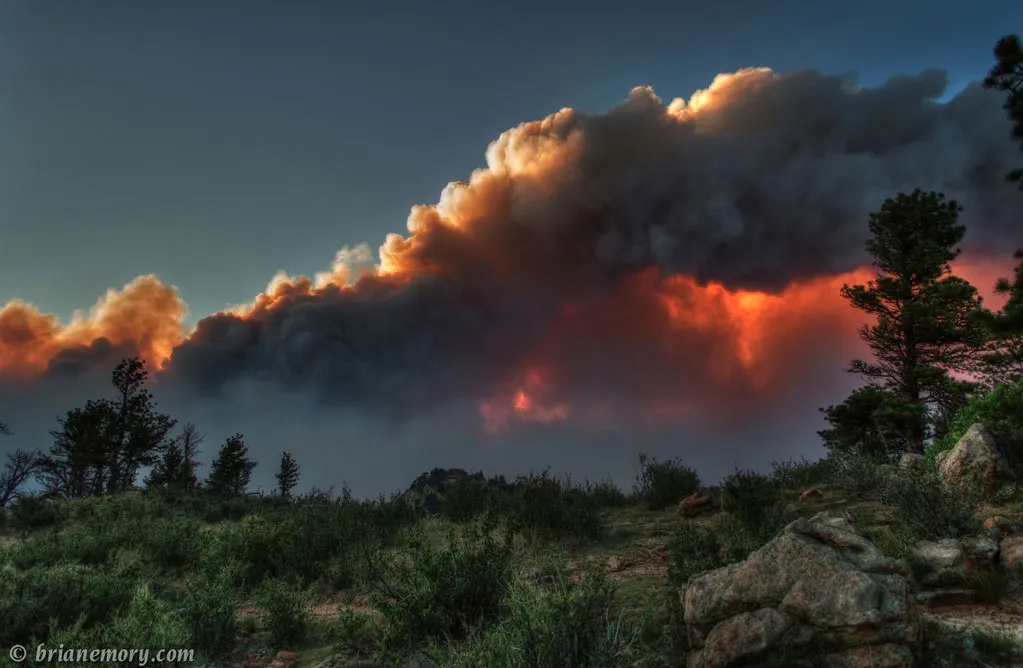
"There's quite a fire burning west of Fort Collins, Colorado. It created some pretty spectacular views as the setting sun shone through the clouds and smoke," Brian Emory who took this shot of the High Park Fire on June 10, 2012, wrote on his Flickr page.
The High Park Fire continues to burn areas west of Fort Collins, Colo., shown here in a June 11, 2012, photo taken by Brian Emory. "The Colorado wildfire continues to make for some amazing sunsets," he writes on his Flickr page.
"Another Colorado night, another great sunset thanks to the High Park fire," Brian Emory writes on his Flickr page. "I really love how the smoke shields the sky from the sun causing a distinct break in the blue. I took this at Riverbend Ponds Natural Area in Fort Collins," on June 22, 2012.
Sign up for the Live Science daily newsletter now
Get the world’s most fascinating discoveries delivered straight to your inbox.
For the science geek in everyone, Live Science offers a fascinating window into the natural and technological world, delivering comprehensive and compelling news and analysis on everything from dinosaur discoveries, archaeological finds and amazing animals to health, innovation and wearable technology. We aim to empower and inspire our readers with the tools needed to understand the world and appreciate its everyday awe.

 Live Science Plus