It's quick and easy to access Live Science Plus, simply enter your email below. We'll send you a confirmation and sign you up for our daily newsletter, keeping you up to date with the latest science news.
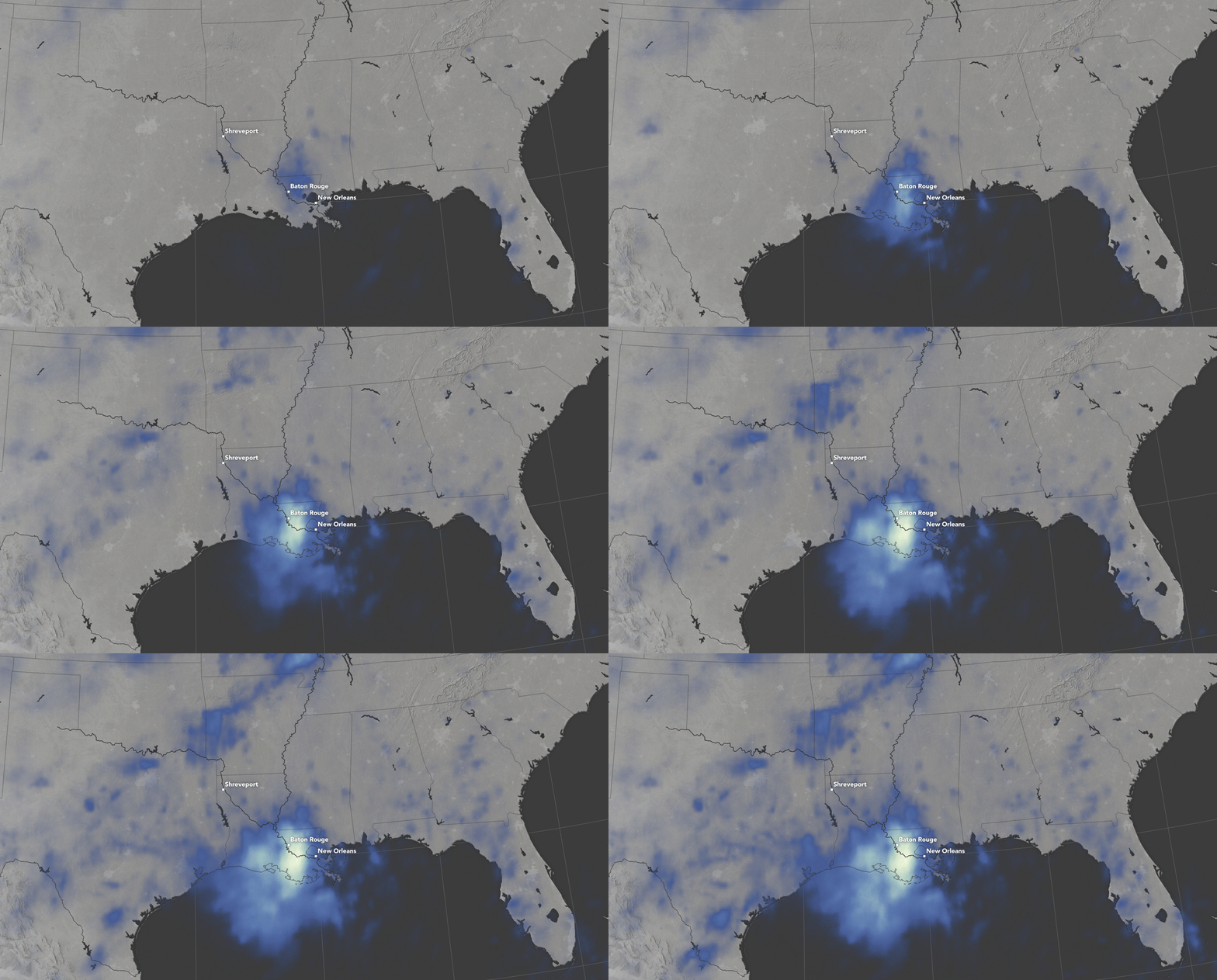
Intense rainfall is causing widespread and disastrous flooding in parts of Louisiana, and new measurements from a NASA satellite illustrate just how much precipitation has accumulated in this region of the Southern United States.
The animation depicts rainfall totals every 3 hours over a 72-hour span, from Aug. 12 to 14. Some areas received more than 20 inches (50.8 centimeters) of rain over those three days.
Rain totals in southern Louisiana were at least 600 percent over normal levels over a seven-day period, according to the Lower Mississippi River Forecast Center of the U.S National Weather Service. [Aftermath of a Storm: Images from Hurricane Katrina]
A NASA satellite measured rainfall in Louisiana over a 72-hour span.
(Image credit: NASA)
Data collected from the Integrated Multi-Satellite Retrievals for GPM (IMERG), a product of the Global Precipitation Measurement (GPM) mission, offers essential rainfall observations for NASA, the Japan Aerospace Exploration Agency and five other national and international partners.
NASA noted that their observed totals are regional and remotely sensed, according to the Earth Observatory. As such, rainfall accumulations could be much higher when measured from the ground.
The downpours in Louisiana have resulted in rapidly rising rivers and serious flooding, forcing tens of thousands of people from their homes and taking at least 11 lives.
The National Weather Service described the heavy rain event as an "inland sheared tropical depression." High moisture content in the atmosphere combined with low pressure fueled the intense rain storms, according to meteorologists Jeff Masters and Bob Henson.
Sign up for the Live Science daily newsletter now
Get the world’s most fascinating discoveries delivered straight to your inbox.
"Like a tropical depression, the low had a warm core, and the counterclockwise flow of air around the storm brought huge amounts of tropical moisture from the near-record-warm waters of the Gulf of Mexico and northwest Atlantic northwards over land," Masters and Henson wrote on their blog, Weather Underground. "The amount of moisture in the atmosphere over the Gulf Coast region over the past week has been nothing short of phenomenal."
Areas along the Amite River have experienced the most extreme flooding — the river exceeded its previous height record in Magnolia, Louisiana, by more than 6 feet (1.8 meters). An aerial photography mission conducted by NOAA captured some of the damage from the historic flooding, showing areas in Port Vincent, southeast of Baton Rouge, with streets and houses submerged in floodwaters.
Kacey Deamer is a journalist for Live Science, covering planet earth and innovation. She has previously reported for Mother Jones, the Reporter's Committee for Freedom of the Press, Neon Tommy and more. After completing her undergraduate degree in journalism and environmental studies at Ithaca College, Kacey pursued her master's in Specialized Journalism: Climate Change at USC Annenberg. Follow Kacey on Twitter.