'Horizontal Tornado' Captured By Amateur Videographer

Get the world’s most fascinating discoveries delivered straight to your inbox.
You are now subscribed
Your newsletter sign-up was successful
Want to add more newsletters?

Delivered Daily
Daily Newsletter
Sign up for the latest discoveries, groundbreaking research and fascinating breakthroughs that impact you and the wider world direct to your inbox.

Once a week
Life's Little Mysteries
Feed your curiosity with an exclusive mystery every week, solved with science and delivered direct to your inbox before it's seen anywhere else.

Once a week
How It Works
Sign up to our free science & technology newsletter for your weekly fix of fascinating articles, quick quizzes, amazing images, and more

Delivered daily
Space.com Newsletter
Breaking space news, the latest updates on rocket launches, skywatching events and more!

Once a month
Watch This Space
Sign up to our monthly entertainment newsletter to keep up with all our coverage of the latest sci-fi and space movies, tv shows, games and books.

Once a week
Night Sky This Week
Discover this week's must-see night sky events, moon phases, and stunning astrophotos. Sign up for our skywatching newsletter and explore the universe with us!
Join the club
Get full access to premium articles, exclusive features and a growing list of member rewards.
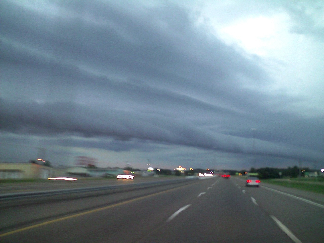
New images of a weird weather phenomenon known as a roll cloud have surfaced from Richland, Miss.
The images, taken on a camera phone by Mississippi resident Daniel Blake Fitzhugh, reveal a seemingly endless roll cloud, or arcus cloud, a low cloud formation that forms over the sea or at the edges of thunderstorms. Fitzhugh sent in an image and video of the cloud to LiveScience after seeing an earlier report of a roll cloud off the coast of Brazil.
Fitzhugh told LiveScience he captured the video and image of a roll cloud in 2010 in Richland, a town on the outskirts of Jackson, Miss.
"It had been cloudy and windy all day," Fitzhugh wrote in an email. "I was heading north and the cloud was going west to east. I noticed it and was extremely surprised! I had never seen anything like it before." [See video of the roll cloud]
The cloud was rolling around like a "sideways tornado," Fitzhugh said. In fact, roll clouds form where sinking cold air drives low-hanging, moist warm air upward, where cooler temperatures condense the moisture in that air to form clouds. Winds create the weird rolling effect. Their more commonly spotted cousin, shelf clouds, form on the leading edges of thunderstorms; while shelf clouds are attached to the bulk of a storm, these tubular clouds aren't.
Tornadoes are also associated with storms, but they occur when thunderstorm updrafts tilt rotating air vertically. Unlike tornadoes, roll clouds aren't dangerous.
They are rare, however. One of the best chances to see a roll cloud is off the coast of Queensland, Australia. Here, sea winds regularly form a reoccurring roll cloud known as Morning Glory during the fall months.
Get the world’s most fascinating discoveries delivered straight to your inbox.
You can follow LiveScience senior writer Stephanie Pappas on Twitter @sipappas. Follow LiveScience for the latest in science news and discoveries on Twitter @livescience and on Facebook.

Stephanie Pappas is a contributing writer for Live Science, covering topics ranging from geoscience to archaeology to the human brain and behavior. She was previously a senior writer for Live Science but is now a freelancer based in Denver, Colorado, and regularly contributes to Scientific American and The Monitor, the monthly magazine of the American Psychological Association. Stephanie received a bachelor's degree in psychology from the University of South Carolina and a graduate certificate in science communication from the University of California, Santa Cruz.
 Live Science Plus


