It's quick and easy to access Live Science Plus, simply enter your email below. We'll send you a confirmation and sign you up for our daily newsletter, keeping you up to date with the latest science news.
Residents and travelers across Newfoundland can expect Leslie's windswept rains and rough seas to be at their peak Tuesday morning and midday.
While not likely to regain hurricane strength Leslie is picking up forward speed and will race across Newfoundland between 30 and 40 mph Tuesday. Wind shear should prevent Leslie from becoming a hurricane prior to landfall in Newfoundland, but hurricane-force gusts are likely.
Seas will continue to build Atlantic Canada waters through Monday with gusty squalls moving to Newfoundland Monday night.
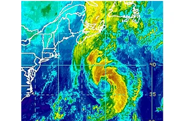
According to Expert Senior Meteorologist Dan Kottlowski, head of the AccuWeather.com Hurricane Center, "The strongest winds will occur in southeastern Newfoundland with the the heaviest rains in the northwestern part of the province."
(Image credit: Accuweather.com)
St. John's and Bonavista, Newfoundland could experience gusts to hurricane force Tuesday morning and midday over a several-hour stretch.
Meanwhile, torrential rainfall lasting 3 to 6 hours is likely in central Newfoundland towns such as Gander and Burgeo. From 2 to 4 inches (50 to 100 millimeters) of rain is forecast with locally higher amounts in the Annieopsquotch Mountains. There is the potential for flash and urban flooding.
Sign up for the Live Science daily newsletter now
Get the world’s most fascinating discoveries delivered straight to your inbox.
People and fishing interests should prepare for a warmer version of a strong winter storm or nor'easter.
"Weather conditions similar to Igor in 2008 are possible," Kottlowski said.
Expert Senior Meteorologist Alex Sosnowski recently said, "Any non-destructive rain would be welcomed over much of Atlantic Canada, due to a warm, dry summer in the region."
Leslie will continue to interact with a front and trough of low pressure moving in from the west.
(Image credit: Accuweather.com)
"The interaction will enhance some of the rain and thunderstorms along the front as it pushes eastward across Nova Scotia, New Brunswick and the Gulf of St. Lawrence region into Monday night," Sosnowski said," Although Leslie is a larger system, coming in farther west over Newfoundland, it will not be quite as intense as Igor was."
With much of the country experiencing an unseasonably warm winter, fears of climate change come to mind. See how well you understand recent weather, climate and the difference between them.