It's quick and easy to access Live Science Plus, simply enter your email below. We'll send you a confirmation and sign you up for our daily newsletter, keeping you up to date with the latest science news.
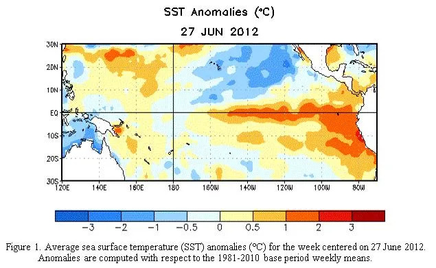
Warming sea surfaces in the tropical Pacific, in an image released July 5th, 2012. There's a greater than 50 percent chance that El Niño conditions will develop during the second half of 2012.
The western half of the continental U.S. and central and northern Alaska could be in for a warmer-than-average winter, while most of Florida might be colder-than-normal December through February, according to NOAA's annual Winter Outlook.
Forecasters with NOAA's Climate Prediction Center say a wavering El Niño, expected to have developed by now, makes this year's winter outlook less certain than previous years.
"This is one of the most challenging outlooks we've produced in recent years because El Niño decided not to show up as expected," said Mike Halpert, deputy director of NOAA's Climate Prediction Center. "In fact, it stalled out last month, leaving neutral conditions in place in the tropical Pacific."
When El Niño is present, warmer ocean water in the equatorial Pacific shifts the patterns of tropical rainfall that in turn influence the strength and position of the jetstream and storms over the Pacific Ocean and United States. This climate pattern gives seasonal forecasters confidence in how the U.S. winter will unfold. An El Niño watch remains in effect because there's still a window for it to emerge.
Other climate factors can influence winter weather across the country. Some of these factors, such as the North Atlantic Oscillation, a prominent climate pattern, are difficult to predict more than one to two weeks in advance. The NAO adds uncertainty to the winter outlook in the Northeast and Mid-Atlantic portions of the country.
Sign up for the Live Science daily newsletter now
Get the world’s most fascinating discoveries delivered straight to your inbox.
Areas ravaged by extreme drought over the past year are unlikely to see much relief from drought conditions this winter.
In the 2012 U.S. Winter Outlook (December through February) odds favor:-Warmer-than-average temperatures in much of Texas, northward through the Central and Northern Plains and westward across the Southwest, the Northern Rockies, and eastern Washington, Oregon and California, as well as the northern two-thirds of Alaska.
-Cooler-than-average temperatures in Hawaii and in most of Florida, excluding the panhandle.
-Dryer-than-average conditions in Hawaii, the Pacific Northwest and Northern California, including Idaho, western Montana, and portions of Wyoming, Utah and most of Nevada.
-Dryer-than-average conditions in the upper Midwest, including Minnesota, Wisconsin, Iowa and northern Missouri and eastern parts of North and South Dakota, Nebraska, Kansas, and western Illinois.
-Wetter-than-average conditions across the Gulf Coast states from the northern half of Florida to eastern Texas.
The rest of the country falls into the "equal chance" category, meaning these areas have an equal chance for above-, near-, or below-normal temperatures and/or precipitation.
This seasonal outlook does not project where and when snowstorms may hit or provide total seasonal snowfall accumulations. Snow forecasts are dependent upon the strength and track of winter storms, which are generally not predictable more than a week in advance.
The only sure thing about weather forecasts is that they’re wildly different all over the planet. Test your knowledge on the wild ranges in temperature, precipitation and more.