


In Photos: Nike Missile Sites Leave Footprints

Nike Missiles

The Nike missiles, named after the Greek goddess of victory, were a key part of the U.S. national defense system from 1954 to the 1970s, with nearly 300 sites holding supersonic surface-to-air missiles ready to launch, around the country. The advent of long-range intercontinental ballistic missiles (ICBMs) made the Nike missiles obsolete. Now, the abandoned launch sites are quickly disappearing from view.
Google Earth images show a time sequence from 1993 (upper left) through 2012 (lower right), revealing a Pittsburgh Defense Area that was later abandoned and covered with housing.
Lorton defense
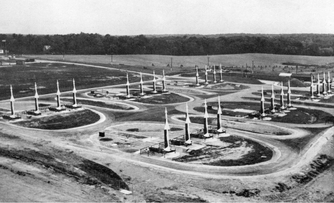
One of the first operational Nike missile sites was in Lorton, Va. Construction began in March 1954, and the site was operational in 1955.
Secretary of the Army, Charles C. Finucane, labeled it the "National NIKE Site," and hosted visits by foreign dignitaries and national and local politicians. Initially armed with Nike-Ajax missiles, the site was upgraded to Nike-Hercules missiles around 1958. The site was deactivated in 1973.
Ajax and Hercules

Nike Ajax (left) and Hercules (right) missiles during test launches.

Wayland launch

A black-and-white air photo from 1957 downloaded from the USGS Earth Explorer showing both the Wayland Launch and Control sites clearly (marked with squares) in Massachusetts.
Wayland site

Here, a zoomed-out view at the Wayland launch site in 1957.
Oahu open air

This Google Earth image shows the Oahu Defense Area in Hawaii, which was equipped with missiles in open air with earthen revetments, or embankments, between paired launch sites, shown here in 1968.
Oahu overgrowth

The Oahu Defense Area with some scrub overgrowth shown here in this Google Earth image from 2013.
Get the world’s most fascinating discoveries delivered straight to your inbox.
Cleveland Defense

A Nike missile site, located in the Cleveland suburbs on the south shore of Lake Erie, shown in this USGS Earth Explorer image taken on April 13, 1962. The Integrated Fire Control site (yellow circle) and the missile launch site (red circle) are visible here.
Parks and pavement

By 2012, as seen in this Google Earth image, the Integrated Fire Control site (yellow circle) had become a park, and the launch site (red circle) had been paved over and used for parking school buses. The launch site was less than one-tenth of a mile from the backyards of the houses along Charles Street.
Seattle Defense

Located southeast of Seattle, Wash., the Seattle Defense Area is due east of a large housing community that looks to be lower in elevation than the land holding the defense site. This historic air photo taken in September 1968 shows no obvious surface disruption where the housing development stands.
Seattle Defense - 2012

Google Earth image revealing the Seattle Defense Area in 2012.

For the science geek in everyone, Live Science offers a fascinating window into the natural and technological world, delivering comprehensive and compelling news and analysis on everything from dinosaur discoveries, archaeological finds and amazing animals to health, innovation and wearable technology. We aim to empower and inspire our readers with the tools needed to understand the world and appreciate its everyday awe.