
Satellite imagery provides a unique perspective on our planet and can encompass a wide range of different scientific disciplines including climate change, weather, volcanic eruptions and even animal behavior. Every week, we take a bird's eye view of Earth, and see how it affects the people living on it.
See more stunning pictures of Earth

-
 Indonesia's near-identical, 'Twin Peaks' volcanoes form striking mirror image
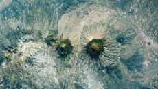
Earth from space A 2021 astronaut photo shows the surprising similarities between Mount Sundoro and Mount Sumbing, which lie at the heart of Java, Indonesia.
2 CommentsEarth from space -
 Trio of drastically different US lakes straddles the border between states
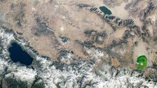
Earth from space A 2020 astronaut photo shows three uniquely colored lakes — Tahoe, Walker and Mono — straddling contrasting biomes on either side of the California-Nevada border.
Earth from space -
 Rusty, orange water 'bleeds' across brilliant Bolivian lagoon
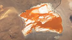
Earth from space A 2015 astronaut photo shows dark-orange water that appears to bleed across the bright-white floor of a high-altitude salt lake in the Bolivian Andes.
Earth from space -
 Gold glitters around Ghana's 'lake of souls' thanks to catastrophic meteor strike
Earth from space A 2015 satellite photo shows a series of golden tendrils surrounding Ghana's Lake Bosumtwi, which is considered sacred to the local Asante people. The lake and its surroundings were shaped by a massive meteor impact around 1 million years ago.
3 CommentsEarth from space -
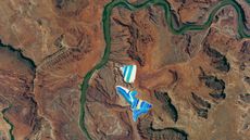 Bright-blue 'potash ponds' shine alongside a dark-green river in Utah
Earth from space A 2017 astronaut photo shows two sets of solar evaporation ponds alongside the Colorado River. The stripy structures are used to refine potassium chloride, or "potash," which is mined nearby.
Earth from space -
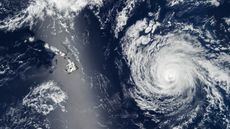 Shimmering silver 'sunglint' obscures Hawaii as hurricane approaches
Earth from space A 2025 satellite photo shows the swirling cyclone of Hurricane Kiko bearing down on Hawaii while the island state was obscured by a bright, reflective streak.
Earth from space -
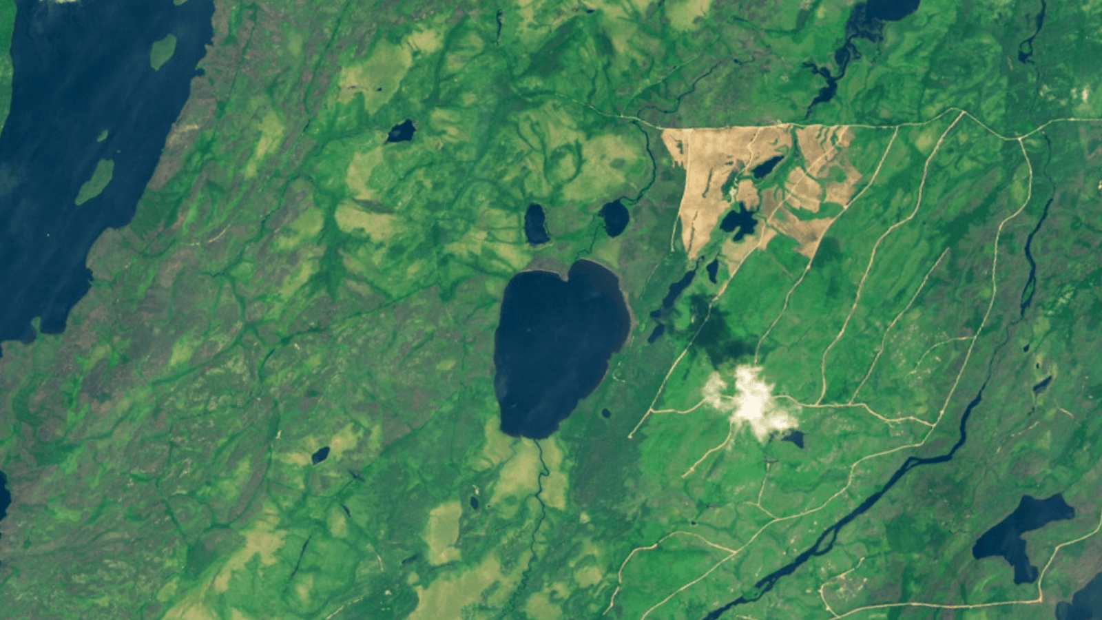 Canadian 'emoji' lake vanishes after dramatic, landslide-like collapse
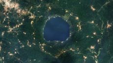
Earth from space A pair of satellite photos reveals the drastic transformation of Canada's Lake Rouge, which was fully drained after the sudden collapse of one of its banks. A multitude of factors led to the demise of the shocked-emoji-like lake, experts say.
Earth from space -
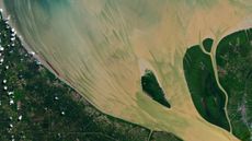 Full moon helps paint vibrant, muddy 'brushstrokes' in Indonesian river
Earth from space A 2024 satellite snap shows suspended sediments streaking across the mouth of the Rokan River, thanks in part to a particularly high tide caused by a full "Strawberry Moon."
Earth from space -
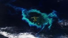 Glowing ring of plankton surrounding New Zealand islands linked to deadly underwater plateau
Earth from space A recent satellite photo captured a gleaming halo of phytoplankton encircling the remote Chatham Islands. The stunning sight is the result of a hidden underwater structure, which has also helped kill hundreds of cetaceans.
3 CommentsEarth from space


