As the Northeast digs out from under the snow dumped by the Christmas Blizzard of 2010, we wondered how this storm stacked up against another big snowstorm from last winter.
Below, two "snotorious" storms of 2010 go toe-to-toe. [Related: What's a Blizzard?].
Names:
Latest Videos From
February: Snowmageddon, Snowpocalypse, SnOMG, First North American Blizzard of 2010
December: Christmas Blizzard of 2010, East Coast Blizzard, Boxing Day Blizzard
Dates:
Feb. 5-6, 2010
Dec. 26-27, 2010
The term "snowmageddon" and "snowpocalypse" originated with the first February blizzard of 2010, and stuck when President Obama used them. However, another severe snowstorm hit soon after on Feb. 9 and 10, and another struck later in the month. The nicknames are often used loosely to describe the winter weather for the month of February 2010.
Highest Snowfall:
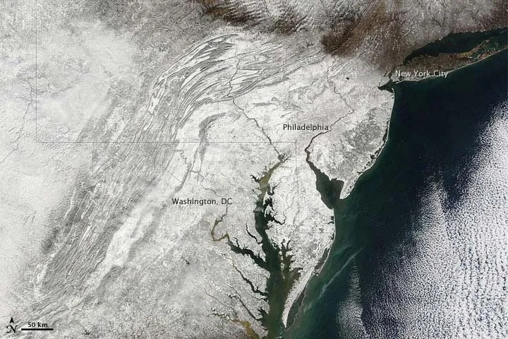
February: 38.3 inches (97 centimeters) at Elkridge, Md.
December: 32 inches (81 cm) at Rahway, N.J.
The February blizzard also dumped a record-breaking 32.4 inches (82.3 cm) of snow at Washington's Dulles International Airport. However, that storm largely spared New York City. The Christmas Blizzard, however, brought 20 inches (50.8 cm) of snow to Central Park, while Washington was spared. New York City's record of 26.9 inches (68.3 cm) of snow, set in February 2006, still stands.
Number of States that Declared a State of Emergency:
February: 6
December: 6
A state of emergency in Philadelphia forced the cancellation of an NFL Sunday night football game during the December storm. The postponement prompted Pennsylvania Gov. Ed Rendell to declare that delaying the game was further evidence of the "wussification of America."
The game was later played on a Tuesday night for the first time since 1946. The Minnesota Vikings upset the Philadelphia Eagles, 24-14.
Percentage of U.S. Covered:
February: 59.9 percent
December: 54.5 percent
After the second snowstorm in February, a whopping 68.1 percent of the country was blanketed by snow.
Flights Canceled:
February: About 7,000
December: About 5,000
Top winds:
February: 56 mph (93 kph) at many coastal locations
December: 80 mph (128.7 kph) at Wellfleet, Mass.
Fatalities:
February: 41 estimated
December: 12 estimated
Number of Tech Media Network Staff Stranded in Far Away Cities by the Storm:
February: 0
December: 8

 Live Science Plus