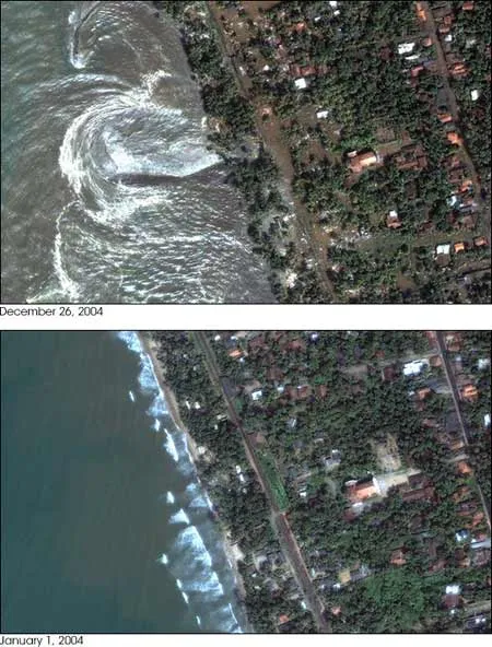
A new analysis of the December earthquake that caused disastrous tsunami waves to strike Asia and Africa finds it was three times more powerful than earlier measurements suggested.
This would make it the second largest earthquake ever instrumentally recorded.
Seismologists Seth Stein and Emile Okal from Northwestern University said Tuesday that the Sumatra earthquake had a magnitude of 9.3. Earlier measurements had estimated the temblor at 9.0. Because the magnitude scale is logarithmic, a change of 0.3 units corresponds to a three-fold increase in intensity.
Latest Videos FromLive Science
The newly recognized power might explain why the resulting tsunami of Dec. 26, 2004 was so destructive. The only earthquake with a greater recorded magnitude - 9.5 - occurred in Chile in May 22, 1960.
The new magnitude for the Sumatra earthquake does not contradict previous estimates so much as it enhances what is known. The separate numbers come from measurements of seismic wave amplitudes at different periods, or wavelengths.
"The magnitude of an earthquake depends on the period that you measure it," Stein told LiveScience in a telephone interview.
Location of the Dec. 26, 2004 earthquake and aftershocks, along with the shifting tectonic plates that caused it all.
The original 9.0 estimate of the earthquake was based on 300-second waves. Stein and Okal looked instead at 3,200-second (53-minute) waves, which corresponds to the lowest natural frequency - or fundamental - of the planet.
"The 53-minute waves are the slowest free oscillations of the Earth," Stein said. "They are the hardest to excite."
It takes a very large earthquake - magnitude 9 or higher - to generate detectable waves at these long period oscillations, Stein said. Most of the energy in the tsunami-causing earthquake was in these slow-moving waves.
The energy released by an earthquake depends on two things: the amount of slip in the colliding plates of the planet and the length of fault line affected.
Scientists estimate that the Indian plate slipped 33-50 feet (10 to 15 meters) under the Burma microplate on Dec. 26. What they apparently underestimated was the extent of this slippage.
"The rupture zone was much larger than previously thought," Stein said. "The initial calculations that it was a 9.0 earthquake did not take into account what we call slow slip, where the fault, delineated by aftershocks, shifted more slowly."
By Stein and Okal's estimates, the complete rupture zone - both the slow slip and the earlier measured fast slip regions - was 750 miles (1,200 kilometers) long, tripling what the initial calculations had put forth.
The north-south orientation of slow slip fault line also helps explain the path of the tsunami, since the highest amplitude waves usually travel perpendicular to the fault line. If the fast-slip region had been the only rupture, the largest waves would have headed in a southwest direction - into the center of the Indian Ocean.
"But the alignment of the slow slip region implies that much of the energy was sent towards Sri Lanka," Stein said.
An earthquake releases the strain that accumulates over centuries between plates pushing into each other. For this reason, it may be a very long time before anything like a magnitude 9.3 earthquake erupts again in this part of the fault line. But Stein pointed out that there are other areas that still have built-up strain.
"The segments to the south could break anytime, even tomorrow," Stein said.
Related Stories
The Odds of Dying
Global Disaster Hotspots
How Tsunamis Work
Tsunamis in History
The Megatsunami: Possible Modern Threa