


Know When To Go: A New Way to Keep Firefighters Safe from Harm (Op-Ed)
This article was originally published at The Conversation. The publication contributed the article to LiveScience's Expert Voices: Op-Ed & Insights.
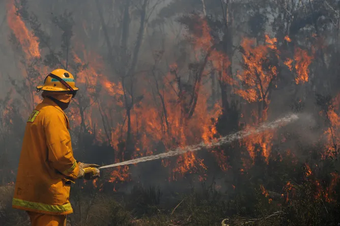
For a firefighter, knowing when it’s time to evacuate can be the difference between life and death. But that can be a difficult call to make when you’re trying to protect life, property and resources while battling wildfires in arduous weather and terrain.
In a recent article published in International Journal of Wildland Fire, we present a new way to help firefighters “know when to go”.

Whether working at the fire’s edge or creating a fire break far from the front, firefighters must maintain situational awareness and monitor impending threats to their safety. When firefighters are unable to properly recognise risks, or they underestimate conditions, the results can be tragic.
Knowing when to evacuate relies on the idea of a trigger – when a condition is reached, a specific set of actions should occur.
A spatial trigger could be set at a ridgeline. If a fire reaches that ridgeline, firefighter evacuation to a safe area would be triggered.
Our model uses knowledge of fuel, terrain, and predicted weather conditions to set triggers on the landscape before firefighters are deployed, providing a tool that can assist the decision to evacuate and help firefighters avoid being trapped.
Get the world’s most fascinating discoveries delivered straight to your inbox.
We start with the idea of a safety zone. A safety zone is an area where firefighters will not be threatened by the direct impacts of the fire. It is usually a clearing with a diameter several times the expected flame length.
We can calculate the time it should take firefighters to travel to that safety zone based on their assignment. Since there are multiple modes of potential travel, we calculate travel times on foot, by engine, and by bulldozer. Travel time is adjusted for slope, since steep terrain will impede travel.
Once these travel times to safety zones are calculated, we use fuel, terrain, and forecast weather conditions to model the fire spread rate. By creating a network of fire spread rates, we can calculate when the fire could potentially reach the evacuation route and the safety zone.
A “trigger buffer” can then be created that surrounds the evacuation route and safety zone. If the trigger buffer is crossed by the fire, it’s time to evacuate.

The above figure illustrates the trigger buffer concept for a fire in California. Firefighters are assigned along a road running from north to south, as the fire approaches from the southwest. Morning winds are forecast to be from the northeast between 6.4 and 12.9 kilometres an hour, switching to the southwest between 9.7 and 19.3 kilometres an hour in the afternoon.
A safety zone is set where the road reaches a river at its northern end.
The model calculates fire spread rates based on the predicted wind conditions and the time required for firefighters to evacuate to the safety zone on foot along the road. The buffer is larger on the southern end of the road, because firefighters must leave that area much earlier to reach the safety zone.
Predicting firefighter travel times and fire spread rates also provides information on when not to evacuate. If the fire is too close and the safety zone is too far away, then firefighters may be trapped along their evacuation route.
If the trigger buffer has already been crossed and there is no way to reach a safety zone without risking entrapment, then the best strategy would be to find an area in the immediate vicinity to deploy fire shelters. Having a few additional minutes to find the best area to shelter in place could mean the difference between life and death.
This model does not replace on-the-ground decision-making. Rather, it provides a tool that helps firefighters understand the risk of entrapment under a given set of fuel, terrain, and weather conditions.
There is no replacement for expert decision-making, and the location of the fire still has to be known for a trigger buffer to be effective. Remote sensing, potentially by unmanned aerial vehicles, provides one way to monitor fire location and provide updates to firefighters in the field.
In the more general case, this model can also provide evacuation trigger buffers for communities threatened by bushfire. Termed “WUIVAC” for Wildland Urban Interface eVACuation, modelling of evacuation travel times and fire spread rates can help determine when a household or community should evacuate to a safer location. Factors such as the number of households and potential for traffic incidents can be incorporated into travel times.
For strategic decision making, trigger buffers can be modelled under “worst case” scenarios where wind speed and direction are based on historical maximum values. Communities can use these strategic trigger buffers to plan their bushfire response.
The list of challenges to firefighters continues to grow. Changing climate means that firefighters are facing new fire threats and working under more difficult conditions. Increasing population in the wildland urban interface requires firefighters to protect more lives, property, and resources.
Our hope is that modelling can provide tools to protect the safety of the men and women who keep us safe from fire.
This article was also co-authored by Greg Fryer, Assistant Superintendent of the Bonneville Interagency Hotshot Crew.
Philip Dennison receives funding from the National Science Foundation, NASA, and Bureau of Land Management.
Tom Cova receives funding from the National Science Foundation.
This article was originally published at The Conversation. Read the original article. The views expressed are those of the author and do not necessarily reflect the views of the publisher. This version of the article was originally published on LiveScience.