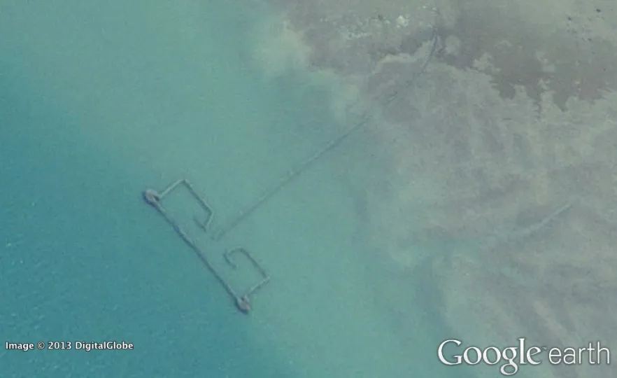
Google Earth's detailed images of our planet's surface could help scientists investigate overfishing from space. A new study of fish traps in the Persian Gulf suggests that many fish go uncounted after they are caught.
Two researchers from the University of British Columbia in Canada used Google Earth's satellite images to count intertidal fishing weirs off the coast of six countries in the Persian Gulf.
Traditionally built with date palm fronds, fishing weirs have been used for centuries as a means of trapping fish. Today, the structures are often made with bamboo and galvanized mesh wire, and in some countries, they might be contributing to the problem of bad data on fish catches. [12 Strangest Sights on Google Earth]
Latest Videos From
Overexploitation of the world's oceans and seas could lead to serious problems in terms of conservation and food security, but researchers have had a hard time estimating the impact of fishing because of unreliable catch statistics. Many countries underreport how many fish small-scale fisheries and illegal fishing operations harvest.
The results of the new study highlight that discrepancy: The researchers counted 1,900 weirs along the Persian Gulf coast during 2005, which they estimate translates to 34,170 tons (31,000 tonnes) of fish. That year, however, the countries in the region only reported a total catch of 5,800 tons (5,260 tonnes) to the United Nation's Food and Agriculture Organization.
What's more, Iran, Saudi Arabia and Qatar reported no catch data from weirs at all that year. The researchers say this is especially problematic in the case of Iran, where 728 weirs were spotted, resulting in an estimated 13,225-ton (12,000 tonnes) catch.
"Time and again we've seen that global fisheries catch data don't add up," study researcher Daniel Pauly said in a statement. "Because countries don't provide reliable information on their fisheries' catches, we need to expand our thinking and look at other sources of information and new technologies to tell us about what's happening in our oceans."
Pauly and fellow researcher Dalal Al-Abdulrazzak wrote in the Journal of Marine Science that their study shows satellite imagery also could be used to expose illegal marine practices, assess the impact of oil spills and monitor activities in marine protected areas.
Using Google Earth, researchers previously have found archaeological sites in Saudi Arabia, discovered a remarkably well-preserved impact crater in Egypt, and monitored nests of masked boobies, all from behind a computer screen.
Follow Megan Gannon on Twitter and Google+. Follow us @livescience, Facebook & Google+. Original article on LiveScience.

 Live Science Plus