
 Live Science Plus


In Photos: A Floating 'Island' of Rocks

Pumice Raft

On Aug. 9, the HMNZS Canterbury, a Royal New Zealand Air Force ship, observed a stretch of floating pumice, measuring a whopping 300 miles (482 kilometers) in length and more than 30 miles (48 km) wide.
Off the Coast

The pumice "island" was floating in the South Pacific Ocean off the coast of New Zealand.
Porous Pumice

Pumice, which forms when volcanic lava cools quickly, is riveted with pores due to gas trapped inside the lava as it hardens and can therefore float.

Veiled By Clouds

The undersea eruption responsible for the pumice raft is hidden by clouds in this morning image, which was taken by NASA's Moderate Resolution Imaging Spectroradiometer on July 19, 2012.
Spotting the Pumice

On the same day, though this time in the afternoon, NASA's MODIS snaps imagery clearly showing the Havre Seamount eruption, including the gray pumice, ash-stained water and the volcanic plume.
Pumice in July

This NASA MODIS image, taken on July 30, 2012, reveals the spreading pumice "raft" near Havre Seamount. (Pumice located by Erik Klemetti on Wired.com)
Havre Seamount
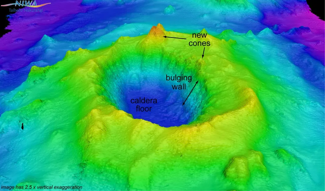
A multibeam echosounder image showing the undersea volcano called Havre Seamount, including a new cone that formed during the July 2012 eruption.
Get the world’s most fascinating discoveries delivered straight to your inbox.
