


NASA Releases New Views of Earth
Signs of life on Earth, such as the bright lights of cities and the phytoplankton that swim in the ocean, can now be seen in an astronaut's-eye view of the Earth.
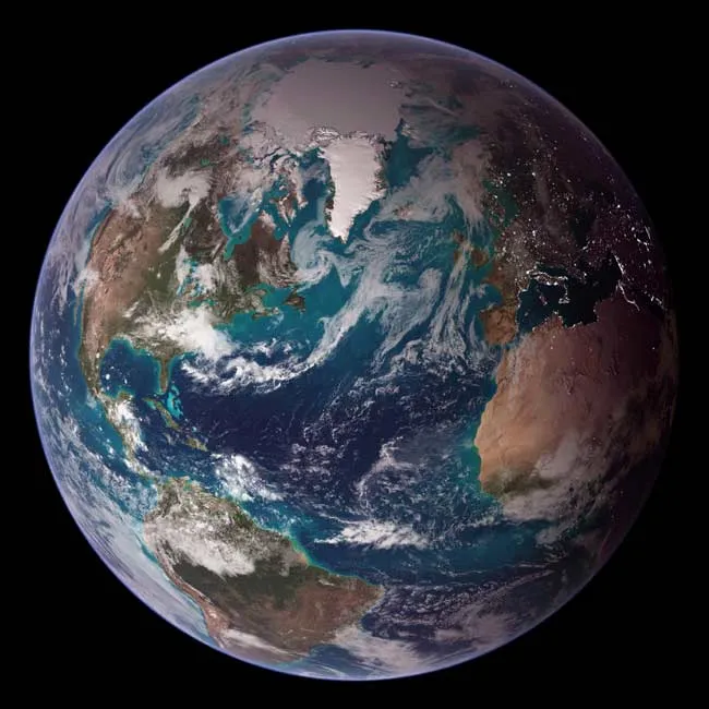
NASA scientists have created two new images of Earth as it appears from space, a vista often called the "Blue Marble," combining data of the oceans, land surfaces and sea ice taken from many different satellites.
The original project, Blue Marble 2000, was completed for the 30th anniversary of Earth Day and aimed to recreate the view of Earth that Apollo astronauts had from space. The final image, released in April 2000, displayed cloud cover from a single day, the oceans, exaggerated topographic features and vegetation for the Western Hemisphere.
The new images have combined even more of Earth's features into more complete, higher-resolution images of both the Eastern and Western hemisphere. The data used to create the new images span a longer period of time than the original and have a resolution of 500 meters (1,600 feet), versus the 1,000 meters (3, 273 feet) resolution of the older image.
Measurements of reflected sunlight taken by the Moderate Resolution Imaging Spectroradiometer (MODIS) on NASA's Terra satellite in July 2004 were used to recreate the land surfaces. MODIS observations of daytime sea ice between late August and early September 2001 were used to recreate polar sea ice in the image.
The ocean was generated by combining Terra MODIS observations of the reflectance of sea water with Aqua MODIS observations of chlorophyll content data over the open ocean to represent the activity of phytoplankton.
Cloud cover is taken from a single-day snapshot by MODIS on July 29, 2001.
Get the world’s most fascinating discoveries delivered straight to your inbox.
City lights as they would appear on Earth at night were taken from data collected by the Defense Meteorological Satellite Program mission between 1994 and 1995.
Topography is based on radar data collected by the Space Shuttle Endeavor during an 11-day mission in February 2000.
The new project, dubbed Blue Marble: Next Generation, also includes other images that are monthly composites of the Earth that show the seasonal variations in vegetation and ice cover over an entire year.

Andrea Thompson is an associate editor at Scientific American, where she covers sustainability, energy and the environment. Prior to that, she was a senior writer covering climate science at Climate Central and a reporter and editor at Live Science, where she primarily covered Earth science and the environment. She holds a graduate degree in science health and environmental reporting from New York University, as well as a bachelor of science and and masters of science in atmospheric chemistry from the Georgia Institute of Technology.