
 Live Science Plus


Hurricane Irma Photos: Images of a Monster Storm

Passing over Saint Martin

The GOES-16 satellite captured this image of Hurricane Irma passing over Saint Martin and Anguilla on Sept. 6. Winds are still raging at 185 mph (295 km/h), with the storm moving at about 16 mph (26 km/h) toward the west-northwest, according to the National Hurricane Center.
Irma Engulfs Barbuda
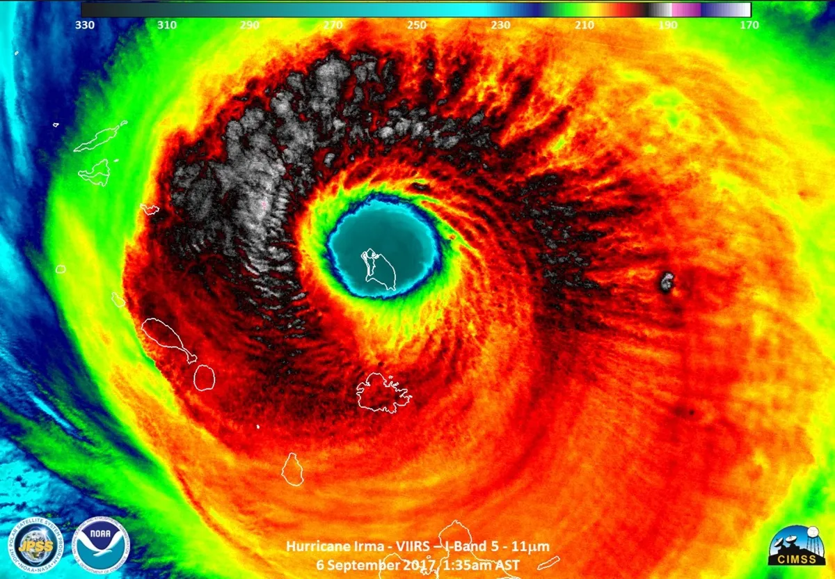
The eye of Hurricane Irma completely engulfs the island of Barbuda, shown here in this Suomi NPP satellite image captured on Sept. 6, 2017.
Preparing for the storm

Drivers line up at a 7/Eleven to buy gas in Delray Beach, Florida, on Sept. 5, 2017. Residents were preparing early for Hurricane Irma, which is expected to hit the Florida Keys and parts of the Florida peninsula.

Gravity waves

Hurricane Irma's maximum sustained winds reached 185 mph (nearly 300 km/h) early Tuesday afternoon (Sept. 5). Here, you can see another measure of its intensity: gravity waves. In a tweet on Sept. 5, NASA said, "The gravity wave pattern emanating outward is astounding. Like someone dropping rocks into a pond." When air gets pushed from one spot to another, gravity waves form; researchers looking at satellite images found that hurricanes and other tropical cyclones generate these high-frequency waves that radiate outward. And recently, scientists reported this year in the journal Geophysical Research Letters, found that gravity wave amplitude could indicate a cyclone's intensity.
Nighttime view

The Visible Infrared Imaging Radiometer Suite (VIIRS) on the Suomi NPP satellite captured this nighttime image of Hurricane Irma on Sept. 5, when the storm's center was moving due west. The VIIRS day-night band was used to capture the image; the instrument detects light in wavelengths ranging from green to near-infrared and then uses filters to reveal city lights, auroras, wildfires and even reflected moonlight, according to NASA's Earth Observatory. Here, the clouds are lit by a nearly full moon.
Moonlight on Irma's eye

The moon shines near the eye of Hurricane Irma in this image captured Tuesday night (Sept. 5) by the Hurricane Hunters of the Air Force Reserve, or the 53rd Weather Reconnaissance Squadron. This squadron, which is part of the Department of Defense, flies Lockheed-Martin WC-130J aircraft into hurricanes like Irma.
Eye of the storm
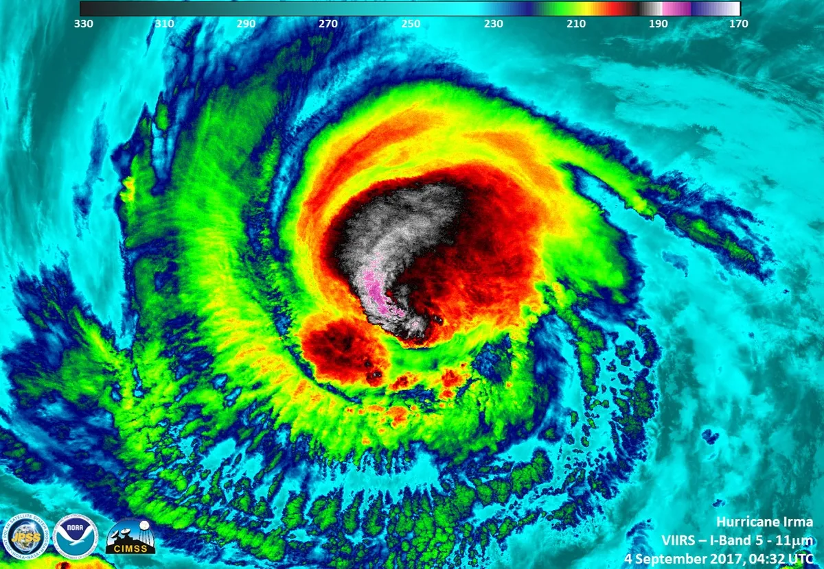
Hurricane Irma gained Category 5 status on Sept. 5. An instrument aboard the Suomi NPP satellite flew over Irma when it was classified as a Category 3 hurricane on Sept. 4, 2017, at 12:32 a.m. EDT.
Get the world’s most fascinating discoveries delivered straight to your inbox.
In the Caribbean

Hurricane Irma was a Category 4 storm on Sept. 4, 2017, when it was swirling in the Caribbean near Puerto Rico. This image was taken by NOAA's weather satellite, GOES-16.
Stadium Effect of Irma

The Reserve Citizen Airmen, part of the Hurricane Hunters of the Air Force Reserve, captured this image of Category 5 Hurricane Irma. The image shows the so-called stadium effect, a phenomenon that occurs in strong tropical cyclones in which the clouds of the eyewall curve outward the higher up they get. The result is the appearance of an open dome.
Thundestorms forming

At 11:47 p.m. EDT on Aug. 31, 2017 (0347 GMT on Sept. 1), the VIIRS instrument aboard NASA-NOAA’s Suomi NPP satellite captured a night-time infrared image of Hurricane Irma in the Atlantic Ocean that showed powerful thunderstorms around the eye.
