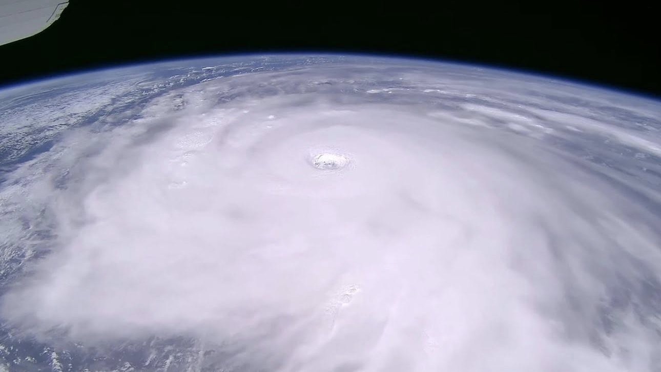
'A serious threat': China braces as Super Typhoon Ragasa, this year's strongest storm, nears with winds of up to 177 mph
Millions across China are under evacuation or stay-at-home orders as the storm closes in on the country's southern coast.


China's southern megacities have entered emergency lockdown as they brace for the impact of a gigantic "super typhoon" predicted to make landfall on Wednesday (Sept. 24).
Super Typhoon Ragasa, the world's most powerful tropical cyclone this year, has already lashed Taiwan and the northern Philippines with torrential rain and destructive winds of up to 177 mph (285 km/h) — the equivalent of a strong Category 5 hurricane — leaving at least five people dead and dozens missing, according to officials.
Now, millions of people in Hong Kong, Macao and Shenzhen have been evacuated or urged to stay at home as the storm carves a path across China's south coast.
The typhoon is expected to make landfall in the country's Guangdong province Wednesday. So far, more than 770,000 people have been evacuated from Guangdong alone, with the number expected to rise to more than a million by the end of today (Sept. 23), according to the state-run broadcaster China Central Television.
"Ragasa will pose a serious threat to Hong Kong, which could reach the levels of Hato in 2017 and Mangkhut in 2018," Eric Chan, the city's chief secretary for administration, said Monday (Sept. 22), referring to two previous super typhoons that caused billions of dollars in damage. (A typhoon is considered a "super typhoon" if wind speeds reach 115 mph (185 km/h).
Hurricanes and typhoons are tropical storms that grow from a thin layer of ocean water that evaporates due to winds. That moisture rises to form storm clouds. The warmer the ocean is, the more energy the system gets, pushing the formation process into overdrive and enabling violent storms to rapidly take shape.
This is why storm season occurs from June to November and why the most powerful storms typically happen between August and September, when ocean temperatures peak.
Get the world’s most fascinating discoveries delivered straight to your inbox.
RELATED STORIES
Ragasa's extreme intensity has led to some claims that the storm is close to the upper limit of what Earth is capable of producing. There's some truth to this: Current calculations of the maximum potential intensity of storms peak at roughly 200 mph (322 km/h).
This estimate is made by a fairly straightforward formula that balances the kinetic energy of the storm lost to surface friction with the energy it extracts from warm ocean water.
Yet climate change is raising this bar, and scientists are discovering that it has already made extremely active hurricane seasons much more likely than they were in the 1980s. Since March 2023, average sea surface temperatures around the world have hit record-shattering highs, giving storms an extra shot of strength.
Thankfully, some of Ragasa's power will abate before the storm hits land. The typhoon is expected to weaken to the equivalent of a Category 3 hurricane, with wind speeds of roughly 115 mph (185 km/h), before making landfall between Shenzhen City and Xuwen county in Guangdong, according to China's National Meteorological Centre.

Ben Turner is a U.K. based writer and editor at Live Science. He covers physics and astronomy, tech and climate change. He graduated from University College London with a degree in particle physics before training as a journalist. When he's not writing, Ben enjoys reading literature, playing the guitar and embarrassing himself with chess.
You must confirm your public display name before commenting
Please logout and then login again, you will then be prompted to enter your display name.

 Live Science Plus


