


Hurricane Irma Photos: Images of a Monster Storm
Introduction

Hurricane Irma, which strengthened into a Category 5 storm on Sept. 5, 2017, is barreling toward southern Florida and parts of the Lesser Antilles. This storm comes on Hurricane Harvey, which made landfall near Corpus Christi, Texas, before dumping record levels of rain on Houston and its surrounding areas as a tropical storm.
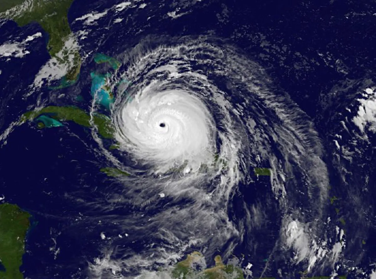
The Visible Infrared Imaging Radiometer Suite (VIIRS) instrument aboard the NOAA/NASA Suomi NPP satellite captured this visible imagery of Hurricane Irma at 11:15 am EDT on Aug. 31, 2017. Check out more photos of this monster storm.
Pummeling Florida Keys

NOAA's GOES-16 satellite captured this geocolor image of Irma's eye over the Florida Keys at approximately 9 a.m. EDT on Sunday, Sept. 9, 2017. Irma made landfall on the Florida Keys Sunday morning as a Category 4 storm. This is the first year on record that two Category 4 (or higher) hurricanes have made landfall on the continental United States in a year, according to Phil Klotzbach, an atmospheric scientist at Colorado State University.

Miami skyline

The Miami skyline can be seen as the outer bands of Hurricane Irma, as a Category 4 hurricane, start to reach Florida on Sept. 9, 2017. Irma has the Florida Keys and the west coast of the peninsula in its crosshairs, according to the National Hurricane Center. The storm is expected to come ashore Sunday morning (Sept. 10).
Titanic trio
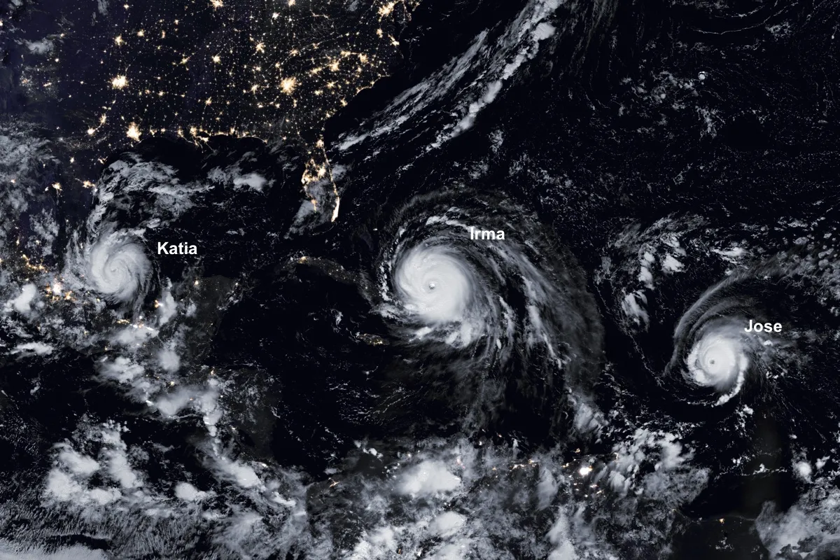
Here, hurricanes Katia, Irma and Jose swirl in the Atlantic on Sept. 8, 2017. The raging trio was captured by the Visible Infrared Imaging Radiometer Suite (VIIRS) on the Suomi NPP satellite. The day-night band allowed the instrument to show both the city lights as well as the swirling hurricanes.
Irma in infrared

The Suomi NPP satellite captured this infrared image on Sept. 8 at 2:39 a.m. ET, showing the now-Category 4 hurricane's well-defined eye. Convection can be seen around the eye, a telltale sign of an intense tropical storm.
High waves

Storm surge and high waves lash a resort on the Dutch Island of St. Maarten, which suffered a direct hit from Hurricane Irma on Sept. 6.
Get the world’s most fascinating discoveries delivered straight to your inbox.
Waves of destruction

Hurricane Irma caused massive destruction on the Dutch island of St. Maarten. The storm made landfall in the Caribbean as a Category 5 hurricane, with 185-mph (298 km/h) winds.
Extensive damage

Hurricane Irma caused massive destruction to a resort on the Dutch island of St. Maarten. The Category 5 storm made landfall in the Caribbean early in the morning on Sept. 6, packing winds of 185 mph (298 km/h).
Storm surge

Debris is seen during a storm surge near the Puerto Chico Harbor during the passing of Hurricane Irma on Sept. 6 in Fajardo, Puerto Rico.
Irma meets the Bahamas
Hurricane Irma barreled through the Bahamas on Friday, Sept. 8. The eye of the storm is expected to continue moving near the Central Bahamas at about 14 mph (22 km/h). Here, an image taken at 4:45 a.m. ET on Sept. 8 by NOAA's GOES East satellite.
In the line of duty

A lone police car on patrol during the passing of Hurricane Irma in Fajardo, Puerto Rico. The Category 5 storm skirted Puerto Rico on Sept. 6, packing winds of more than 180 mph (290 km/h).
