


Hurricane Irma Photos: Images of a Monster Storm
Rainfall accumulation

On Sept. 1 at 1:47 a.m. EDT (0547 GMT), satellites observed a band of rain on Irma's northern side dropping rain at a rate of almost 6.3 inches (159 mm) per hour where storm tops were reaching heights of over 9.6 miles (15.5 kilometers).
Swirling in the Atlantic
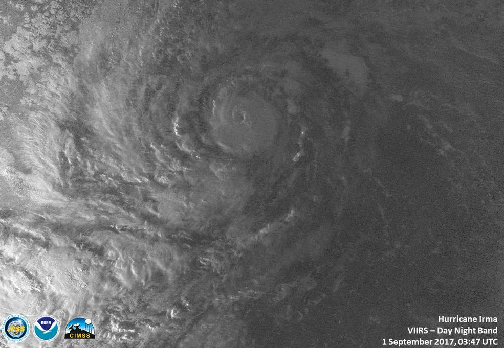
The VIIRS instrument aboard NASA-NOAA's Suomi NPP satellite captured a night-time image of Hurricane Irma in the Atlantic Ocean that showed a tight circulation on Sept. 1, 2017.
Heading toward Leeward Islands

The extremely dangerous Category 5 storm, Hurricane Irma, can be seen east of the Leeward Islands on Sept. 5, 2017. The National Hurricane Center urged residents of the islands to make any last preparations for the storm. The hurricane is forecast to move over parts of the northern Leeward Islands Tuesday tonight and early Wednesday (Sept. 6).

Gathering strength

The GOES-16 satellite captured this geocolor image of Hurricane Irma on the morning of Sept. 5. The Category 5 hurricane made landfall in the Caribbean and still poses a threat to the U.S. Virgin Islands, Puerto Rico and possibly Florida.
Eye on Florida

Hurricane Irma batters Florida and Cuba in this image, taken Sunday (Sept. 10) with data gathered by the U.S. Geostationary Operational Environmental Satellite 13 (GOES-13). Hurricane-strength winds ripped through Florida as the eye made landfall in the southwestern part of the state. Storm surges increased sea level as far north as Charleston, South Carolina, according to NASA's Near Earth Observatory.
Powerful winds

This natural-color image of Hurricane Irma was taken by the Moderate Resolution Imaging Spectroradiometer (MODIS) on NASA’s Terra satellite. The National Weather Service (NWS) warned coastal residents in Florida and beyond of storm surges that could flood what was once dry land.
"This is a life-threatening situation," the NWS said, according to NASA's Near Earth Observatory.
Get the world’s most fascinating discoveries delivered straight to your inbox.
