Why were the Texas flash floods so catastrophic?
More than 100 people have died in devastating flash floods in Kerr County, Texas. But what caused this extreme weather, and will events like this get more common?

Get the world’s most fascinating discoveries delivered straight to your inbox.
You are now subscribed
Your newsletter sign-up was successful
Want to add more newsletters?
Join the club
Get full access to premium articles, exclusive features and a growing list of member rewards.
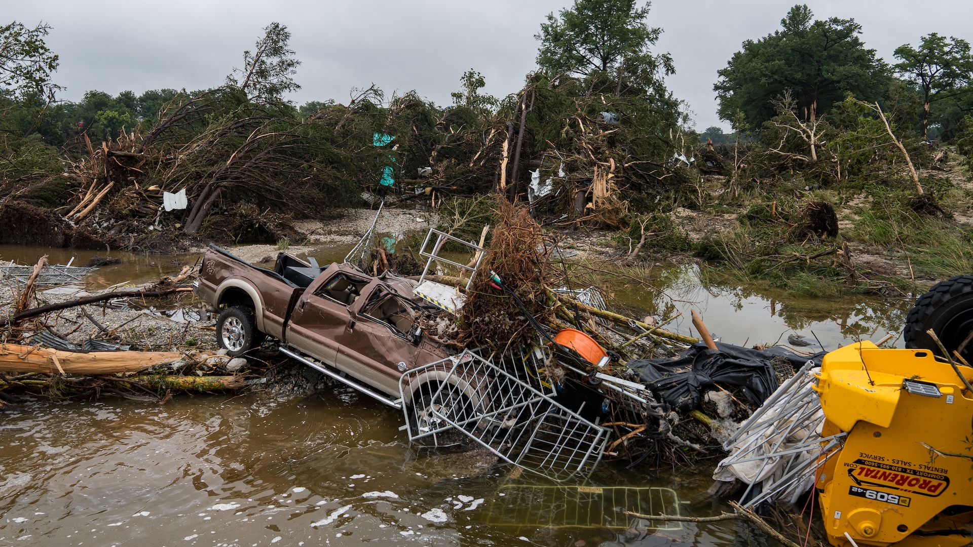
In the early hours on Friday (July 4), a large storm dropped about a foot of water in just a few hours over the Texas Hill Country. In 45 minutes, the water ran down the region's slopes into the Guadalupe River, which rose by more than 26 feet (8 meters) and burst its banks. In Kerr County, the deluge of water swept away people, homes and infrastructure and, as of July 8, more than 100 people have died.
So what caused such catastrophic flooding?
First off, the area is prone to flash flooding. In fact, Texas leads the U.S. in deaths due to flood. This is partially because of its hilly terrain and semiarid soil, which does not absorb much moisture, Hatim Sharif, a professor of civil and environmental engineering at the University of Texas, San Antonio, wrote for The Conversation. "The water sheets off quickly and the shallow creeks can rise fast."
What is flash flooding, and why was it so bad in Texas?
Flash floods are a special type of flood "usually characterized by raging torrents after heavy rains that rip through river beds, urban streets, or mountain canyons sweeping everything before them," according to the National Weather Service. They can occur within minutes or a few hours of excessive rainfall.
Texas is no stranger to flooding, and this particular area is known as "Flash Flooding Alley," Daniel Swain, a climate scientist at UCLA, told Live Science. "All the ingredients were in place for a potentially extreme rainfall," he said.
The major driver of these floods was the sheer quantity of water, Swain said. "An extraordinarily persistent torrential thunderstorm just sat over the same watershed for several hours and slowly propagated down that watershed in the direction of the flood wave."
Related: Climate change made April's catastrophic floods worse, report finds
Get the world’s most fascinating discoveries delivered straight to your inbox.
The remnants of Tropical Storm Barry, which hit near Mexico last week, had already added moisture and instability into the atmosphere. Then, an easterly wind blew this saturated air inland, forcing the warm atmospheric air upward as it moved toward Texas. That air "rises into thunderstorms producing torrential rainfall, with very extreme rainfall rates on the order of two or three inches per hour and this is sustained over hours," Swain said.
In Texas, that created an extreme flash flood localized on one river system.
Can scientists predict flash floods?
While meteorologists can identify conditions that tend to fuel flash floods and regions that are prone to them, predicting exactly where and when one is likely to occur is very difficult, one expert told Live Science.
"It is very difficult to predict intense rainfall and flash flooding," said Jess Neumann, a geographer who specializes in flood risk management at the University of Reading in the U.K. "There is always uncertainty in a forecast in terms of the exact amount of rain that will fall, where precisely it will fall, and how that water will behave and move across the land once it reaches the ground."
In this case, the National Weather Service did issue a flash flood warning at 1:26 a.m. local time on Friday, and posted a follow-up emergency flash flood warning on X at 4:06 a.m.
Some pundits have suggested that recent mass layoffs at the National Oceanic and Atmospheric Administration, which runs the National Weather Service, may have hindered surveillance efforts ahead of these events. For example, KXAN reported that the warning coordination meteorologist at the National Weather Service Austin/San Antonio office, took early retirement in the wake of the NOAA funding cuts. The office is responsible for the areas most affected by the flash flood.
However, Swain said that the predictions from the office were as good as could be expected. “The real failure here was in the communication of that forecast and the failure of local authorities to have a plan of action and to put it into place to keep people safe,” he said.
Will flash flooding get worse in future?
As the climate warms, scientists warn that extreme rainfall events — such as the one that led to the Texas flash flood — will become more common. A warmer atmosphere can hold more water vapor, which will eventually fall to Earth as precipitation.
A fundamental law of thermodynamics known as the Clausius-Clapeyron equation, which describes the relationship between temperature and vapor pressure, predicts that for every degree Celsius that the atmosphere's temperature rises, its water-vapor-carrying capacity will increase by about 7%.
However, it might be even worse for flash flooding, Swain said. "When you talk about the very most extreme rain events — and, in particular, the very most extreme thunderstorm downpours — they increase at an even faster rate that is close to double that."
There are many places in the US, including several in southeastern states, which have a heightened flash flood risk due to their hilly geography and proximity to the Gulf of Mexico.
“When you have immediate proximity to an exceptionally warm body of water, occasional storm systems that push air rapidly upslope and unstable atmospheres that can occur, you can see these sorts of events,” said Swain. “The number of places where this at least is occasionally relevant is quite widespread.”

Sarah Wild is a British-South African freelance science journalist. She has written about particle physics, cosmology and everything in between. She studied physics, electronics and English literature at Rhodes University, South Africa, and later read for an MSc Medicine in bioethics.
Since she started perpetrating journalism for a living, she's written books, won awards, and run national science desks. Her work has appeared in Nature, Science, Scientific American, and The Observer, among others. In 2017 she won a gold AAAS Kavli for her reporting on forensics in South Africa.
You must confirm your public display name before commenting
Please logout and then login again, you will then be prompted to enter your display name.
 Live Science Plus


