Hurricane Matthew Photos: See How the Monster Storm Evolved
Preparations in Florida
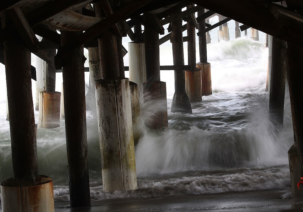
In Florida, residents are preparing for the arrival of Hurricane Matthew. In this photo, waves from the storm churn up water beneath Cocoa Beach Pier on Oct. 6 in Cocoa Beach, Florida.
Haiti floods
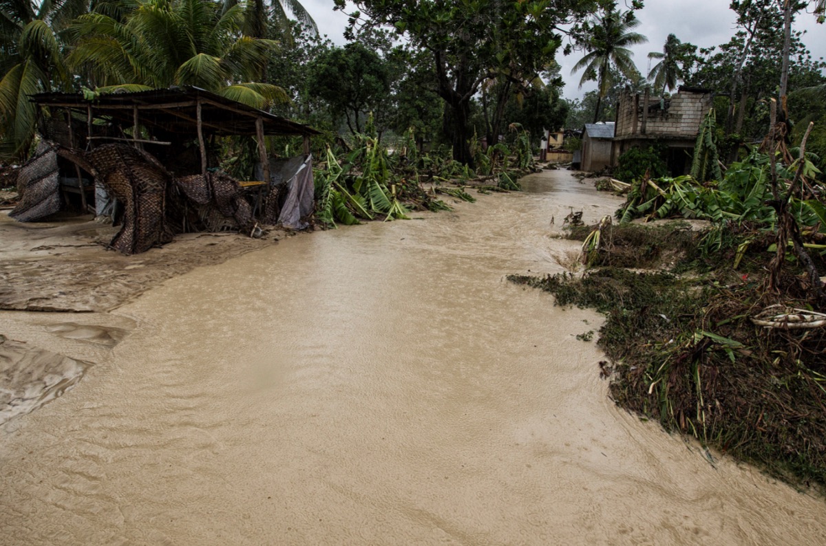
Overflowing water from a nearby river floods homes near the western town of Leoganne in Haiti on Oct. 5, 2016. Hurricane Matthew hit Haiti on Tuesday, Oct. 4, as a Category 4 storm, pummeling the poor nation with heavy rains and high winds.
Monster storm
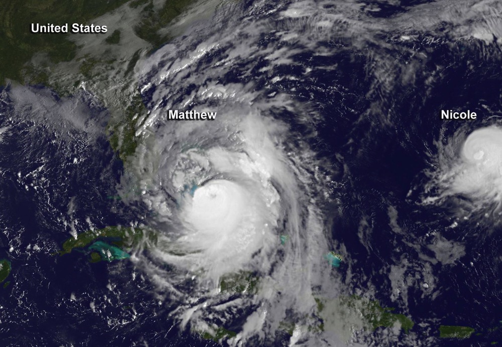
This visible image taken on Oct. 6, 2016, at 7:45 a.m. EDT from NOAA's GOES-East satellite shows Hurricane Matthew to the west of a much smaller Tropical Storm Nicole. Nicole is about 400 miles (640 kilometers) south of Bermuda.
Crossing a river

People cross an overflowing river using a rope and porters after a bridge washed away due to the pounding from Hurricane Matthew, which passed over Haiti on Oct. 4, 2016. The capital, Port au Prince was mostly spared the full strength of the hurricane; but reportedly the western cities of Les Cayes and Jeremie were slammed with hurricane-force winds and high water.
Reconnaissance patrol
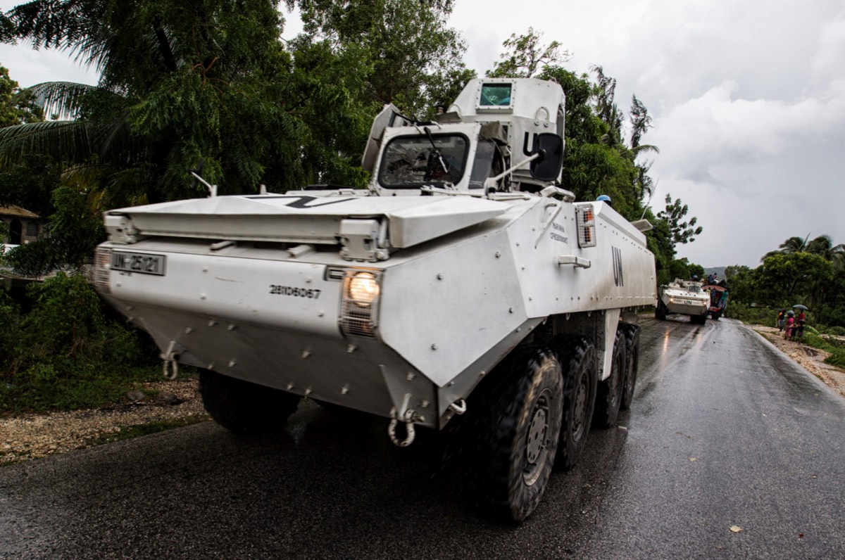
United Nations Stabilization Mission in Haiti (UN MINUSTAH) military conduct a reconnaissance patrol near the Haitian town of Leoganne on Oct. 5, 2016, a day after Hurricane Matthew passed over the nation.
Leoganne river
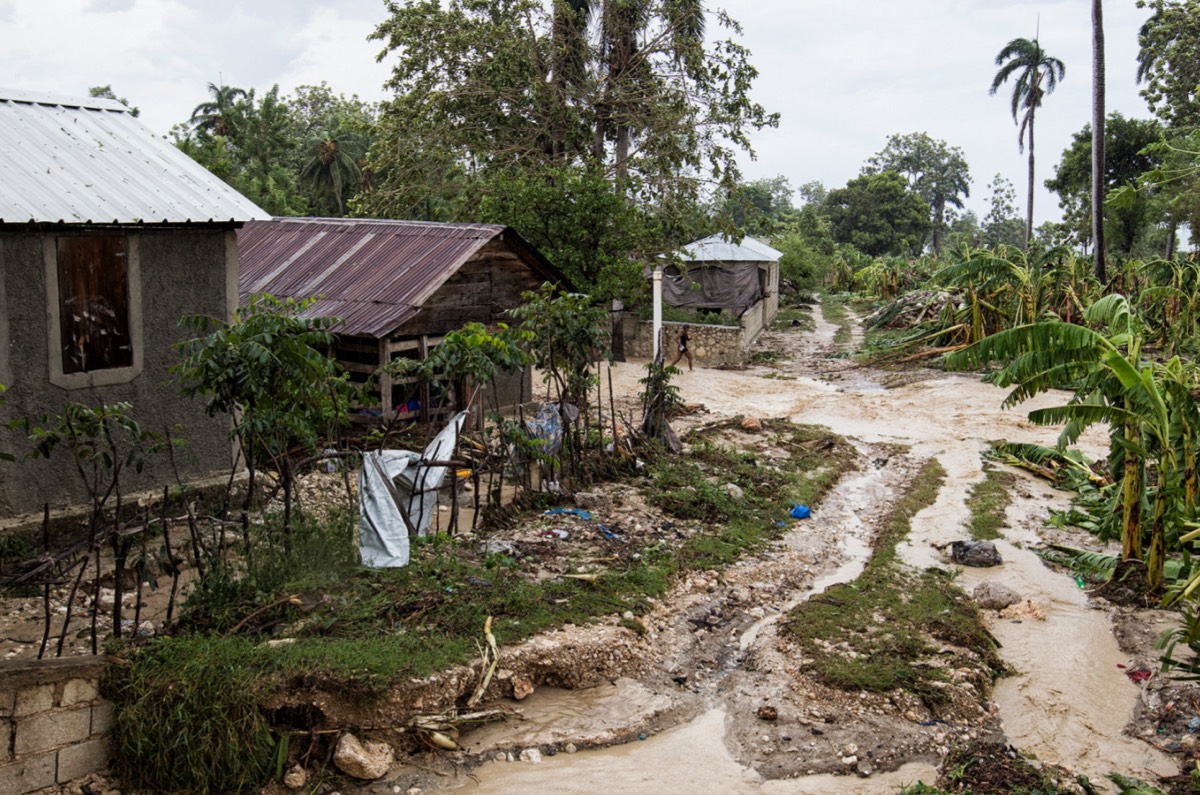
Waters overflow the banks of a river near the western town of Leoganne in Haiti on Oct. 5, a day after Hurricane Matthew passed over the nation.
Downed trees
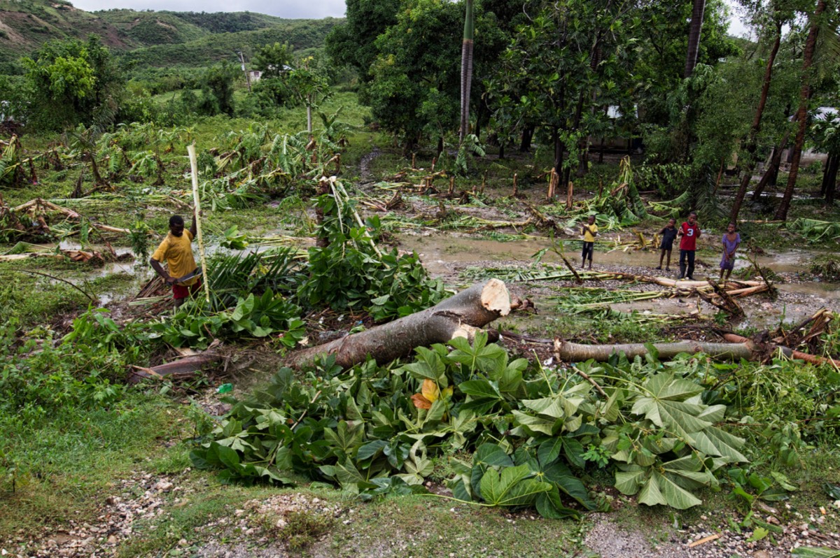
A man near the western Haitian town of Leoganne works to clear trees from his property on Oct. 5, 2016, that were downed when Hurricane Matthew passed over Haiti on Oct. 4. His family wasn't injured, but he lost his crops and livestock, according to the United Nations Stabilization Mission in Haiti (UN MINUSTAH).
Get the world’s most fascinating discoveries delivered straight to your inbox.
Matthew's aftermath
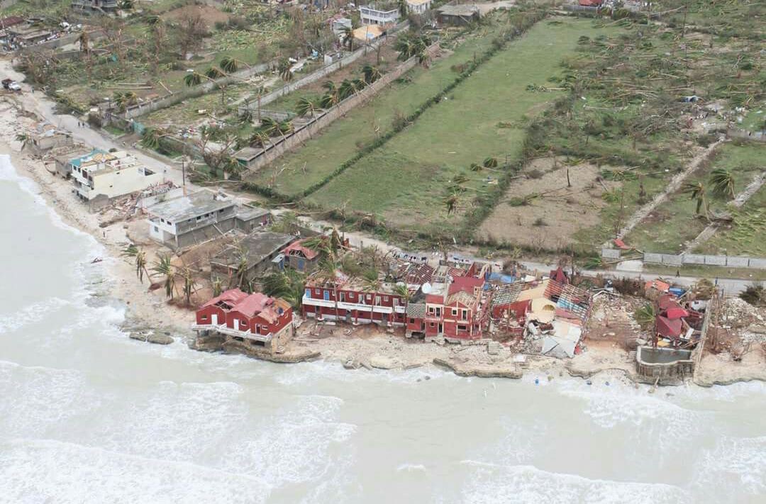
Hundreds of people have died from the havoc wreaked by Hurricane Matthew, which swept through the nation on Oct. 4, 2016, as a Category 4 storm. Here flooding can be seen from above.
Les Cayes Cathedral
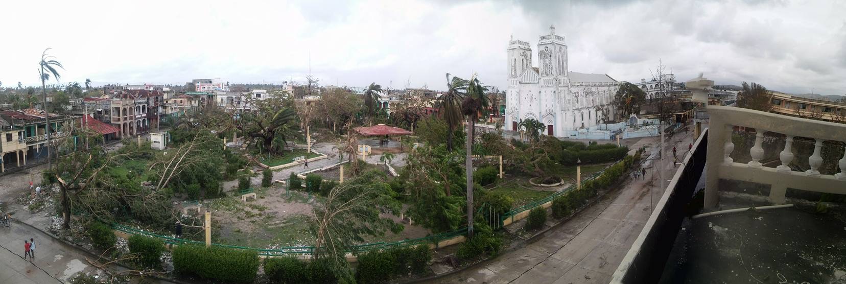
One of the more badly hit areas, the western Haitian city of Les Cayes, can be seen here, with the cathedral visible in the background. The photo was taken after Hurricane Matthew passed through the nation on Oct. 4, 2016.
Hurricane Matthew - Haiti
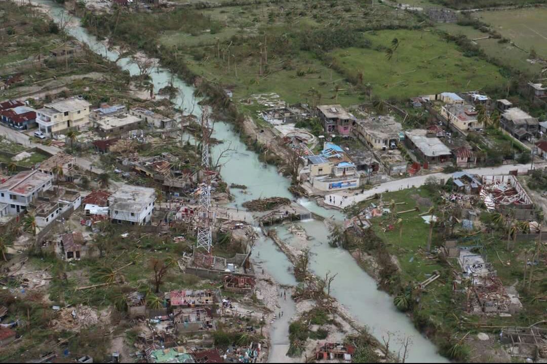
Damage from Hurricane Matthew, which passed through Haiti on Oct. 4, 2016, as a Category 4 storm, is evident in this aerial view showing downed trees and flooding. Aerial assessments by the United Nations Office for the Coordination of Humanitarian Affairs (OCHA) began on Oct. 6, in Haiti, where OCHA estimates more than 350,000 people need humanitarian assistance.


