Hurricane Matthew Photos: See How the Monster Storm Evolved
Get the world’s most fascinating discoveries delivered straight to your inbox.
You are now subscribed
Your newsletter sign-up was successful
Want to add more newsletters?
Join the club
Get full access to premium articles, exclusive features and a growing list of member rewards.
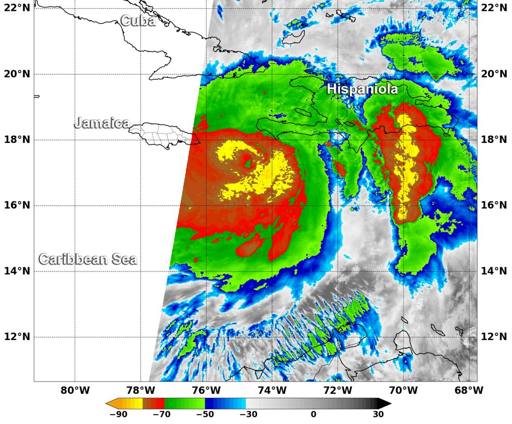
Heavy rainfall

An infrared image taken by the MODIS Instrument on NASA's Aqua satellite at 2:10 a.m. EDT on Oct. 4, 2016. The image shows the cloud temperature in the storm. Red cloud tops indicate colder temperatures and a high chance of heavy rainfall.
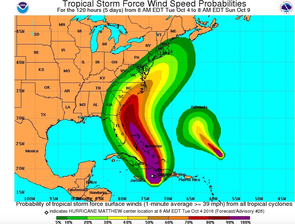
Storm forecast

Hurricane Matthew (left) wind speeds are expected to be highest in Haiti, Cuba and the Bahamas (magenta) and then lessen as the system moves northward, whereas Tropical Storm Nicole (right) is moving to the northwest, according to a forecast made at 8 a.m. EDT Tuesday (Oct. 4).
Get the world’s most fascinating discoveries delivered straight to your inbox.
 Live Science Plus


