DARPA's 'Aerial Dragnet' Will Monitor Drones in Cities

While air traffic control systems track, guide and monitor thousands of planes and helicopters every day, one group of sky flyers remains unmonitored: drones.
In recent years, small unmanned aerial vehicles (UAVs), such as commercial quadcopters and hobby drones, have become less expensive and easier to fly — adding traffic to airspace that's already congested. Drones are also more adaptable for terrorist or military purposes, and because they are currently flying unmonitored, U.S. forces want to be able to quickly detect and identify UAVs, especially in urban areas.
A new project launched by the Defense Advanced Research Projects Agency (DARPA), the Pentagon's research arm, wants to map all small drone activity in urban settings. Managers of the Aerial Dragnet program are soliciting proposals to help the military provide continuous surveillance of drones on a city-wide scale. [Humanoid Robots to Flying Cars: 10 Coolest DARPA Technologies]
"Commercial websites currently exist that display in real time the tracks of relatively high and fast aircraft — from small general aviation planes to large airliners — all overlaid on geographical maps as they fly around the country and the world," DARPA program manager Jeff Krolik said in a statement. "We want a similar capability for identifying and tracking slower, low-flying unmanned aerial systems, particularly in urban environments."
Aerial Dragnet will initially focus on protecting military troops who are operating in urban settings overseas. However, DARPA said that the system could be applied stateside to help protect civilians in U.S. metropolitan areas from drone terrorist threats.
While there are UAV tracking systems in development, these surveillance methods are focused on open areas. Urban areas present a particular challenge for monitoring small drones and other UAVs, because sight lines are very limited, according to DARPA officials.
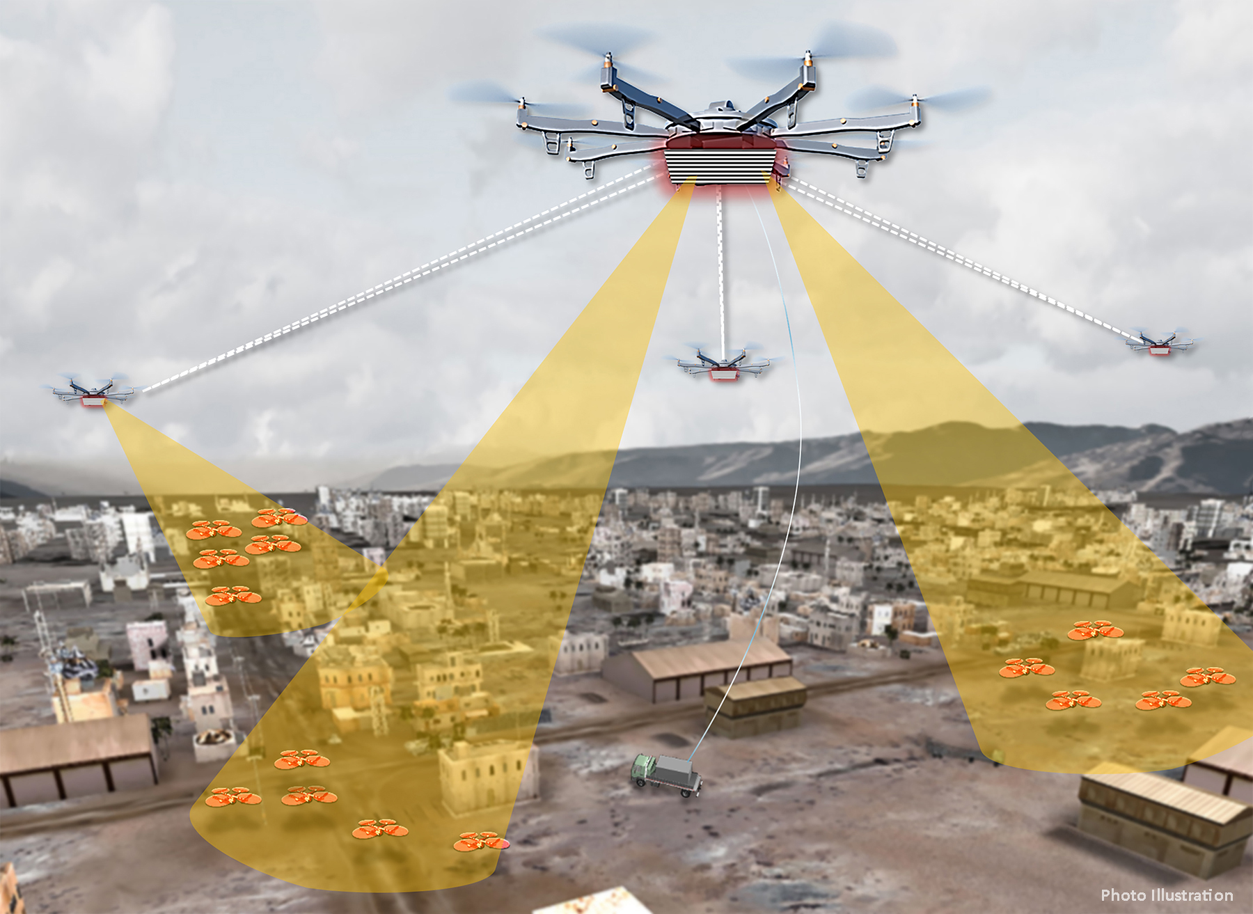
DARPA therefore envisions "a network of surveillance nodes" for Aerial Dragnet that uses sensor technologies that can look over and between buildings, tracking drones and UAVs even when the robotic flyers disappear from sight. This network could be mounted on long-endurance UAVs, resulting in a super drone network to monitor other drones — as an artist's concept shows.
Get the world’s most fascinating discoveries delivered straight to your inbox.
The agency is hosting a Proposers Day on Sept. 26 for new technologies for the Aerial Dragnet program.
Original article on Live Science.

 Live Science Plus


