


Why Did Hurricane Michael Become Such a Monster Storm So Quickly?
Forecasters watching Hurricane Michael barrel toward the Gulf coast of Florida earlier this week saw the storm do something "most unusual."
The hurricane intensified despite encountering wind shear —a change in wind speed or direction at different levels in the atmosphere—that might have normally weakened the storm.
"Michael's steady intensification over the past 48 hours in the face of 20-knot [23 mph] westerly shear defies traditional logic," hurricane specialist Stacy Stewart wrote in a memo from the National Hurricane Center on Monday (Oct. 8). "Either the shear calculations are unrepresentative or Michael has become more inertially stable due to its large eye and large outer wind field, making it more shear-resistant."
So how would forecasters typically expect wind shear to affect a storm? That's explained in part by the shape of a hurricane. [Hurricane Season 2018: How Long It Lasts and What to Expect]
Other non-hurricane storm systems, such as Nor'easters that hit the mid-Atlantic, are driven by differences in temperature and take on a sloped shape in the atmosphere. The warmest parts of the storm closest to Earth's surface are usually out at the front of the system with the highest part trailing back usually to the west and northwest to where the cold air is.
Hurricanes, meanwhile, stretch from Earth's surface to the upper reaches of the atmosphere and each level of the storm needs to be stacked and working in coordination to help the massive system gain energy and grow in intensity.
"With a hurricane you can see the eye from outer space; it's more like a chimney," Joel Cline, Tropical Program Coordinator at NOAA's National Weather Service, told Live Science. "If the chimney's not perfectly straight, you can have the hottest fire —in other words, the warmest water —but the flame goes out."(Warm water fuels hurricanes.)
Get the world’s most fascinating discoveries delivered straight to your inbox.
Wind shear could disrupt the hurricane, essentially tilting or breaking up the chimney, which would weaken the storm. But that didn't happen in Hurricane Michael's case.
"There was some available wind shear when it was near Cuba right before it went into the Gulf, and wind shear is one of the variables that will decrease the intensity of a storm," Marangelly Fuentes, a NASA atmospheric scientist, told Live Science. But the storm really intensified, going from a Category 1 to a Category 4 hurricane in a matter of 24 hours, once it went into the Gulf.
"You have to remember that Michael actually intensified to a Category 4 —almost 5 right now —after it was in the Gulf of Mexico where there was not that much shear," Fuentes said.
A lack of shear was just one of the factors that caused Michael to intensify, Fuentes explained. Sea-surface temperatures are warmer than average in the Gulf of Mexico right now, adding more fuel to the storm. A lack of friction from land also allowed Michael to keep gaining strength over the water.
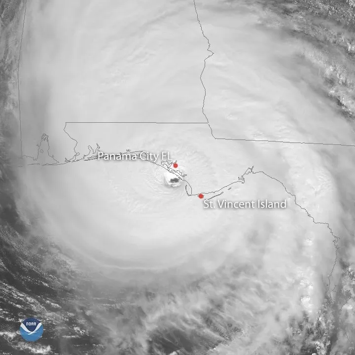
The huge storm strengthened to a Category 4 hurricane overnight, packing winds up to 145 mph (230 km/h) as it approached the Florida Panhandle this morning.
"People get very fixated on the category numbers—it doesn'tmatter at this point," Kline said. In addition to the potentially deadly storm surge expected to hit parts of the Florida coast, the wind damage will be extensive near the eye of the storm, Kline said, and rainfall is a big concern, especially in areas that were lashed by Florence last month. "Because of what's happened [with Florence] in the recent past, there's a greater chance of flash floods."
And while a Category 4 storm might be unprecedented for the Florida Panhandle, Kline noted that major hurricanes are predicted to strike this part of the Florida coast about every 30 years, as a National Hurricane Center map shows.
Original article on Live Science.
