'Extremely Dangerous' Dorian Becomes Strongest Hurricane in Modern History for the Bahamas
The Northwestern Bahamas has never in modern history seen such a beast of a storm.

Get the world’s most fascinating discoveries delivered straight to your inbox.
You are now subscribed
Your newsletter sign-up was successful
Want to add more newsletters?
Join the club
Get full access to premium articles, exclusive features and a growing list of member rewards.
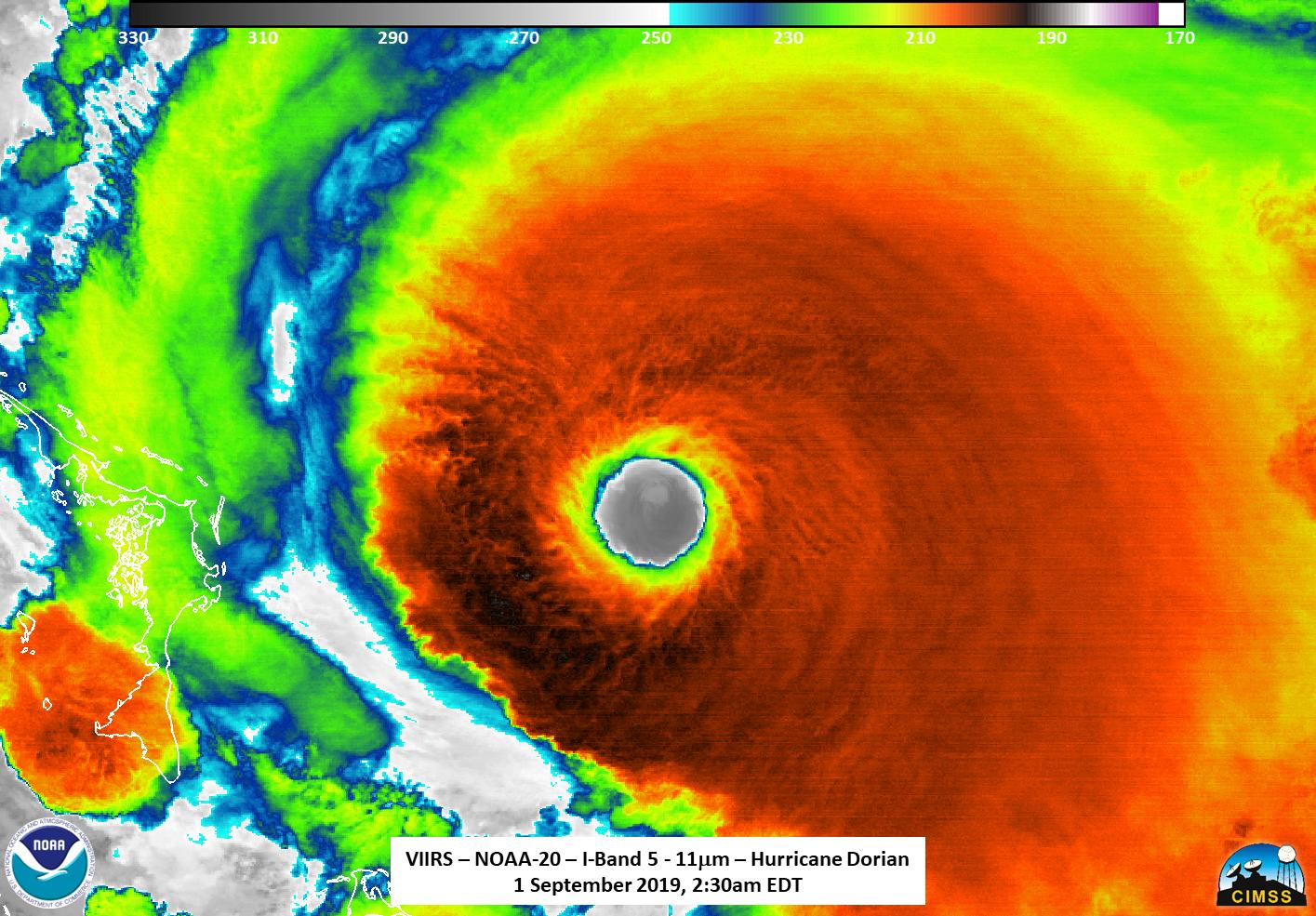
The monstrous Dorian has become the strongest hurricane to hit the Northwestern Bahamas, with sustained winds reaching 180 mph (285 km/h), the National Hurricane Center (NHC) reported today (Sept. 1) at 11 a.m. ET.
At that time, the eye of the Category 5 storm was churning about 20 miles (30 kilometers) east-northeast of Great Abaco Island and 205 miles (330 km) east of West Palm Beach, Florida. The storm is moving toward the west at about 7 mph (11 km/h). That slow speed means Dorian will have plenty of time to dump huge amounts of rain along its path.
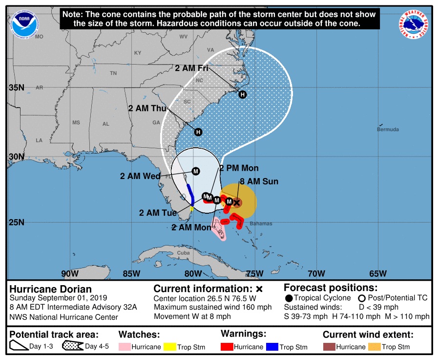
The NHC forecasts the core of Dorian will continue to move over Great Abaco and then near or over Grand Bahama Island later tonight and Monday (Sept. 2). Late Monday through Tuesday night, the extremely dangerous storm is expected to move closer to the east coast of Florida.
Article continues belowRelated: Hurricane Season 2019: How Long It Lasts and What to Expect
"Catastrophic hurricane conditions are occurring in the Abacos Islands and will spread across Grand Bahama Island later today and tonight," the NHC said in the 11 a.m. update.

Dorian is truly a giant, continuing to grow larger in size, NHC forecasters say. Currently, hurricane-force winds extend 45 miles (75 km) from the hurricane's center.
Where (and if) Dorian will make landfall in the U.S. seems to be an open question, with forecasts showing various possibilities from Florida north to the Carolinas, according to a CNN report.
Get the world’s most fascinating discoveries delivered straight to your inbox.
If Dorian does make landfall as a Category 5 storm, that would make the storm a rare one. In 2017, two storms did so — Maria, which slammed into Dominica; and Irma, which hit Cuba, Barbuda, Saint Martin and the British Virgin Islands as a Category 5.
The last storm to hit the United States at Category 5 strength was Hurricane Michael, which hit near Mexico Beach and Tyndall Air Force Base, Florida, on Oct. 10, 2018. That was the first hurricane of that strength to make U.S. landfall since 1992, when Hurricane Andrew hit land near Homestead, Florida. The only other storms known to have made U.S. landfall at that strength are Hurricane Camille in 1969 and the so-called Labor Day Hurricane in 1935.
A Hurricane Warning is in effect for the Northwestern Bahamas, excluding Andros Island, while a hurricane watch is in effect for Andros Island and north of Deerfield Beach to the Volusia/Brevard County Line. A "warning" means hurricane conditions are expected in that area, and a "watch" means those conditions are possible in that area.
- Hurricanes from Above: Images of Nature's Biggest Storms
- Photos: Hurricane Michael Toppled Over Trees and Uprooted 19th Century Artifacts
- Inside Irma's Eye: Hurricane Hunters Capture Jaw-Dropping Photos
Originally published on Live Science.
Jeanna Bryner is managing editor of Scientific American. Previously she was editor in chief of Live Science and, prior to that, an editor at Scholastic's Science World magazine. Bryner has an English degree from Salisbury University, a master's degree in biogeochemistry and environmental sciences from the University of Maryland and a graduate science journalism degree from New York University. She has worked as a biologist in Florida, where she monitored wetlands and did field surveys for endangered species, including the gorgeous Florida Scrub Jay. She also received an ocean sciences journalism fellowship from the Woods Hole Oceanographic Institution. She is a firm believer that science is for everyone and that just about everything can be viewed through the lens of science.
 Live Science Plus


