Photos: Fiery Lava from Kilauea Volcano Erupts on Hawaii's Big Island
Get the world’s most fascinating discoveries delivered straight to your inbox.
You are now subscribed
Your newsletter sign-up was successful
Want to add more newsletters?

Delivered Daily
Daily Newsletter
Sign up for the latest discoveries, groundbreaking research and fascinating breakthroughs that impact you and the wider world direct to your inbox.

Once a week
Life's Little Mysteries
Feed your curiosity with an exclusive mystery every week, solved with science and delivered direct to your inbox before it's seen anywhere else.

Once a week
How It Works
Sign up to our free science & technology newsletter for your weekly fix of fascinating articles, quick quizzes, amazing images, and more

Delivered daily
Space.com Newsletter
Breaking space news, the latest updates on rocket launches, skywatching events and more!

Once a month
Watch This Space
Sign up to our monthly entertainment newsletter to keep up with all our coverage of the latest sci-fi and space movies, tv shows, games and books.

Once a week
Night Sky This Week
Discover this week's must-see night sky events, moon phases, and stunning astrophotos. Sign up for our skywatching newsletter and explore the universe with us!
Join the club
Get full access to premium articles, exclusive features and a growing list of member rewards.
Lava flow
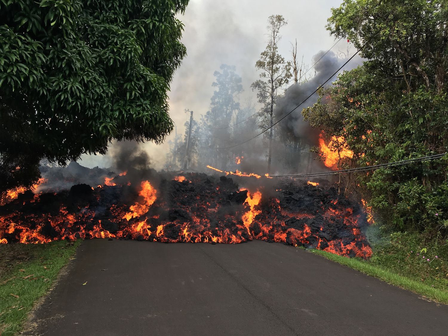
A lava flow moves on Makamae Street in the Leilani Estates on May 6.
Summit lava lake
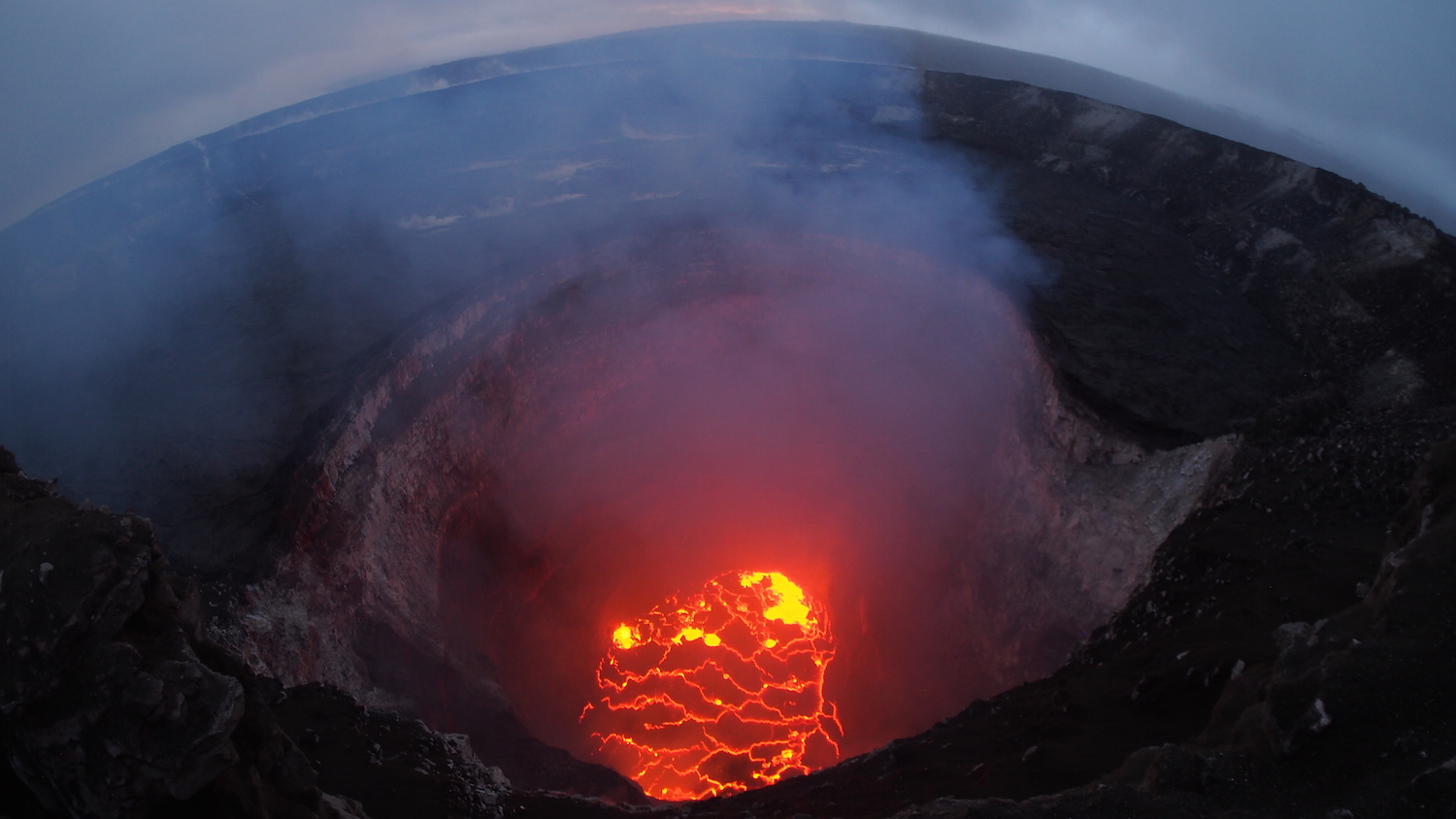
This May 6 photo shows Kilauea's summit, which holds a lake of lava. Since Pu'u 'Ō'ō's increased activity, this lava lake has dropped significantly, the USGS said.[Read more about Kilauea's 2018 eruption here]
Volcano spatter
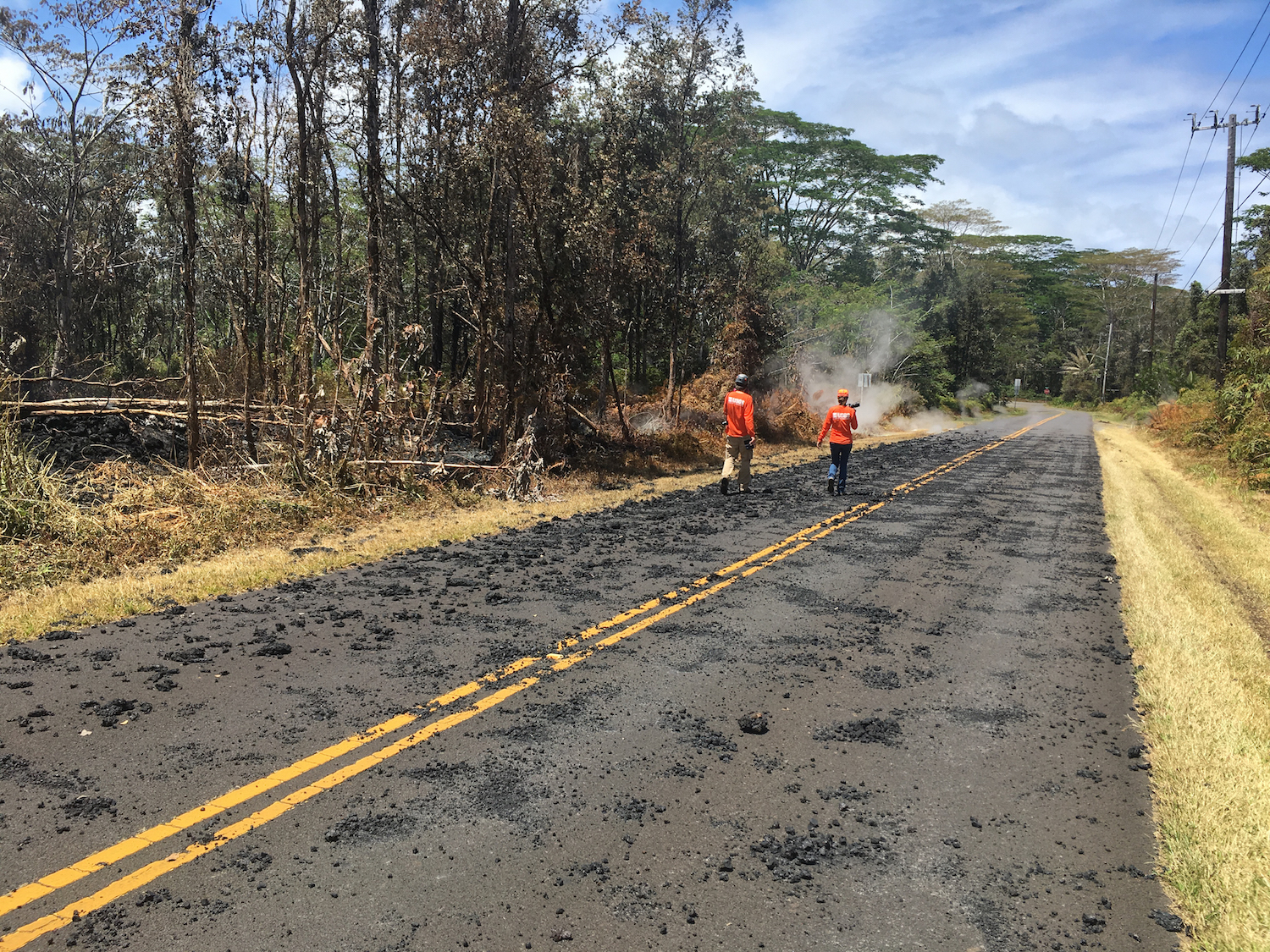
U.S. Geological Survey (USGS) scientists monitor the eruption in the Leilani Estates, a residential neighborhood affected by Mount Kilauea's rumbling activity. This photo, taken on May 6, shows spatter (blobs of lava that were thrown into the air) from a volcanic fissure on Leilani Avenue.
Spatter sample
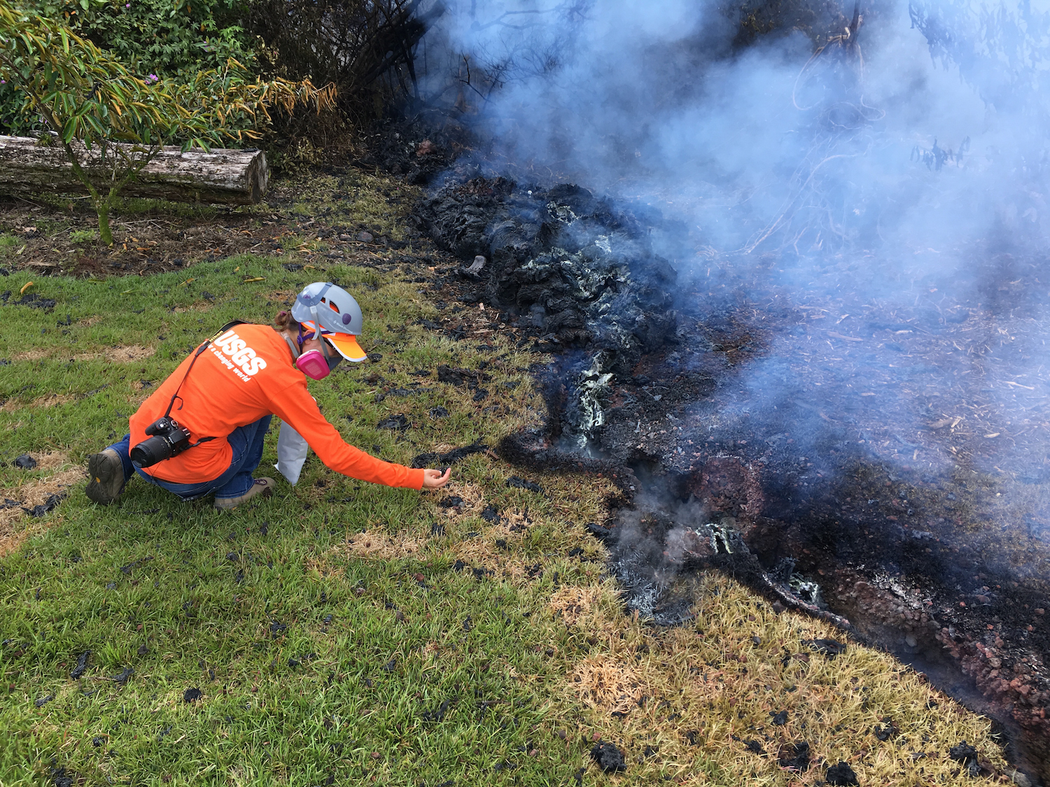
A geologist from the Hawaiian Volcano Observatory collects a sample of lava spatter for analysis on May 6.
Panoramic view
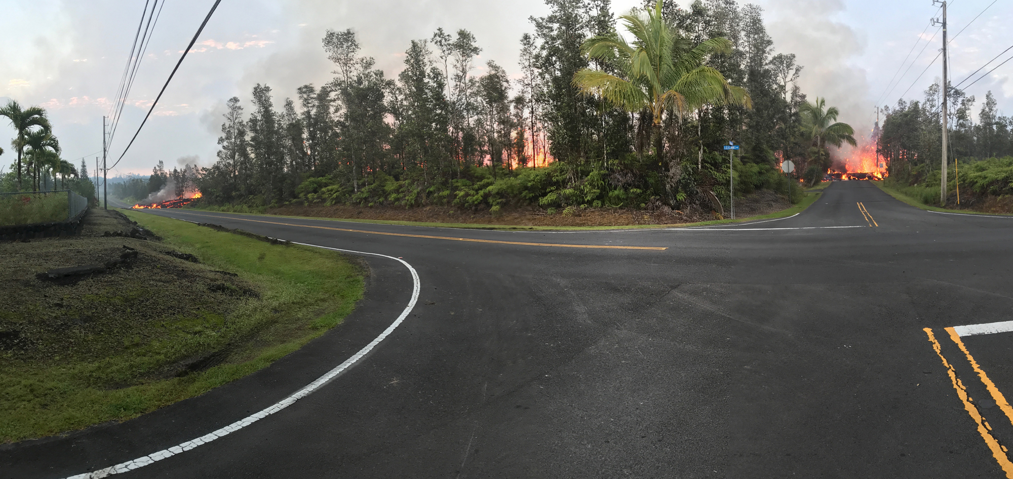
A panoramic view of fissure 7 taken from the intersection of Leilani and Makamae streets in the Leilani Estates subdivision on May 5.
[Read more about Kilauea's 2018 eruption here]
Red hot lava
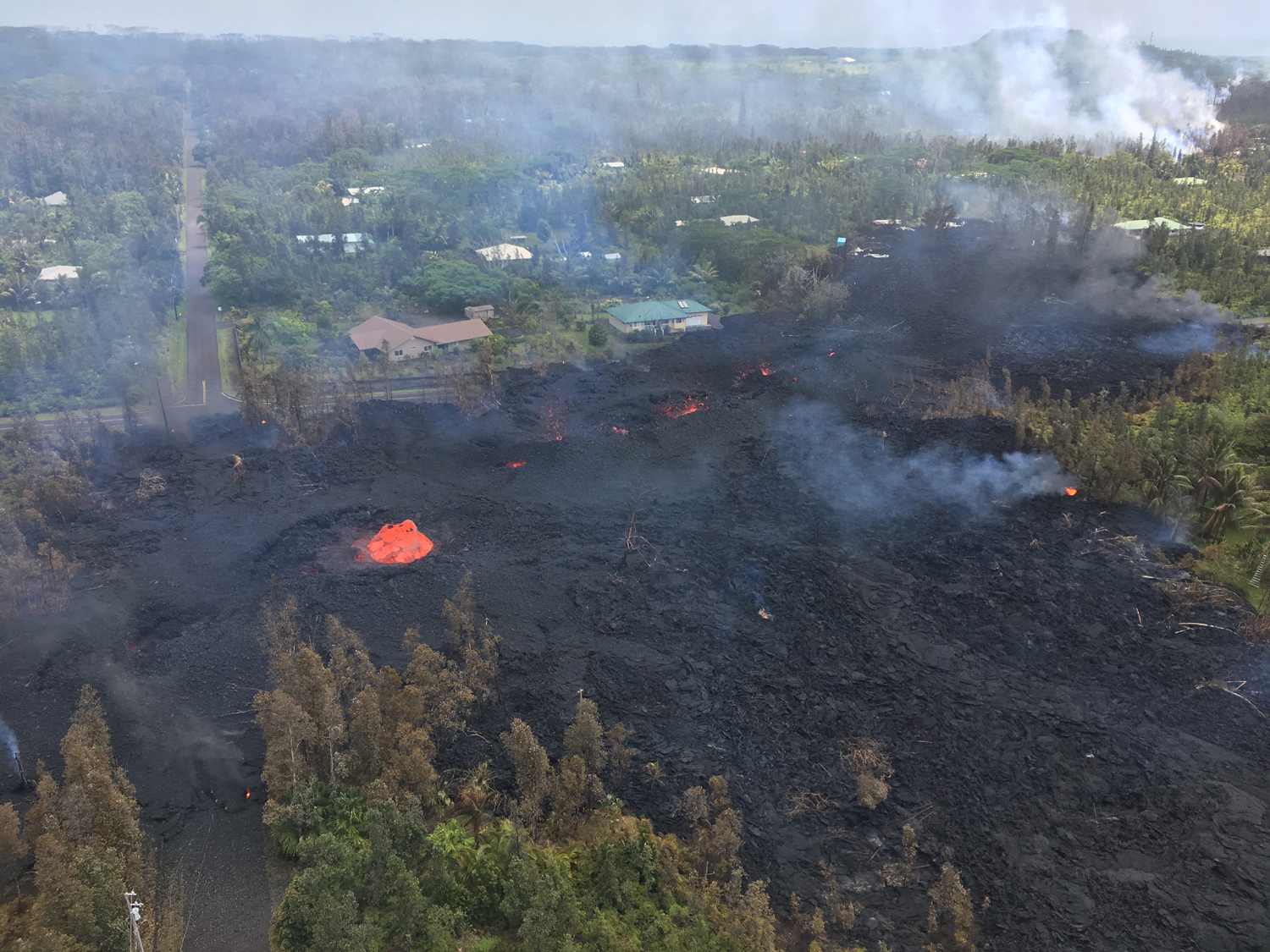
Lava covered the road and forest near fissure 7 on May 5.
Cracked road
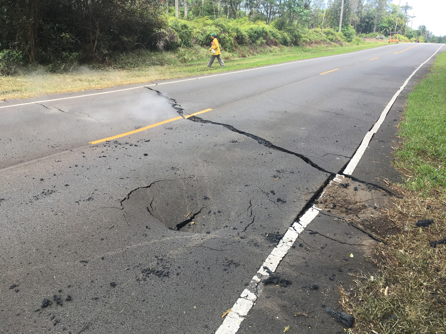
A crack appeared on Pohoiki Road in the Leilani Estates subdivision on May 5.
Get the world’s most fascinating discoveries delivered straight to your inbox.
Road block
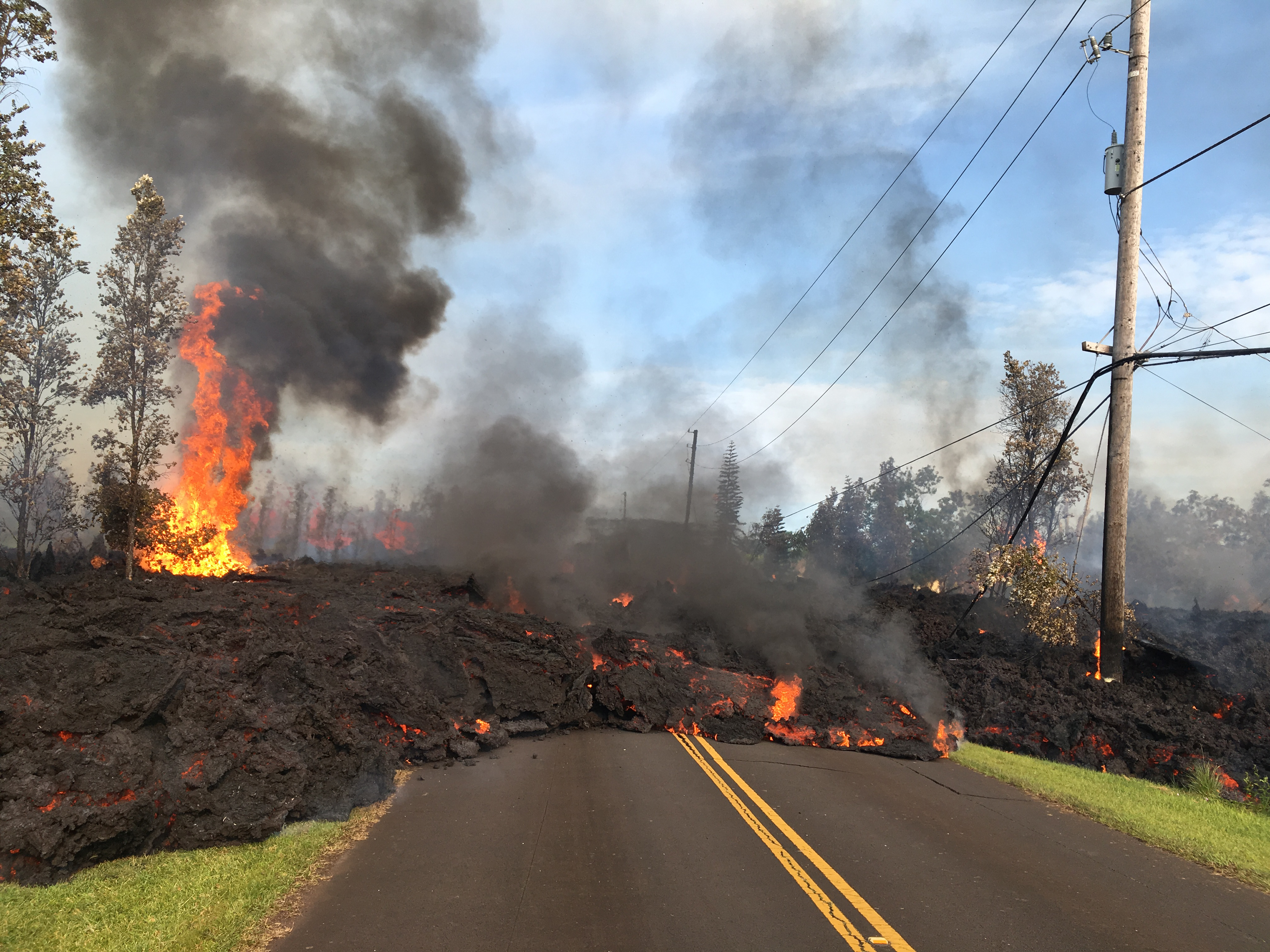
Fissure 7 spewed out lava that slowly advanced on Hookupu Street in the Leilani Estates on May 5.
Thermal map
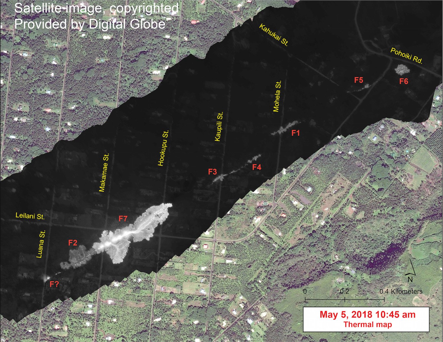
This map shows a mosaic of thermal images collected during a helicopter flight over the fissures at Leilani Estates on May 5. The map is a satellite image provided by DigitalGlobe. The white areas on the dark image indicate the hottest areas, with fissure 7 (F7) showing the most heat from its lava flow.
Fissure fire
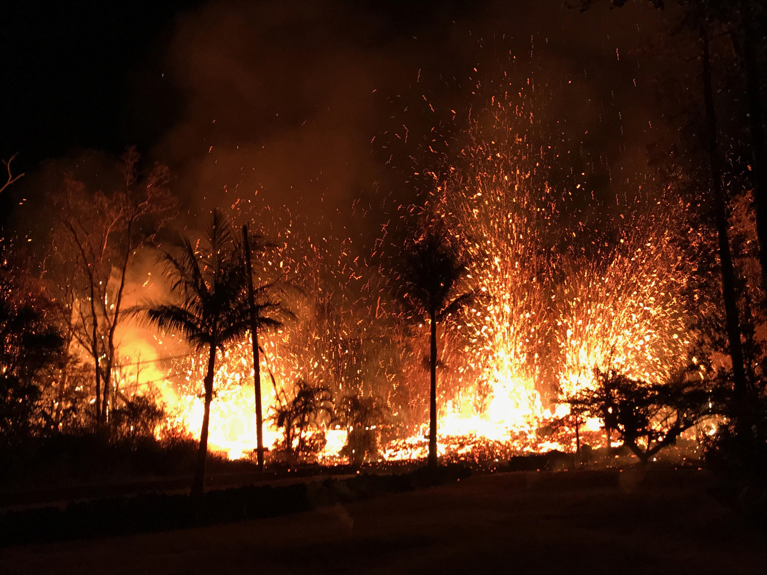
A new fissure erupted with a small spattering of lava on the evening of May 5. Later that night, lava fountains as high as 230 feet (70 meters) were erupting from the fissure.
[Read more about Kilauea's 2018 eruption here]

Laura is the managing editor at Live Science. She also runs the archaeology section and the Life's Little Mysteries series. Her work has appeared in The New York Times, Scholastic, Popular Science and Spectrum, a site on autism research. She has won multiple awards from the Society of Professional Journalists and the Washington Newspaper Publishers Association for her reporting at a weekly newspaper near Seattle. Laura holds a bachelor's degree in English literature and psychology from Washington University in St. Louis and a master's degree in science writing from NYU.
 Live Science Plus


