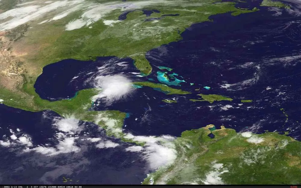
After days of watching the storm system develop over the southeastern Gulf of Mexico, the National Hurricane Center (NHC) declared the formation of Tropical Storm Karen at 9 a.m. EDT this morning (Oct. 3). Karen is expected to strengthen over the next two days, possibly reaching hurricane strength tomorrow, before an anticipated impact along the U.S. Gulf Coast over the weekend.
Hurricane hunter aircraft investigated Karen this morning and found that it had maximum sustained winds of 60 mph (95 km/h) and a circulation that was developed enough to call it a tropical storm. The warm Gulf waters will likely continue to fuel Karen and could push its winds over the 74 mph (119 km/h) threshold that marks a hurricane. Whether or not Karen would stay a hurricane through landfall is uncertain, and could depend on the track it takes.
The cone that marks the range of possible paths the storm might take has a fairly wide spread, reaching from southeast Louisiana to the Florida Panhandle. Forecasters at the NHC say that if the hurricane tracks to the east, it is likely to be a stronger storm at landfall than if it tracks to the west. [Hurricane Season 2013: Complete Coverage]
Latest Videos From
The NHC currently has a hurricane watch in effect from Grand Isle, La., to Indian Pass, Fla., (not including New Orleans), and a tropical storm watch in effect from west of Grand Isle to Morgan City, La., as well as New Orleans and Lake Pontchartrain. Watches mean that the conditions issued for the watch are possible within the area within about 48 hours.
If and when Karen makes landfall, it will be only the second storm to directly hit the United States this season (Tropical Storm Andrea made landfall over Florida early in the season). Karen is the 11th named storm of the 2013 season, which was expected to have 13 to 19 named storms (tropical storms and hurricanes), of which seven to 11 were predicted to become hurricanes. If Karen reaches hurricane status, it will only be the third storm of the year to do so, far below expectations, and it will be doing so past the typical peak in hurricane activity. (The other two hurricanes were Humberto and Ingrid; Humberto stayed well out to sea, while Ingrid made two landfalls over Mexico.)
Meteorologist Brian McNoldy has written at the Washington Post's Capital Weather Gang blog that a number of unforeseen factors have kept a lid on the 2013 hurricane season, including unusually dry air over the Atlantic.
While Karen spins up over the Gulf, now Tropical Depression Jerry is winding down over the Atlantic and is expected to fizzle out by the weekend.
Though large swaths of the U.S. federal government have been furloughed because of the shutdown over a budget impasse — including the NHC's parent agency, the National Oceanic and Atmospheric Administration — NHC forecasters remain on duty and their website is still up and running as their work is considered crucial to protecting U.S. life and property.
Follow Andrea Thompson @AndreaTOAP, Pinterest and Google+. Follow us @livescience, Facebook & Google+. Original article on LiveScience.