How the 'deadly December tornado' carved a 250-mile path through 4 states
The death toll in Kentucky could exceed 70 from the record-breaking tornado.

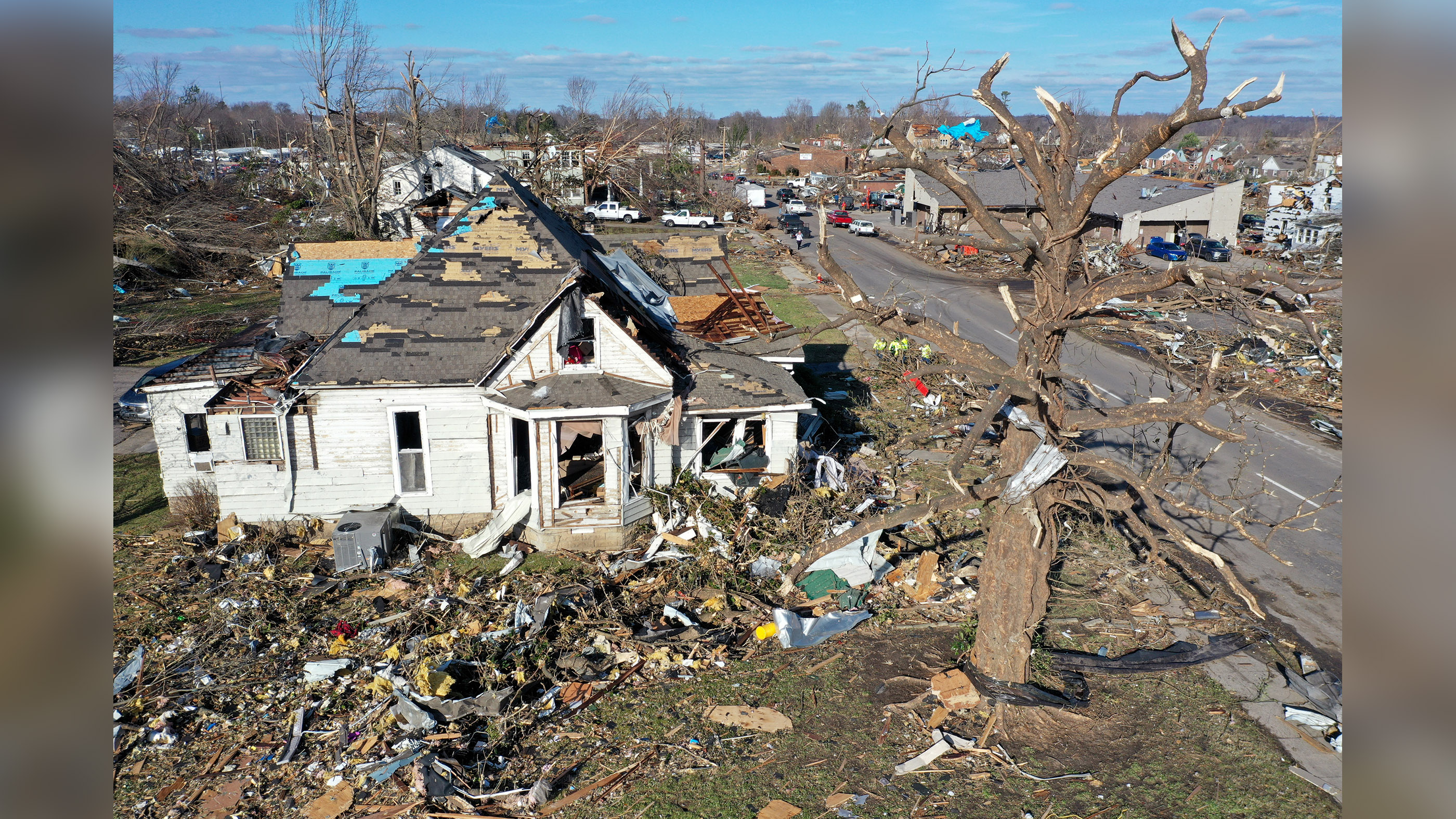
Damage from the tornadoes that ripped through the Midwest overnight Friday (Dec. 10) is still being assessed, but the violent storms will go down in history as some of the deadliest and longest-lasting, according to meteorologists.
More than 30 tornadoes were reported across six states overnight — Arkansas, Illinois, Kentucky, Missouri, Mississippi and Tennessee — the National Weather Service tweeted, with one of those tornadoes (or perhaps a cluster) chiseling out a path of destruction about 250 miles (400 kilometers) long, The Washington Post reported. If that destructive storm was in fact a single entity, it will become the longest path of a single tornado in U.S. history, as well as the first so-called quad-tornado, meaning it swept through four states — northeast Arkansas, southeast Missouri, northwest Tennessee and western Kentucky, the Post said.
In just Kentucky, the death toll could rise to more than 70, CNN reported. And tornadoes reportedly caused the collapse of several large buildings, including a Mayfield Consumer Products candle factory (where 110 people are thought to have been at work), an Amazon warehouse in western Illinois (where at least two died) and a nursing home in Arkansas, CNN said.
Article continues belowTornadoes form when denser cold air collides with and pushes down warm, moist air, resulting in thunderstorms. As the warm air rises, it creates an updraft. If winds are jostling that rising air, pushing it from side to side, the result can be a spinning storm. These spinning winds are most likely in supercells, which are the strongest types of thunderstorms. But even spinning air isn't always enough to spawn a tornado. For that to happen, air near the ground must both sink and rise; with enough of these rising and sinking wind gusts, the air near the ground begins to spin, according to the National Center for Atmospheric Research.
NEW: @NOAA's #GOES16🛰️ tracked the fast-moving #severe thunderstorms that produced a devastating #TornadoOutbreak overnight. More than 30 #tornadoes were reported across 6 states. Kentucky's governor called it "the most severe and deadly tornado event in Kentucky history." #KYwx pic.twitter.com/wmZplFUP0jDecember 11, 2021
And a long-lived tornado like the one that struck Friday night is even less likely, because the conditions have to be just right, said meteorologist and writer Bob Henson. "To get a long-lived tornado, you've got to have a long-lived tornado-producing thunderstorm. This is normally a supercell, a storm type that can maintain itself for hours with the help of strong vertical wind shear (winds that veer and/or increase with height) and continuous access to warm, moist air near the surface," Henson told Live Science in an email.
And if too many of those thunderstorms form at once, they compete with each other, making it even more difficult for one to spawn a long-lived tornado. If the conditions are right for just a few strong thunderstorms to form, the environment right around the supercell must be perfect as well. Those localized conditions must be conducive to the circulation (or spinning) in the storm to extend to the ground for a prolonged period of time. "Only if all these factors come into alignment do you get a truly long-lived tornado-producing storm like the one that struck the Mississippi Valley on Friday night, which helps explain why these are so rare," Henson told Live Science.
This weekend's severe storms, and the tornadoes they spawned, were partly fueled by the warmer-than-average weather in the Midwest — which could experience temperatures some 40 degrees Fahrenheit (22.2 degrees Celsius) above average this week — a sign that climate change is rearing its head, the Post reported.
Get the world’s most fascinating discoveries delivered straight to your inbox.
Though the National Weather Service has yet to release a severity rating on the Enhanced Fujita scale for the quad-state tornado, the damage suggests it was on the upper end. That tornado leveled Mayfield, Kentucky, where debris was launched more than 30,000 feet (9,100 meters) into the air and homes were sliced off their foundations, the Post reported.
"Last night was one of the most shocking weather events in my 40 years as a meteorologist — a violent tornado (in December!) drawing comparisons to the deadliest and longest-tracking tornado in U.S. history," tweeted Jeff Masters, a former hurricane scientist with the National Oceanic and Atmospheric Administration, who in 1995 founded the weather service called Weather Underground.
The spate of intense tornadoes also indicates residents of tornado-prone regions need to be vigilant beyond the so-called tornado season that tends to peak in the spring. "It's certainly fair to say that Friday's disaster should disabuse anyone of the notion that tornado 'season' is limited to spring," meteorologist Bob Henson wrote for Yale Climate Connections on Saturday (Dec. 11). "Residents of the world's most tornado-prone nation have to be vigilant year round, especially in a climate where winter warm spells are getting warmer."
Originally published on Live Science.
Editor's note: This article was updated with additional information from meteorologist Bob Henson.
Jeanna Bryner is managing editor of Scientific American. Previously she was editor in chief of Live Science and, prior to that, an editor at Scholastic's Science World magazine. Bryner has an English degree from Salisbury University, a master's degree in biogeochemistry and environmental sciences from the University of Maryland and a graduate science journalism degree from New York University. She has worked as a biologist in Florida, where she monitored wetlands and did field surveys for endangered species, including the gorgeous Florida Scrub Jay. She also received an ocean sciences journalism fellowship from the Woods Hole Oceanographic Institution. She is a firm believer that science is for everyone and that just about everything can be viewed through the lens of science.