 Live Science Plus


You are now subscribed
Your newsletter sign-up was successful
Want to add more newsletters?

Delivered Daily
Daily Newsletter
Sign up for the latest discoveries, groundbreaking research and fascinating breakthroughs that impact you and the wider world direct to your inbox.

Once a week
Life's Little Mysteries
Feed your curiosity with an exclusive mystery every week, solved with science and delivered direct to your inbox before it's seen anywhere else.

Once a week
How It Works
Sign up to our free science & technology newsletter for your weekly fix of fascinating articles, quick quizzes, amazing images, and more

Delivered daily
Space.com Newsletter
Breaking space news, the latest updates on rocket launches, skywatching events and more!

Once a month
Watch This Space
Sign up to our monthly entertainment newsletter to keep up with all our coverage of the latest sci-fi and space movies, tv shows, games and books.

Once a week
Night Sky This Week
Discover this week's must-see night sky events, moon phases, and stunning astrophotos. Sign up for our skywatching newsletter and explore the universe with us!
Join the club
Get full access to premium articles, exclusive features and a growing list of member rewards.
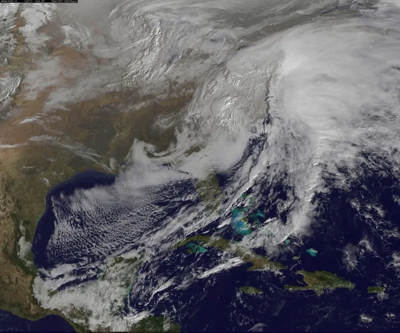
As spring arrives — albeit slowly — East Coasters are saying goodbye to an especially punishing winter.
The animation stitches together imagery taken from space by NOAA's GOES-East satellite every day from Jan. 1 to March 24, 2014.
The creator, Dennis Chesters, of the NASA/NOAA GOES Project at the Goddard Space Flight Center in Greenbelt, Md., said in a statement: "The once-per-day imagery creates a stroboscopic slide show of persistent brutal winter weather."
Major cities reported astounding tallies of winter snow. Residents of Washington, D.C., saw 30.3 inches (76.9 centimeters) of snow during the 2013-2014 season — nearly double the city's average snowfall of 15.3 inches (38.8 cm), according to the National Weather Service. A whopping 80 inches (203 cm) of snow fell on Chicago, far exceeding the typical 34.4 inches (87.3 cm).
The GOES-East satellite is perched in a geostationary orbit, meaning it hovers over the same part of the globe all the time, moving in tandem with Earth's rotation. The spacecraft captures images of the Northern Hemisphere every half hour and then takes a shot of the entire Western Hemisphere every three hours, according to NOAA.
The images of clouds taken by the GOES satellite are used by the National Weather Service to monitor storms. The 2014 winter weather video also incorporates true-color imagery of the land and sea obtained with NASA's Earth-watching NASA's Aqua and Terra satellites.
Follow Megan Gannon on Twitter and Google+. Follow us @livescience, Facebook & Google+. Original article on Live Science.

