One Year Ago Today: Future Superstorm Sandy Formed
Get the world’s most fascinating discoveries delivered straight to your inbox.
You are now subscribed
Your newsletter sign-up was successful
Want to add more newsletters?
Delivered Daily
Daily Newsletter
Sign up for the latest discoveries, groundbreaking research and fascinating breakthroughs that impact you and the wider world direct to your inbox.
Once a week
Life's Little Mysteries
Feed your curiosity with an exclusive mystery every week, solved with science and delivered direct to your inbox before it's seen anywhere else.
Once a week
How It Works
Sign up to our free science & technology newsletter for your weekly fix of fascinating articles, quick quizzes, amazing images, and more
Delivered daily
Space.com Newsletter
Breaking space news, the latest updates on rocket launches, skywatching events and more!
Once a month
Watch This Space
Sign up to our monthly entertainment newsletter to keep up with all our coverage of the latest sci-fi and space movies, tv shows, games and books.
Once a week
Night Sky This Week
Discover this week's must-see night sky events, moon phases, and stunning astrophotos. Sign up for our skywatching newsletter and explore the universe with us!
Join the club
Get full access to premium articles, exclusive features and a growing list of member rewards.
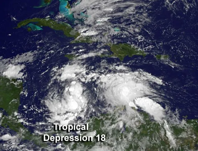
One year ago today, the weather system that would later become Superstorm Sandy, first formed as Tropical Depression 18 in the Caribbean Sea. Before the day was out, it had strengthened into Tropical Storm Sandy, the 18th named storm of the 2012 Atlantic hurricane season.
Two days later, the storm hit Jamaica as a Category 1 hurricane, where it caused millions of dollars in damage. It re-emerged over the warm ocean waters and rapidly strengthened into a Category 3 storm, making it the second major hurricane of the season. After traveling over Cuba, Sandy was weakened, and meandered across the Bahamas, before moving parallel to the U.S. East Coast and regaining strength. It regained hurricane status and became a Category 2 storm before becoming an extratropical cyclone (one powered by the temperature difference across a storm front, instead of the warm water and convection that fuel tropical cyclones).
Sandy made landfall near Atlantic City, N.J., around 8 p.m. EDT on Oct 29, 2012. It caused significant storm surge and flooding along the Jersey coast and up through New York City and along Long Island. Sandy's surge came in part from its considerable size — it was the second largest Atlantic tropical cyclone on record. (Tropical cyclone is the generic term used to describe hurricanes, typhoons and tropical storms.)
Follow Andrea Thompson @AndreaTOAP, Pinterest and Google+. Follow us @livescience, Facebook & Google+.
Get the world’s most fascinating discoveries delivered straight to your inbox.

Andrea Thompson is an associate editor at Scientific American, where she covers sustainability, energy and the environment. Prior to that, she was a senior writer covering climate science at Climate Central and a reporter and editor at Live Science, where she primarily covered Earth science and the environment. She holds a graduate degree in science health and environmental reporting from New York University, as well as a bachelor of science and and masters of science in atmospheric chemistry from the Georgia Institute of Technology.
