
 Live Science Plus


Satellite Snaps Stunning Dawn View of Hurricane Sandy

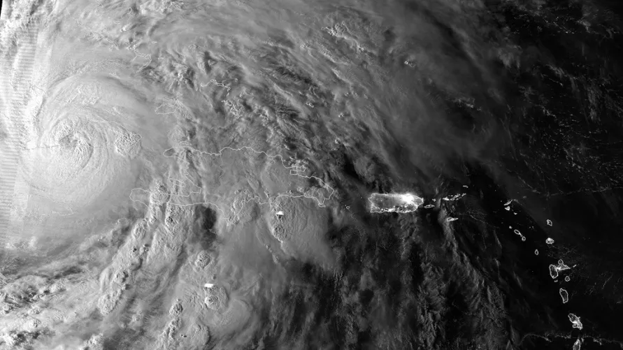
The Suomi NPP satellite caught this image of Hurricane Sandy yesterday morning (Oct. 25), just as the cyclone passed over Cuba.
In the image, you can see the hurricane’s enormous size; as of 11 a.m. today (Oct. 26), Sandy boasts tropical storm-force winds, extending out to 275 miles (445 kilometers) from its center, according to the National Hurricane Center.
It is currently 460 miles (740 km) southeast of Charleston, S.C., and moving to the northeast slowly, at 6 mph (9 kph). It's packing maximum sustained winds of 80 mph (130 kph), with higher gusts, making it a Category 1 hurricane on the Saffir-Simpson scale, the scale used to measure hurricane strength.

Sandy is likely to make landfall somewhere between North Carolina and as far north as Long Island, N.Y.
Winds of more than 50 mph (80 kph) are expected over much of the East Coast, said Louis Uccellini, director of NOAA's National Centers for Environmental Prediction, during a news conference this morning. Winds may also reach speeds of up to 100 mph (160 kph) in some areas, according to several of the models used to predict the hurricane's effects.
Sandy is likely to drop rain and snow over a wide area of the East Coast. In the shorter term, Sandy is expected to produce a total of 6 to 12 inches (15 to 30 centimeters) of rain across Haiti and the Dominican Republic, with 20 inches (50 cm) possible in certain areas. These rains may produce life-threatening flashfloods and mudslides, especially in mountainous regions.
The hurricane could also produce an especially large storm surge thanks to the full moon on Monday, Oct. 29.
Sandy is likely to intensify after passing over the Gulf Stream, and strong winds will be produced when it collides with a system exiting the East Coast, similar in some ways to what happened with 1991's "Perfect Storm."
Follow OurAmazingPlanet on Twitter @OAPlanet. We're also on Facebook and Google+.
