


The fierce Hurricane Katrina, which devastated the Gulf Coast, taking more than 1,800 lives, made landfall 10 years ago. And though meteorologists knew then it would slam New Orleans with levee-toppling intensity, today's weather forecasters are even better equipped to give notice of a storm's coming havoc.
Overall, meteorologists have a much better sense of where hurricanes will go and how strong they will be than they did before Hurricane Katrina, said Chris Davis, the associate director of the Mesoscale and Microscale Meteorology Laboratory at the National Center for Atmospheric Research in Boulder, Colorado.
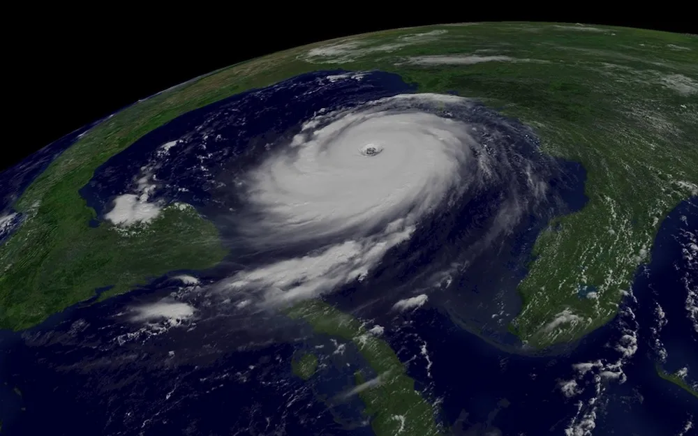
That's because of a host of factors, from more powerful computers, to improved global weather models, to better atmospheric data from satellites, Davis said. [Aftermath of a Storm: Images from Hurricane Katrina]
Concrete improvements
Scientists have improved the lead-time for cyclones by about 12 hours. In 2005, people had 36 hours' notice for a cyclone watch, which means gale and storm force winds are possible; that's now 48 hours, said Chris Vaccaro, the director of the National Oceanic and Atmospheric Administration communications and external affairs. Warnings, which mean gale and storm force winds are likely, now have a 36-hour lead-time, up from 24 hours a decade ago. The tropical weather outlook, which describes weather fronts moving toward the United States, can now look five days ahead, rather than three as it could in 2005.
In addition, worried coastal inhabitants can now use the experimental Potential Storm Surge Flooding Map to see where and how high storm surges or floodwaters are likely to get. In addition, uncertainty or error in the track, or path of the center of the cyclone, is now about 40 percent narrower, Vaccaro added. For instance, if meteorologists had to predict Hurricane Katrina's likely path today, they would have provided a clearer sense of which areas would receive the brunt of the storm.
Better track
Get the world’s most fascinating discoveries delivered straight to your inbox.
To prepare for a hurricane, people need to know a storm's track, or where the center is likely to make landfall, as well as its intensity, or the strength of the storm (which can help predict potential damage). Both of those measures have improved in the last decade, Davis said.
First, supercomputers are much more powerful now, allowing weather models to crunch much more data to predict a hurricane's course. In addition, the models themselves have improved.
A global weather model predicts winds, and winds largely determine where a hurricane will go, Davis said. That weather model has greatly improved, thanks to better global measurements of satellite data. (Satellites collect data on how much radiation is absorbed and emitted by the Earth — information that scientists use to infer atmospheric temperature, water vapor, carbon dioxide content and other factors that can alter regional winds, Davis said).
The general rule of thumb is that forecasts improve by about a day per decade, meaning that meteorologists can predict the track of a hurricane one day further into the future after 10 years of weather improvements, Davis said.
Better intensity
Meteorologists can also better predict how fiercely a storm will lash the coast and inland areas. Hurricane hunters still fly planes into the eye of the storm to measure wind and temperature, but that's very challenging, he said. These planes have Doppler radars in the tail and can fly in and around storms for hours, taking the needed measurements to predict intensity. [In the Eye of the Storm: NASA's Hurricane Hunters]
Yet, intensity predictions haven't improved as much as track forecasts, he said. That's in part because meteorologists still don't have the ability to measure with great accuracy the details that affect storm intensity, such as the moisture profile coming into the storm, or the vertical wind shear (the variation in horizontal wind with height), Davis added.
"The moisture from the hurricane comes from the ocean, but exactly how it's transferred is not completely understood," Davis said. Getting more data would require flying closer to the areas where storms can form, but flying in winds of greater than 50 to 60 mph (80 to 100 km/h) is basically impossible, he added. To get around that, NOAA and other national weather services are now beginning to use remotely piloted vehicles.
Beyond that, on the small scale, the behavior of a hurricane is just inherently more unpredictable or chaotic than its large-scale behavior, Davis said.
Follow Tia Ghose on Twitter and Google+. Follow Live Science @livescience, Facebook & Google+. Original article on Live Science.

Tia is the editor-in-chief (premium) and was formerly managing editor and senior writer for Live Science. Her work has appeared in Scientific American, Wired.com, Science News and other outlets. She holds a master's degree in bioengineering from the University of Washington, a graduate certificate in science writing from UC Santa Cruz and a bachelor's degree in mechanical engineering from the University of Texas at Austin. Tia was part of a team at the Milwaukee Journal Sentinel that published the Empty Cradles series on preterm births, which won multiple awards, including the 2012 Casey Medal for Meritorious Journalism.