


Destructive U.S. Tornadoes of April 2014: Gallery
Arkansas Before Tornado

This image, from April 25 and acquired by the Moderate Resolution Imaging Spectroradiometer (MODIS) on NASA’s Aqua satellite, shows the area before the storm.
Arkansas After Tornado

This image, acquired on April 28 by the Moderate Resolution Imaging Spectroradiometer (MODIS) on NASA’s Aqua satellite, shows what appears to be a tornado track north of Little Rock, Arkansas. The tracks are pale brown trails where trees and plants have been uprooted, leaving disturbed ground.
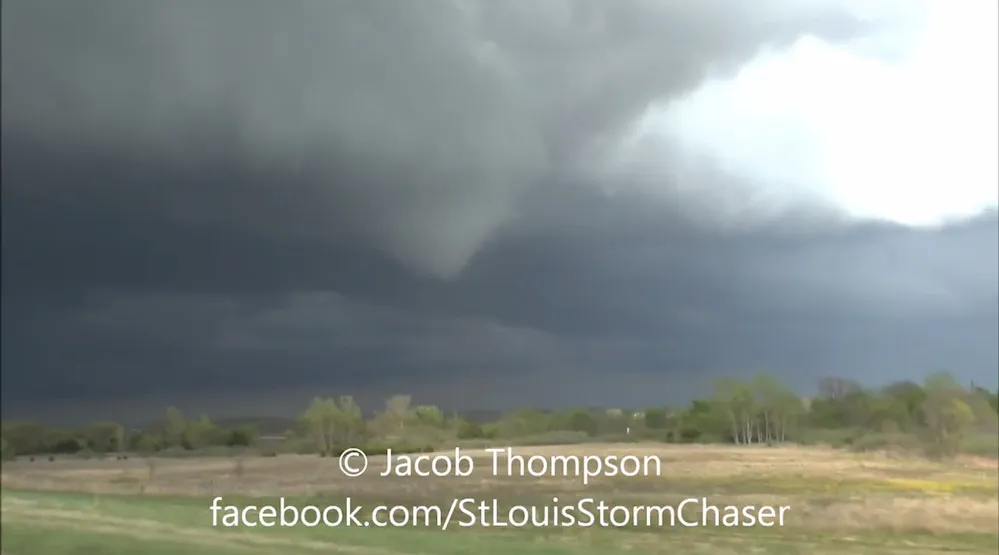
Arkansas Tornado

Drone video screenshot of the Arkansas tornado, shot right after it moved just south of Mayflower, Ark.

Arkansas Tornado

Drone video screenshot of the Arkansas tornado, shot right after it moved just south of Mayflower, Ark.
Arkansas Tornado Path

Rotation associated with the parent storm on 04/27/2014 was persistent for roughly 40 miles (Tornado #1) before weakening (where the gap is indicated). Another tornado (Tornado #2) was likely spawned a short time later by the same storm and tracked through White, Jackson, and Independence Counties. Note: Tornado #2 may actually be several tornadoes. This will be determined through damage surveys.
Kansas Tornado
A tornado that formed just north of Fort Scott, Kansas and caused damage as it moved north.
Kansas Tornado

A tornado that formed just north of Fort Scott, Kansas and caused damage as it moved north.
Get the world’s most fascinating discoveries delivered straight to your inbox.
Kansas Tornado

A tornado that formed just north of Fort Scott, Kansas and caused damage as it moved north.
