Incredible Technology: How to Fight Wildfires


Editor's Note: In this weekly series, LiveScience explores how technology drives scientific exploration and discovery.
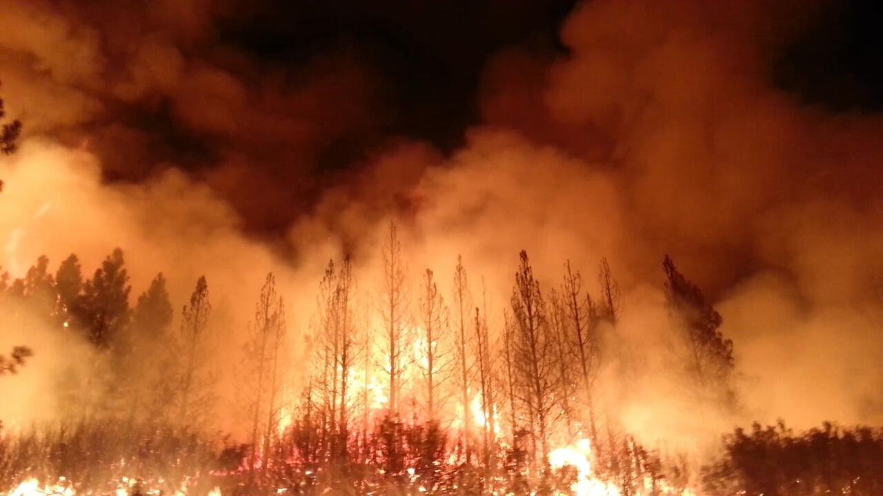
Wildfires, like the Rim Fire raging in Yosemite, Calif., are some of nature's most awesome, and devastating, spectacles, devouring large swaths of forest and grassland in hours.
Battling such blazes requires firefighters to pair traditional techniques, such as firebreaks, to contain the voracious flames, with newer technologies like drones and satellite imaging, to monitor the fire's progress.
Wildfire activity has been 50 percent above average for the last five years, said Julie Hutchinson, battalion chief of the California Department of Forestry and Fire Protection (CAL FIRE). If uncontained, these fires pose a threat to human life and property. [Yosemite Aflame: Rim Fire in Photos]
"We're always looking for technology that could benefit the public and firefighters and provide an additional layer of safety," Hutchinson said.
Containing the blaze
Once a wildfire gets going, containing the blaze is the immediate priority. The standard response includes fire trucks (and related equipment), ground crews, bulldozers and aircraft. On the ground, firefighters lay down fire hoses along the fire's edge, every 100 feet (30 meters) or so. Then firefighter crews or bulldozers create what's known as a firebreak or fire line around the perimeter of the blaze, a strip of land or trench where any potential fuel — such as dry brush or grass — has been removed.
Get the world’s most fascinating discoveries delivered straight to your inbox.
"We don't want the fire to come out of that area, and the only way to do that is to remove any fuel," Hutchinson told LiveScience.
When the media reports a fire is "X percent contained," X refers to the fraction of the fire's circumference around which a fire line extends. For example, if 9 miles (14 kilometers) of fire line surround a fire that is 10 miles (16 km) in circumference, the fire is 90 percent contained.
Sometimes, firefighters create a controlled burn to direct the fire's spread. In a technique called "firing out," a fire is created between the wildfire and a natural barrier, such as a road, to remove any vegetation in the wildfire's path.
Aircraft play an important role, too. Helicopters fly over and dump water or sometimes suppressant foam on fire hotspots. The foam acts as insulation to prevent unburned fuels from catching fire. Fixed wing aircraft called air tankers fly over the blaze dumping flame retardant chemicals, such as ammonium phosphate.
Surveillance from above
Airtankers are also used to monitor fires from above. Aerial camera footage and GPS data are fed into a computer system to improve models of the fire's behavior.
For the first time, firefighters have deployed a Predator drone to fly over the Rim Fire. In contrast to a manned airplane, the remotely piloted aircraft doesn't risk the life of the pilot, and can fly over the fire for much longer. Firefighters are using information gathered by the drone to guide the allocation of firefighting resources on the ground to where they are most needed. The aerial view also reveals the location of critical infrastructure such as power lines, gas lines and water systems in the fire's path. [9 Totally Cool Uses of Drones]
Computer models serve an important role in predicting how a wildfire will behave. The predictions take into account the weather, landscape and fuel conditions.These models provide a snapshot of the fire's potential, Hutchinson said. "Where it becomes important is when you start having multiple fires in a state, and you're having to allocate resources," she added.
To better understand when and where wildfires occur, researchers comb through satellite imagery. The U.S. Forest Service and U.S. Geological Survey are using data from the Landsat Earth-observing satellites to study every major fire in the country since 1984, mapping its severity.
Mark Cochrane, a senior scientist at the Geospatial Sciences Center of Excellence at South Dakota State University, is using satellites data to determine the best techniques for preventing wildfires. "This information helps us understand how what we've done on the landscape affects fires now," Cochrane told LiveScience. Though it varies by region, forest thinning and prescribed burns — both of which aim to eliminate fire fuel before the fire occurs — seem to be the most effective methods, he said.
"It's inevitable wildfires will occur," Cochrane said. "Accepting that fire is part of the landscape, what can we do to inoculate [the land] so that areas where people are living or that are highly valued do not burn?"
Follow Tanya Lewis on Twitterand Google+. Follow us @livescience, Facebook& Google+. Original article on LiveScience.


