
 Live Science Plus


Earth as Art: A Rocky Desert

published
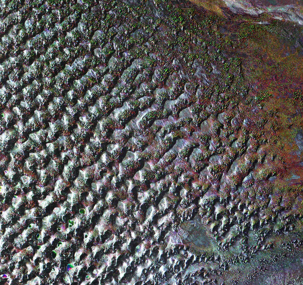
This Envisat radar image features the terrain of the Gobi Desert, which stretches across vast areas of the Mongolian People's Republic and the Inner Mongolian Autonomous Region of China. Envisat
(Image credit: ESA)
Deserts typically conjure images of barren stretches of shifting sand dunes, but Asia's Gobi Desert is covered with bare rock.
The Gobi, which is about 1,600 kilometers (990 miles) in extent from east to west and about 1,000 km (620 miles) from north to south, has a total area of 1,300,000 square km (800,000 square miles), making it the largest desert in Asia and the fourth largest in the world. The desert stretches across vast areas of the Mongolian People's Republic and the Inner Mongolian Autonomous Region of China.

