What Severe Weather Looks Like from Space


Ever wondered what thunderstorms look like from space? Wonder no longer.
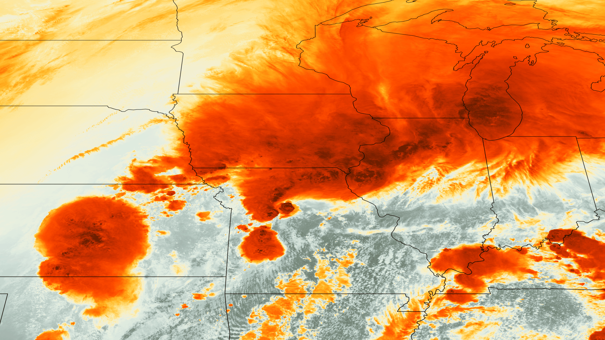
A false-color image, taken by the GOES-13 satellite yesterday afternoon (April 17), shows a series of strong thunderstorms in the Midwest. The dark orange of the cloud tops indicate that they are very cold, a marked contrast to the warm, humid air surrounding it. (The warm air can't be seen since it is transparent in this image.)
This contrast between cold, upper-level air and warm, humid air beneath powers instability in the atmosphere, which gives rise to thunderstorms and occasionally tornadoes, said Bob Henson, a meteorologist and science writer for the National Center for Atmospheric Research (NCAR) in Boulder, Colo.
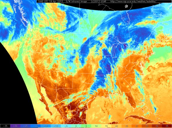
Article continues belowToday (April 18) a new cold front has moved across the center of the country, as can be seen in a second image from NCAR. This has created a "squall line" of thunderstorms composed in part of cold, high level air that stretches from north to south across the country. This system also produces instability and wind shear, which involves wind speed and direction changing with altitude. This situation creates optimal conditions for tornado formation — in fact, there are tornado watches stretching from Michigan to Texas, Henson said.

This cold front is particularly frigid for this time of year, and it has led to an impressive accumulation of snow throughout the Great Plains. Right now, there are more than 4 inches (10 centimeters) of snow stretching north of a line that runs from roughly Denver to Minneapolis, Henson said. On Sunday (April 14), a total of 17.3 inches (44 cm) of snow fell in Bismarck, S.D., the most snow ever to fall on the town in a 24-hour period, Henson added.
The front has also brought record cold. Lubbock, Texas, is expecting freezing temperatures tonight, Henson said. That's more than one week after the latest average freeze for the city. Oklahoma is also expected to see freezing temperatures, which would be the first time this has happened since the 1950s, Henson said.
Editor's note: This article was corrected at 5:45 p.m. to reflect the following: The latest freeze in Lubbock, Texas, is more than one week after the latest average freeze (not more than one week after that latest recorded freeze).
Get the world’s most fascinating discoveries delivered straight to your inbox.
Email Douglas Main or follow him @Douglas_Main. Follow us @OAPlanet, Facebook or Google+. Original article on LiveScience's OurAmazingPlanet.
