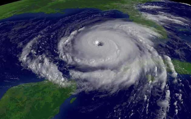
Meteorologists can fairly precisely predict the path a hurricane will take, but forecasting its intensity has been much trickier. A new study of the dynamics at the core of the storm has shed light on a process that can change a hurricane’s intensity, and the finding could improve storm predictions.
The strongest winds of a hurricane occur in the eyewall, a ring of clouds that encircle the relatively calm eye at the center of the storm. For several decades, meteorologists had observed changes in hurricane intensity associated with the replacement of this main eyewall with secondary eyewalls that formed further out in the storm. But they knew very little about how this replacement mechanism operated.
“What has been lacking is a true physical understanding of how this process happens, and then that’s where we come in,” said study author Robert Houze of the University of Washington.
To get a better picture of the energetic ebbs and flows at the center of a storm, Houze’s team sent airplanes with radar to take measurements from within Hurricane Rita in 2005. They found one key to eyewall replacement was the area of dry air that formed between the primary and secondary eyewalls, called the “moat.”
A hurricane’s eyewall pulls up warm, moist air right above the ocean’s surface from within the eye, causing the air above that in the eye to subside.
Outside of the eyewall, rain bands form in the classic spiral formation. These rain bands gradually move outward from eye, but only to a certain distance, where it is speculated that several bands eventually coalesce and form a secondary eyewall outside the first eyewall (imagine a bulls-eye and its surrounding target ring).
Sign up for the Live Science daily newsletter now
Get the world’s most fascinating discoveries delivered straight to your inbox.
The moat region that forms between the two eyewalls was previously not well understood. When the planes for this study flew into the region, they discovered that the air within it was sinking, just as it does in the eye. The moat eventually joined with the eye, essentially choking off the moist air that fed the old eyewall. [graphic / model]
“So the inner eyewall gets surrounded by eye-type air both outside and inside and then has no chance to survive, and that secondary eyewall takes over,” Houze told LiveScience. “So the original eyewall loses its source of energy.”
The details of the study are published in the March 2 issue of the journal Science.
Re-intensification
When the new eyewall forms, its winds are not as strong as old eyewall’s, so the storm’s intensity drops off as it takes over. But eventually, this new eyewall becomes tighter and its winds stronger, so the intensity increases again.
“Any eyewall that forms is going to contract; that’s just its natural behavior,” Houze said. “So once the eyewall is there, it’s going to contract and become smaller, and as it gets smaller, the storm re-intensifies because the momentum is conserved, and it spins faster.” The phenomenon is much like a skater pulling her arms in.
When the new eyewall contracts, it could be more intense or less intense than the original eyewall. When Rita went through replacement, the second eyewall was stronger, so the first eyewall was probably weaker when it first formed than the second one was when it formed. The strength of the eyewalls depends on the underlying ocean surface temperature and other atmospheric factors.
In theory, eyewall replacement could happen multiple times during the life of a storm, but only those that swirl over the ocean for several weeks would likely go through several replacements.
Improving forecasts
Understanding eyewall replacement better could improve hurricane forecasts if planes fly out into storms and return data to run in high-resolution models, Houze said. He and his colleagues ran such a model with the data from Hurricane Rita, and it produced an eyewall replacement event much like the one that actually occurred, though timing and location were not exact.
Though understanding eyewall replacement helps meteorologists grasp some changes in intensity, it doesn’t explain them all. In fact, most hurricanes don’t go through an eyewall replacement. Hurricane Katrina, also studied by Houze, underwent a rapid intensification unrelated to eyewall replacement.
Houze said that having these two examples provides “a natural controlled experiment” that will allow him to look at what conditions might have been different between two otherwise very similar storms.
Andrea Thompson is an associate editor at Scientific American, where she covers sustainability, energy and the environment. Prior to that, she was a senior writer covering climate science at Climate Central and a reporter and editor at Live Science, where she primarily covered Earth science and the environment. She holds a graduate degree in science health and environmental reporting from New York University, as well as a bachelor of science and and masters of science in atmospheric chemistry from the Georgia Institute of Technology.