The smoke drifting from an oil rig that exploded in the Gulf of Mexico earlier this week has been photographed from space by a NASA satellite.
On April 20, 2010, an oil rig explosion in the Gulf of Mexico left a dozen workers missing and several more critically injured and started a large fire that was churning out smoke days later.
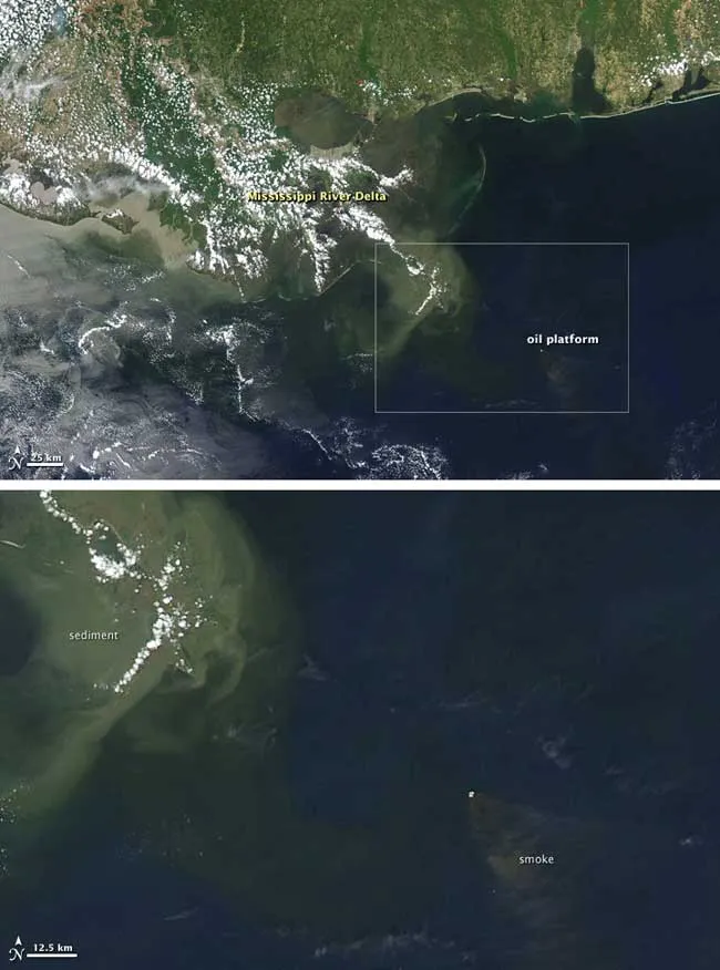
The image showing the plume of smoke billowing from the rig also includes the Gulf Coast and near-shore waters. It was captured by the Moderate Resolution Imaging Spectroradiometer (MODIS) on NASA’s Aqua satellite on April 21.
Latest Videos From
The oil platform appears as a white dot, and a fan of brown smoke extends to the southeast.
In the same image, the Mississippi River Delta is speckled with clouds and outlined by a wide border of greenish-tan sediment.
Although photographs show that the damaged rig was leaking oil, no oil slick is obvious in this image. Oil slicks are notoriously difficult to spot in natural-color (photo-like) satellite imagery because a thin sheen of oil only slightly darkens the already dark blue background of the ocean. Under unique viewing conditions, oil slicks can become visible in photo-like images, but usually, radar imagery is needed to clearly see a spill from space.