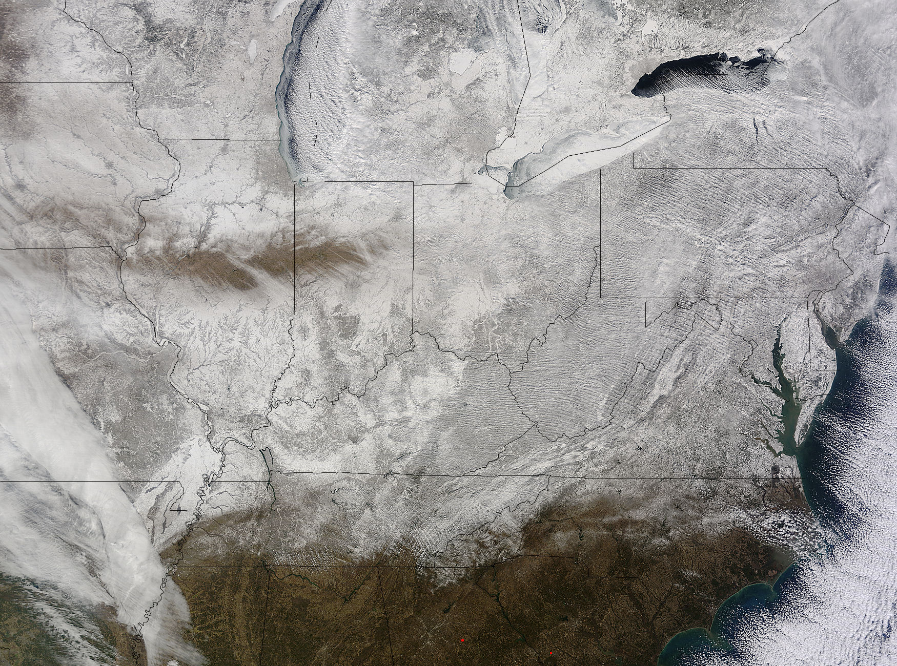
Arctic Blast Blankets Eastern US in Ice and Snow (Photo)


An Arctic blast sweeping across the East Coast, from Canada south to Florida, left much of the country blanketed in ice and snow this week.
NASA's Terra satellite snapped an image of the frigid winter weather from space on Thursday (Feb. 19). A near-record amount of ice covered Lake Ontario, and Lake Erie was almost completely frozen over. Snow covered the landscape from Kentucky to Maryland.
Many all-time records for low temperatures in February fell Friday morning, some set more than a century ago. Temperatures dove to minus 6 degrees Fahrenheit (minus 21 degrees Celsius) in Louisville, Kentucky, and 7 degrees F (minus 14 degrees C) in Charlotte, North Carolina. Cleveland, Ohio, hit minus 17 degrees F (minus 27 degrees C), falling below the previous record set in 1899. The bitter cold also broke records overnight in Macon, Georgia, dropping the mercury down to 18 F (minus 8 degrees C).
Article continues belowThe National Weather Service forecasts another surge of Arctic air again today (Feb. 20) before temperatures warm up for the weekend.
The freezing cold is a striking contrast to the extreme heat in the West, where open water and thin ice nearly forced race officials to move the historic start line for this month's Alaska's Yukon Quest International Sled Dog Race.
And offshore of California, a notorious ridge of high pressure appeared this month, adding to the weather woes. This high-pressure ridge blocks rain-giving storms from reaching the parched state, worsening its ongoing drought. The ridge also helped force the jet stream into an extreme pattern that delivered the East Coast's blast of Siberian and Arctic air this week, meteorologists said.
Follow Becky Oskin @beckyoskin. Follow LiveScience @livescience, Facebook & Google+. Originally published on Live Science .
Get the world’s most fascinating discoveries delivered straight to your inbox.
