It's quick and easy to access Live Science Plus, simply enter your email below. We'll send you a confirmation and sign you up for our daily newsletter, keeping you up to date with the latest science news.
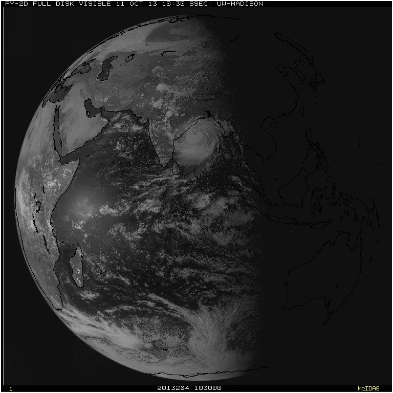
Disaster looms for India as ferocious Cyclone Phailin, currently equivalent in strength to a Category 5 hurricane, bears down on the subcontinent ahead of its expected landfall tomorrow night (Oct. 12), local time.
Experts say that the enormous and powerful storm, with maximum sustained winds of more than 160 mph (260 km/h), will bring a "catastrophic" storm surge, the water that a storm's winds push in front of it and that inundate a coastline as the storm makes landfall, said Hal Needham, a climatologist at Louisiana State University. The storm surge is expected to reach heights of 20 feet (6 meters), Needham told LiveScience.
The storm is likely to be "as bad or worse" than a cyclone that followed a similar trajectory in 1999, called Odisha cyclone for the area it hit. That storm killed about 15,000 people and caused $4.5 billion in damages, said Eric Holthaus, a meteorologist for the online publication Quartz. Phailin (pronounced pie-leen) has now tied the record, with Odisha, for the largest cyclone on record in the Indian Ocean, Holthaus told LiveScience.
While a different rating system is used for cyclones in the Indian Ocean and Bay of Bengal, cyclones are the same phenomenon as the hurricane seen in the Atlantic, where Phailin would be a Category 5 hurricane, the strongest type. According to the U.S. National Weather Service, these types of storms will destroy "a high percentage of framed homes," with "total roof failure and wall collapse. Fallen trees and power poles will isolate residential areas. Power outages will last for weeks to possibly months. Most of the area will be uninhabitable for weeks or months." [A History of Destruction: 8 Great Hurricanes ]
How it got so powerful
Cyclone Phailin underwent a period of rapid intensification in the past couple days — and continues to strengthen — for two primary reasons. First of all, ocean surface temperatures in the Bay of Bengal are warmer than 28 degrees Celsius (82.4 degrees Fahrenheit), which is "about as warm as ocean water can get," Holthaus said. Warm temperatures favor intensification, as hurricanes are basically heat engines and are powered by the transfer of heat energy from the water to the upper atmosphere.
Secondly, there have been very light upper winds, and little wind shear, which is a change in direction or strength of winds with increasing altitude, Needham said. When there is too much wind shear, upper-level winds can tear apart developing hurricanes (and that is why there have been few strong Atlantic hurricanes to date this year). These calm conditions allowed Phailin to grow and strengthen, Needham said.
Sign up for the Live Science daily newsletter now
Get the world’s most fascinating discoveries delivered straight to your inbox.
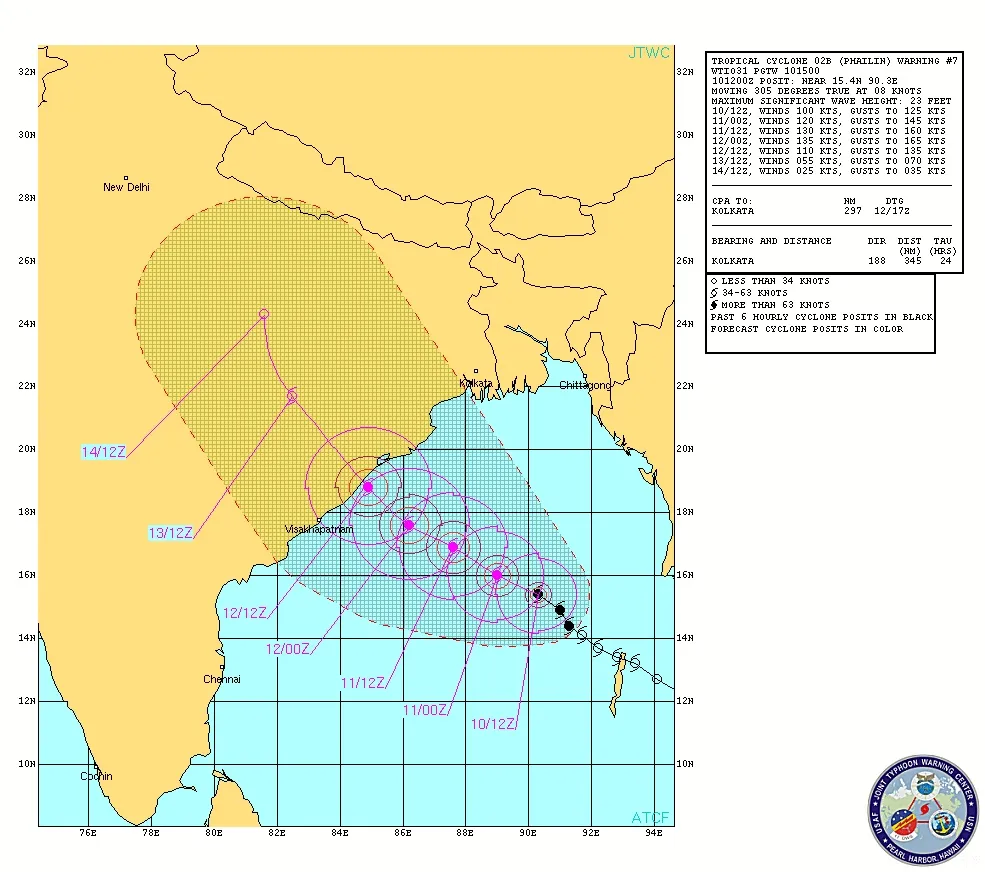
The projected path of Tropical Cyclone Phailin towards India as of 11:30 a.m. ET on Oct. 10, 2013.
(Image credit: JTWC)
Phailin intensified almost as fast as any storm on record, going from the strength of a tropical storm, with wind speeds under 74 mph (119 kph), to the equivalent of a Category 4 hurricane, with wind speeds above 130 mph (209 kph), in the span of 24 hours, Holthaus said. It has also grown to be about half the size of India.
All this is a huge problem for India, and to a lesser extent Bangladesh, with a low-lying and heavily populated coastline, Needham said. The Bay of Bengal is also quite shallow, which means that storm surges tend to get higher because there isn't a well of deep water to deflect energy from the strong winds, he said. The shape of the bay also channels water toward eastern India, making storm surges worse, he added.
Storm surge central
This puts millions of coastal residents in a perilous situation. While hundreds of thousands of people have already evacuated, many more are still at home and are likely to be inundated by the cyclone, Holthaus said.
These facts help explain why the Bay of Bengal, which is a relatively small ocean basin, has experienced approximately 17 of the 23 tropical cyclones that have killed at least 5,000 people in recorded history, Needham said.
Experts say that Cyclone Phailin is likely to be disastrous. "A Category 5 landfall is bad anywhere, and typically the aftermath is described as 'catastrophic,'" said Brian McNoldy, a researcher at the University of Miami, in an email. "It can't get much worse!"
The height of the expected surge would be comparable to that generated by the Galveston hurricane of 1900, which killed more than 6,000 people and is the deadliest natural disaster in American history, the Washington Post reported.
Douglas Main loves the weird and wonderful world of science, digging into amazing Planet Earth discoveries and wacky animal findings (from marsupials mating themselves to death to zombie worms to tear-drinking butterflies) for Live Science. Follow Doug on Google+.

 Live Science Plus