Katrina-Like Storm Surges Could Become Norm


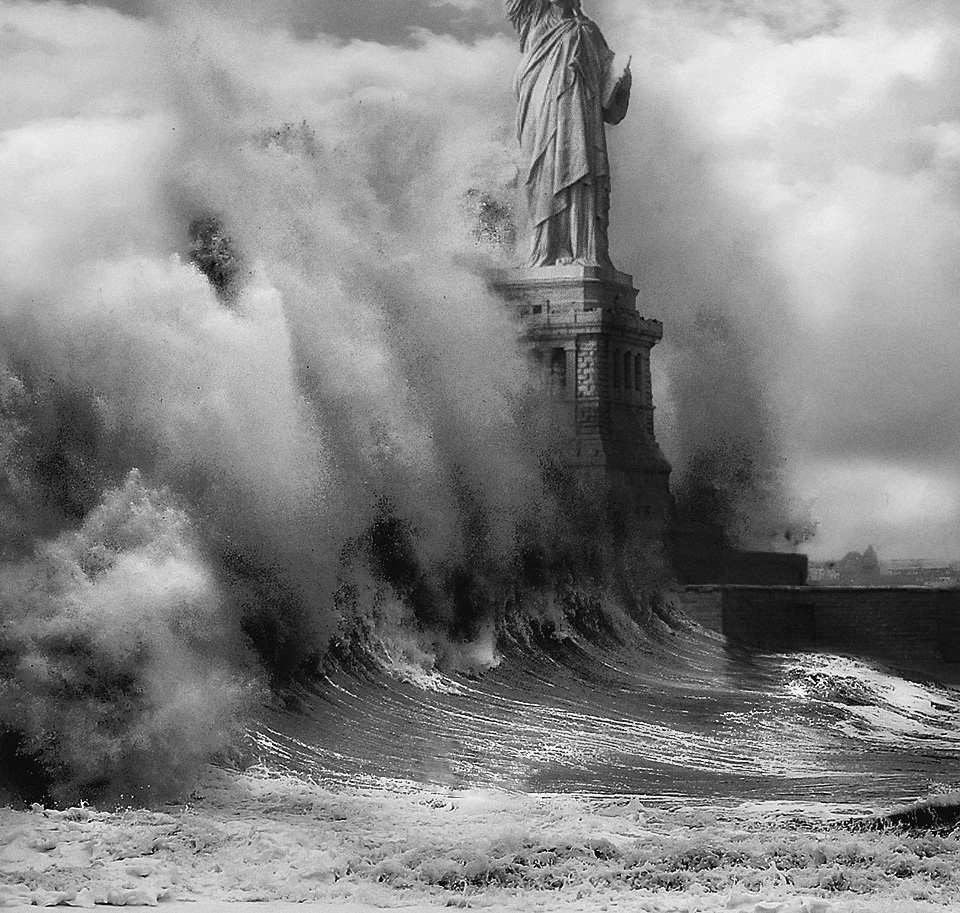
Last year's devastating flooding in New York City from Hurricane Sandy was the city's largest storm surge on record. Though Hurricane Sandy was considered a 100-year-event — a storm that lashes a region only once a century — a new study finds global warming could bring similar destructive storm surges to the Gulf and East Coasts of the United States every other year before 2100.
Severe storms generate both high waves and storm surge, which can combine to erode beaches and dunes and flood coastal communities. Storm surge is seawater pushed ahead of a storm, mainly by strong winds. Onshore, the surge can rise several feet in just a few minutes. High waves travel on top of the surge, and cresting waves raise the sea's height even more.
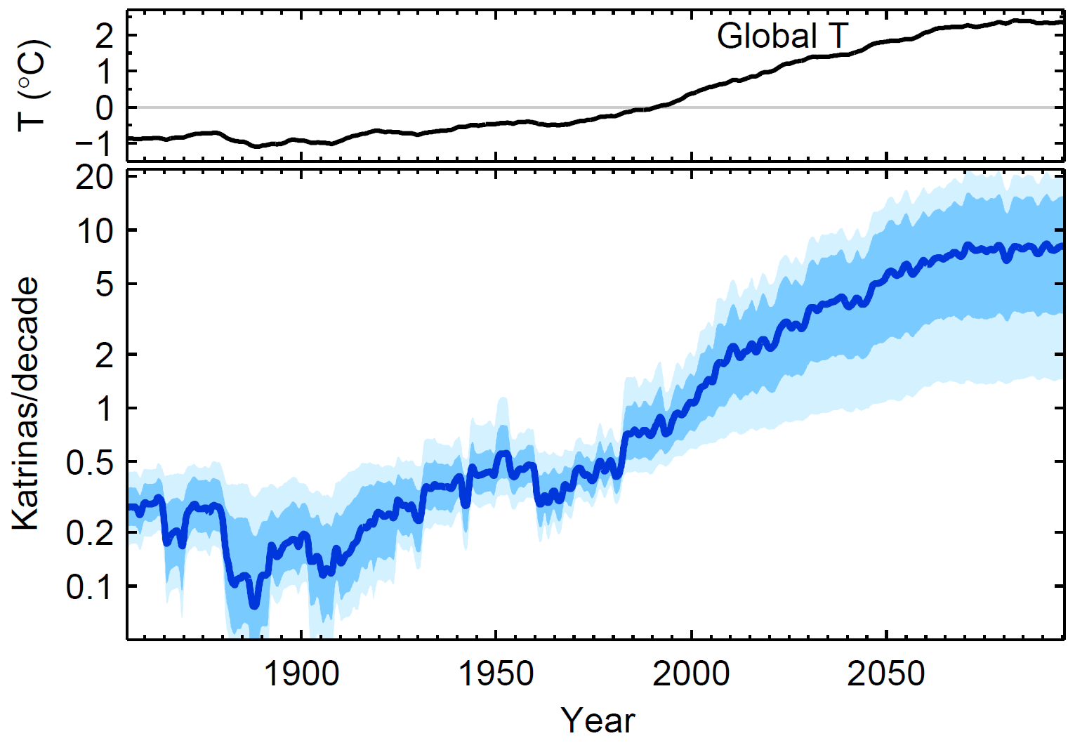
Looking at extreme events, which researchers called "Katrinas" after the 2005 hurricane that flooded the Gulf Coast, a new model predicts Katrina-like storm surges will hit every other year if the climate warms 3.6 degrees Fahrenheit (2 degrees Celsius).
Article continues belowThat would be 10 times the rate seen since 1923, after which there has been a Katrina-magnitude storm surge every 20 years, the study, published in the March 18 issue of the journal Proceedings of the National Academy of Sciences,found.
In 2009, the world's nations agreed to try to limit climate change to a 2 C increase by 2100, but recent studies show temperatures could rise 7.2 F (4 C) before the century ends.
But the tenfold increase in Katrina-like storm surges does not have to translate into a tenfold increase in disasters, said Aslak Grinsted, a climate scientist at the University of Copenhagen in Denmark and the lead study author. "Every Katrina-magnitude event is not necessarily going to be a Katrina-magnitude disaster. It's all about planning smartly," he told OurAmazingPlanet.
Warmer seas spin stronger storms
Get the world’s most fascinating discoveries delivered straight to your inbox.
Scientists know that warmer oceans will change how the Atlantic Ocean spawns hurricanes. More heat means more energy, and many models predict global warming will bring bigger, stronger storms, though the details between the model scenarios differ. But the models could be biased by changes in hurricane observational methods, such as the switch to satellites from planes and ships, which may impact records of wind speed and other storm data, Grinsted said.
Many studies have looked at how the frequency and size of hurricanes will change as global warming raises ocean temperatures, but few have investigated their impact on the Atlantic coast.

To better assess which model does the best job of divining the future, Grinsted and his colleagues constructed a record of storm surges from tide gauges along the Atlantic coast dating back to 1923. "Big storm surges give me a new view of hurricane variability in the past," Grinsted said.
Grinsted weighed each statistical model according to how well they explained past extreme storm surges. One way scientists test climate models is by seeing how well they predict the weather in the past.
Of the competing models, the top performer was one of the simplest. It relied on regional sea surface temperatures in the Atlantic Ocean hurricane birthing ground. The researchers also created a new global "gridded" model, incorporating ocean temperatures around the world. Grinsted said the top models agree roughly on the magnitude of the increase in storm surges, giving him confidence in the results. [Hurricanes from Above: See Nature's Biggest Storms]
A 0.4 C warming corresponded to doubling of the frequency of extreme storm surges, the study found. "With the global warming we have had during the 20th century, we have already crossed the threshold where more than half of all 'Katrinas' are due to global warming," Grinsted said.
James Elsner, a climate scientist at the University of Florida, said he agrees with the study's main finding, but thinks the modeling underestimates the effects of climate factors such as the El Niño/ La Niña Southern Oscillation (ENSO) index, and the North Atlantic Oscillation (NAO). Studies have shown that the warm El Niño events mean fewer hurricanes in the Atlantic, while the NAO influences storm tracks across the ocean basin.
"As the planet warms up and the oceans get warmer, the chances of stronger storms goes up," Elsner said. "I think it's an interesting exercise, but I think statistically, it's got some issues," he told OurAmazingPlanet.
Storm surges and sea level rise
Grinsted is concerned about the combined effects of future storm surge flooding and sea level rise, which adds to the base of the storm surge.
"I think what will be even more important is the background sea level rise, and that is something that is very hard to model," he said.
Hurricane Sandy brought an 11.9-foot (3.6 meters) surge to southern Manhattan, plus a boost from the high tide, creating a storm tide as high as 13.88 feet (4.2 m).
Hurricane Katrina caused storm surge flooding of 25 to 28 feet (7.6 to 8.5 m) above normal tide level along portions of the Mississippi coast and 10 to 20 feet (3 to 6.1 m) above normal tide levels along the southeastern Louisiana coast.
Email Becky Oskin or follow her @beckyoskin. Follow us @OAPlanet, Facebook or Google+. Original article on LiveScience's OurAmazingPlanet.
