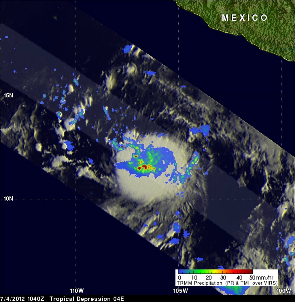
Tropical Storm Daniel Spawns Giant 'Hot Towers'

Get the world’s most fascinating discoveries delivered straight to your inbox.
You are now subscribed
Your newsletter sign-up was successful
Want to add more newsletters?
Join the club
Get full access to premium articles, exclusive features and a growing list of member rewards.
Tropical Storm Daniel, the fourth named storm of the East Pacific season, has roared to life in the Pacific Ocean, and a satellite peering through the top of the storm has spied rain clouds 9 miles (14 kilometers) high inside the gale.
These soaring clouds, known as "hot towers" because they are lofted high into the atmosphere by latent heat, appear to be a telltale sign that a storm will strengthen. NASA researchers have found that when a swirling storm has hot towers toward its middle, it's two times more likely to gain power than rotating storms that lack the tall rain clouds. This was the case with Daniel.
A NASA satellite snapped a picture of the hot towers on July 4, when the burgeoning storm was still a nameless tropical depression — an organized, rotating storm, yet one without the full strength of a tropical storm, which must have winds of at least 39 mph (63 kph).
Article continues belowSure enough, the storm gained power. In the early hours of July 5, its winds ramped up to 45 mph (75 kph), and Tropical Storm Daniel was born. Storms are named only once they attain tropical storm status.
The satellite image of Daniel's clouds revealed the storm was dropping rain at a rate of more than 2 inches (50 millimeters) per hour.
The storm has continued to strengthen, and is packing winds of 70 mph (110 kph), just 4 mph shy of the wind speeds required for hurricane status. Forecasters at the National Hurricane Center expect Daniel to become a hurricane later today (July 6).
The storm is 650 miles (1,045 km) south of Mexico's Baja Peninsula, and is moving farther out to sea, posing no threat to land.
Get the world’s most fascinating discoveries delivered straight to your inbox.
The Pacific basin's fourth named storm comes at a time when the Atlantic Ocean is quiet. So far, four storms have churned to life in that ocean basin, which has experienced some of the earliest named storms on record.
Yet despite the flurry of activity early in the season, forecasters are still expecting a near-normal hurricane season for the Atlantic.
The seasonal outlook calls for a total of nine to 15 named storms. Of those storms, between four and eight are likely to become hurricanes, and between one and three are likely to become major hurricanes.
Follow OurAmazingPlanet for the latest in Earth science and exploration news on Twitter @OAPlanet and on Facebook.

 Live Science Plus


