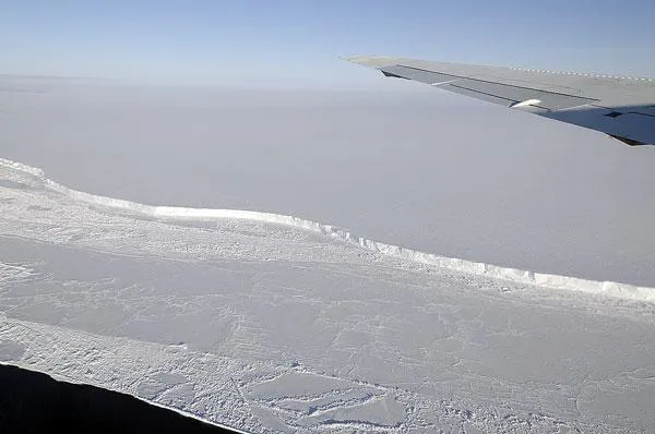
The pilots are suited up, the instruments are onboard, and the planes are on the runway: NASA's Operation IceBridge is geared up for its third year of observing the ice sheets of Antarctica from high above the southernmost continent.
Ninety-eight percent of Antarctica is covered in ice, and the continent holds more than 60 percent of the supply of the world's fresh water. If substantial portions of Antarctica's ice melt, all that water could be released, with substantial implications for sea level rise.
Scientists are concerned about how quickly key features of ice sheets are thinning; for example, Pine Island Glacier, which rests on bedrock below sea level, has been found to be a major source of glacier melt from the West Antarctica Ice Sheet. Better understanding this type of change is crucial to projecting impacts such as sea-level rise.
Latest Videos From
IceBridge science flights put a variety of remote-sensing instruments above Antarctica's land and sea ice, and in some regions, above the ocean floor.
The mission's Gulfstream V carries one instrument: a laser-ranging topography mapper. The DC-8 carries seven instruments, including a laser altimeter to continue the crucial ice sheet elevation record begun by the Ice, Cloud and land Elevation Satellite (ICESat) mission, which ended in 2009. The flying laboratory also will carry radars that can distinguish how much snow sits on top of sea ice and map the terrain of bedrock below thick ice cover. [Images: NASA's IceBridge in Action Over Antarctica ]
While scientists in recent years have produced newer, more detailed data about the ice sheet's surface, the topography of the rocky surface beneath the ice sheet remains unknown in many places. Without knowing the topography of the bedrock, it is impossible to know exactly how much ice sits on top of Antarctica.
A gravimeter aboard the DC-8 will detect subtle differences in gravity to map the ocean floor beneath floating ice shelves. Data on bathymetry, or ocean depth, and ocean circulation from previous IceBridge campaigns are helping explain why some glaciers are changing so quickly.
"With a third year of data-gathering under way, we are starting to build our own record of change," said Michael Studinger, IceBridge project scientist at NASA's Goddard Space Flight Center in Greenbelt, Md. "With IceBridge, our aim is to understand what the world's major ice sheets could contribute to sea-level rise. To understand that, you have to record how ice sheets and glaciers are changing over time."
Early high-priority DC-8 flights include several flight lines over sea ice near the Antarctic Peninsula , before too much of the ice melts in the southern spring. IceBridge sea ice flights are designed to help scientists understand why sea ice in the Southern Hemisphere is not following the steady decline of sea ice thickness and extent seen in the Arctic.
Other high priority flight lines follow ground traverses being made this year and next, during which NASA scientists will travel different sections of the West Antarctic Ice Sheet, measuring snowfall accumulation and the characteristics of Pine Island Glacier. Many flight lines will retrace either previous ICESat-1 tracks or future ICESat-2 tracks. Some also will align with current observations made by the European Space Agency's CryoSat-2 satellite. The overlapping flight lines and satellite tracks ultimately will help scientists improve the accuracy of their data.
"We will be re-surveying our previous flight lines to see how much glaciers and ice sheets have changed, and we'll cover new areas to establish a baseline for future years and the ICESat-2 mission in 2016," Studinger said.
Flights take off from Punta Arenas, Chile, and cross the Southern Ocean to reach destinations including West Antarctica, the Antarctic Peninsula and coastal areas. Each flight lasts 10 to 11 hours.

 Live Science Plus