


Retreating Ice Exposes Arctic Landscape Unseen for 120,000 Years
The retreat of Arctic glaciers is exposing landscapes that haven't seen the sun for nearly 120,000 years.
These rocky vistas have very likely been covered in ice since the Eemian, a period in which average temperatures were up to 3.6 degrees Fahrenheit (2 degrees Celsius) warmer than present, and sea levels up to 30 feet (9 meters) higher.
"The last century of warmth is likely greater than any century prior to this going back 120,000 years," said study leader Simon Pendleton, a doctoral student at the University of Colorado, Boulder's Institute of Arctic and Alpine Research. [See Stunning Photos of Baffin Island Glaciers]

Preserved plants
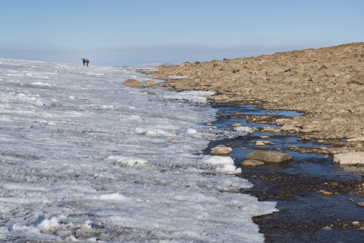
Pendleton and his colleagues walked across these ancient landscapes while taking samples on Baffin Island, Canada. The island is ringed with dramatic fjords, but its interior is dominated by high-elevation, relatively flat, tundra plains.
These tundra plains are covered with thin ice caps. Because the landscape is so flat, the ice caps don't flow and slide like typical glaciers, Pendleton told Live Science. Instead, they simply sit on the underlying rock and soil, preserving everything beneath them like the glass of a museum case.

What's preserved includes tiny Arctic plants and mosses that were last alive when the ice enveloped the land. As the ice melts, Pendleton said, it exposes this ancient, delicate vegetation. Wind and water destroy the long-lost plants within months, but if researchers can get to them first, they can use radiocarbon dating to determine the age of the vegetation.
Under ice
Radiocarbon dating measures the levels of a slowly decaying isotope of carbon, carbon-14. (Carbon-14 has eight neutrons in its nucleus rather than six like regular carbon.) Because scientists know how quickly carbon-14 decays — and plants take in carbon-14 via photosynthesis — they can use the amount of the isotope in an organic sample to determine its age.
Get the world’s most fascinating discoveries delivered straight to your inbox.
Pendleton and his colleagues took 124 samples from 30 locations around eastern Baffin Island, all within about 3 feet (1 m) of the edge of the modern ice cap — the area most recently exposed by melt where remnants of ancient plants had not yet been eroded away.
They found that all of their samples were at least as old as the oldest age that radiocarbon dating can detect: 40,000 years. That's a direct indication that the plants had been under ice for at least that long, the researchers reported Jan. 25 in the journal Nature Communications.
Visible change
The researchers were able to back up those vegetation measurements with measurements of minerals in the nearby rock that also suggested at least 40,000 years of continuous ice coverage. And it's nearly certain that Baffin Island has been entombed in ice for much longer than that, Pendleton said. Forty thousand years ago, the world was in the midst of the last ice age. If it takes temperatures as warm as today's to melt ice that has persisted that long, the last period to find those in the Arctic is nearly 120,000 years ago, Pendleton said. Chances are, some of the landscapes exposed today have been buried since that warm interglacial period. [On Ice: Stunning Images of Canadian Arctic]
"We know there is dramatic change occurring and will continue to occur, but I don't know that we were expecting to find evidence that we're now seeing landscapes and temperatures similar to that of the last interglacial period," Pendleton said.
The changes on Baffin Island are undeniable even to the naked eye, Pendleton said. The research team took samples on the island in 2005, 2013, 2014 and 2015. Year to year, Pendleton said, the retreat of the ice was obvious. The researchers would use GPS to pinpoint their previous sampling point, which had once been at the edge of the ice. At some places, Pendleton said, they'd find themselves the length of a football field from the new edge of the ice.
"To be able to stand there and see that change is — I don't have a good word for it," Pendleton said. "It's kind of breathtaking, in a way."
- Images of Melt: Earth's Vanishing Ice
- Collapsing Beauty: Image of Antarctica's Larsen Ice Shelf
- Earth from Above: 101 Stunning Images from Orbit
Originally published on Live Science.

Stephanie Pappas is a contributing writer for Live Science, covering topics ranging from geoscience to archaeology to the human brain and behavior. She was previously a senior writer for Live Science but is now a freelancer based in Denver, Colorado, and regularly contributes to Scientific American and The Monitor, the monthly magazine of the American Psychological Association. Stephanie received a bachelor's degree in psychology from the University of South Carolina and a graduate certificate in science communication from the University of California, Santa Cruz.