Scientists discover long-lost giant rivers that flowed across Antarctica up to 80 million years ago
Large flat surfaces carved by ancient rivers deep beneath East Antarctica are influencing how ice flows across the continent today, according to a new study.

Scientists have discovered a long-lost landscape that's been preserved beneath the Antarctic Ice Sheet for 30 million years.
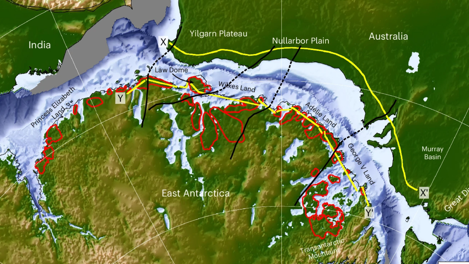
Erosion by ancient rivers appears to have carved large, flat surfaces beneath the ice in East Antarctica between 80 million and 34 million years ago. Understanding how these features formed, and how they continue to affect the landscape, could help refine predictions of future ice loss, researchers reported July 11 in the journal Nature Geoscience.
"We've long been intrigued and puzzled about fragments of evidence for 'flat' landscapes beneath the Antarctic ice sheets," study co-author Neil Ross, a geophysicist at Newcastle University in the U.K., said in a statement. "This study brings the jigsaw pieces of data together, to reveal the big picture: how these ancient surfaces formed, their role in determining the present-day flow of the ice, and their possible influence on how the East Antarctic Ice Sheet will evolve in a warming world."
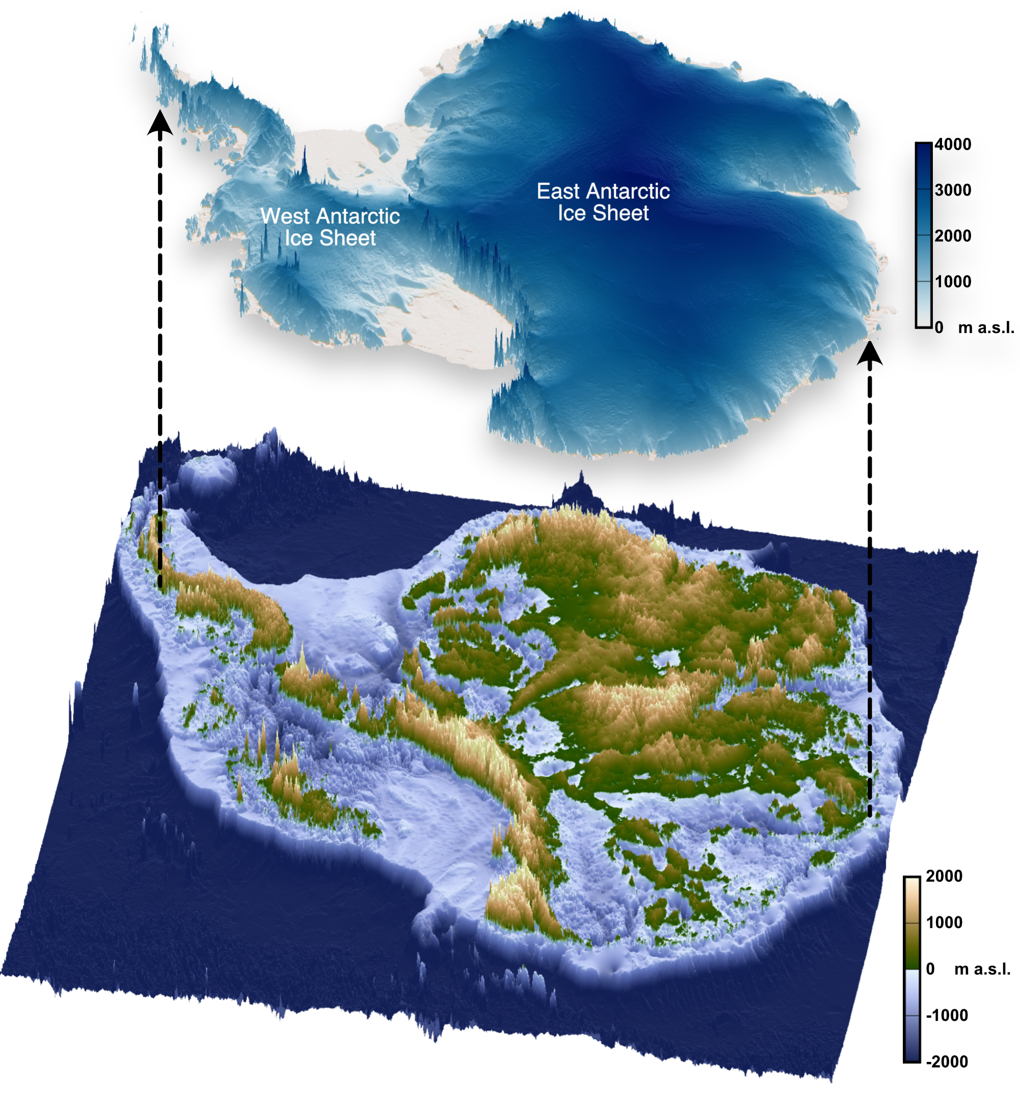
If the East Antarctic Ice Sheet were to melt entirely, it could raise global sea levels by more than 160 feet (50 meters). But accurately predicting how much the ice sheet might melt in the coming years requires scientists to know its past behavior and the conditions at its base.

In the new study, the researchers used radar data from four previous surveys to map the shape of the bedrock beneath the ice.
"When we were examining the radar images of the sub-ice topography in this region, these remarkably flat surfaces started to pop out almost everywhere we looked," study co-author Guy Paxman, a polar geophysicist at Durham University in the U.K., said in the statement. "The flat surfaces we have found have managed to survive relatively intact for over 30 million years, indicating that parts of the ice sheet have preserved rather than eroded the landscape."
The flat expanses, which were interspersed with deep troughs, covered a 2,175-mile (3,500 kilometers) section of the East Antarctic coastline. They likely formed before the East Antarctic Ice Sheet existed but after the supercontinent Gondwana (which contained modern-day Antarctica, Australia, Africa, and India) broke apart.
Get the world’s most fascinating discoveries delivered straight to your inbox.
This helped the researchers to date the flat sections to between 80 million and 34 million years ago.
Atop these flat surfaces, the Antarctic ice moves fairly slowly. But in the troughs between them, the ice flows much faster. Meltwater may have carved these troughs by flowing through natural dips as the East Antarctic Ice Sheet expanded millions of years ago.
The slow flow of ice above the flat surfaces could be regulating ice loss from the continent, the researchers wrote in the study. Further research, such as obtaining and analyzing rock samples from under the ice, could refine projections of future ice loss and sea level rise.
"Information such as the shape and geology of the newly mapped surfaces will help improve our understanding of how ice flows at the edge of East Antarctica," Paxman said. "This in turn will help make it easier to predict how the East Antarctic Ice Sheet could affect sea levels under different levels of climate warming in the future."

Skyler Ware is a freelance science journalist covering chemistry, biology, paleontology and Earth science. She was a 2023 AAAS Mass Media Science and Engineering Fellow at Science News. Her work has also appeared in Science News Explores, ZME Science and Chembites, among others. Skyler has a Ph.D. in chemistry from Caltech.
You must confirm your public display name before commenting
Please logout and then login again, you will then be prompted to enter your display name.
 Live Science Plus


